TopoQuest Logo
Do you find TopoQuest useful?
Help keep TopoQuest running and adding new maps/features by donating!
Bitcoin:  19c7KJd3qBynnjoSw5npx9KScwjBe4ifkT
Litecoin:  LXs6TkuXGGXo1vDsWCkWVdjQX94eUKd6ui
Home View Maps Find Maps Find Places Resources & Links


Cedar Springs Mountain, Oregon Topographic Map

USGS Map Title: Cedar Springs Mountain, OR
USGS Map MRC: 42123G1
DRG (GeoTIFF) Download: o42123g1.tif


Neighboring USGS Topographic Map Quads:


  Days Creek, OR  
42123H2
 

  Milo, OR  
42123H1
 

  Tiller, OR  
42122H8
 

  Starvout Creek, OR  
42123G2
 

  Cedar Springs Mountain, OR  
42123G1
 

  Richter Mountain, OR  
42122G8
 

  King Mountain, OR  
42123F2
 

  Skeleton Mountain, OR  
42123F1
 

  Cleveland Ridge, OR  
42122F8


Map MRC Location:

N43°
W124°
N43°
W123°
H8 H7 H6 H5 H4 H3 H2 H1
G8 G7 G6 G5 G4 G3 G2 G1
F8 F7 F6 F5 F4 F3 F2 F1
E8 E7 E6 E5 E4 E3 E2 E1
D8 D7 D6 D5 D4 D3 D2 D1
C8 C7 C6 C5 C4 C3 C2 C1
B8 B7 B6 B5 B4 B3 B2 B1
A8 A7 A6 A5 A4 A3 A2 A1
N42°
W124°
N42°
W123°

Cedar Springs Mountain, OR USGS 1:24K Topographic Map Preview:
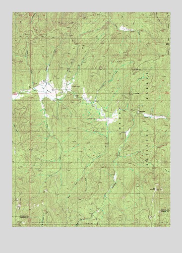
Cedar Springs Mountain, OR USGS Topographic Map
Click on map above to begin viewing in our Map Viewer.

This topographic map contains these locations and features:
Feature Name Type Latitude Longitude GNIS ID View Map
Anchor School (historical)SchoolN42.8232°W123.0606°1137192View Map
Applegate CreekStreamN42.8140°W123.0309°1137275View Map
Binger Post Office (historical)Post OfficeN42.8290°W123.1192°1164919View Map
Canyon Number Three TrailTrailN42.8215°W123.0253°1139167View Map
Castle RockPillarN42.8412°W123.0290°1139445View Map
Cedar Springs MountainSummitN42.7618°W123.1222°1139534View Map
Copper CreekStreamN42.8137°W123.0151°1154521View Map
Cow Creek GorgeValleyN42.8160°W123.0281°1167651View Map
Crater Lake Ski BowlLocaleN42.8735°W123.0637°1155203View Map
Devil CreekStreamN42.8179°W123.0370°1140933View Map
Devils FlatFlatN42.8168°W123.0267°1134598View Map
Devils Flat Guard StationLocaleN42.8168°W123.0267°1140950View Map
Devils Flat Recreation SiteLocaleN42.8182°W123.0267°1156154View Map
Dismal CreekStreamN42.8129°W123.0512°1141049View Map
East Fork Applegate CreekStreamN42.7573°W123.0614°1141527View Map
East Fork Dismal CreekStreamN42.7826°W123.0689°1141556View Map
Elk CreekStreamN42.8276°W123.1206°1154517View Map
French CreekStreamN42.8223°W123.0642°1142459View Map
Granite CreekStreamN42.8179°W123.0553°1154520View Map
Green ButteSummitN42.8560°W123.0020°1143021View Map
Ike ButteSummitN42.8313°W123.0750°1143985View Map
Jack CreekStreamN42.7682°W123.0526°1155081View Map
Koch RanchLocaleN42.8048°W123.0362°1134597View Map
Maple CreekStreamN42.8290°W123.0831°1154519View Map
Meadow CreekStreamN42.8285°W123.1017°1146047View Map
North Fork Dismal CreekStreamN42.8026°W123.0512°1154515View Map
Red MountainSummitN42.7721°W123.0127°1148321View Map
Red Mountain TrailTrailN42.7687°W123.0317°1148325View Map
Snow CreekStreamN42.8273°W123.0995°1149805View Map
Steamboat CreekStreamN42.8276°W123.1164°1154518View Map
Sugar CreekStreamN42.8293°W123.1081°1150528View Map
The MeadowsFlatN42.8285°W123.0939°1151025View Map
West Fork Applegate CreekStreamN42.7573°W123.0614°1152047View Map
West Fork Dismal CreekStreamN42.7826°W123.0687°1152069View Map

Note: Coordinates in the location and feature list above are referenced to NAD83 datum.


Copyright (C) 2008-2025 Ryan Niemi / Sunset Dynamics ... All Rights Reserved