TopoQuest Logo
Do you find TopoQuest useful?
Help keep TopoQuest running and adding new maps/features by donating!
Bitcoin:  19c7KJd3qBynnjoSw5npx9KScwjBe4ifkT
Litecoin:  LXs6TkuXGGXo1vDsWCkWVdjQX94eUKd6ui
Home View Maps Find Maps Find Places Resources & Links


Richville, New York Topographic Map

USGS Map Title: Richville, NY
USGS Map MRC: 44075D4
DRG (GeoTIFF) Download: o44075d4.tif


Neighboring USGS Topographic Map Quads:


  Edwardsville, NY  
44075E5
 

  Heuvelton, NY  
44075E4
 

  Rensselaer Falls, NY  
44075E3
 

  Pope Mills, NY  
44075D5
 

  Richville, NY  
44075D4
 

  Bigelow, NY  
44075D3
 

  Natural Dam, NY  
44075C5
 

  Gouverneur, NY  
44075C4
 

  Edwards, NY  
44075C3


Map MRC Location:

N45°
W76°
N45°
W75°
H8 H7 H6 H5 H4 H3 H2 H1
G8 G7 G6 G5 G4 G3 G2 G1
F8 F7 F6 F5 F4 F3 F2 F1
E8 E7 E6 E5 E4 E3 E2 E1
D8 D7 D6 D5 D4 D3 D2 D1
C8 C7 C6 C5 C4 C3 C2 C1
B8 B7 B6 B5 B4 B3 B2 B1
A8 A7 A6 A5 A4 A3 A2 A1
N44°
W76°
N44°
W75°

Richville, NY USGS 1:24K Topographic Map Preview:
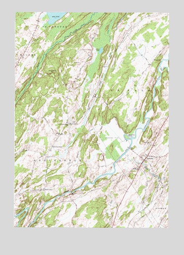
Richville, NY USGS Topographic Map
Click on map above to begin viewing in our Map Viewer.

This topographic map contains these locations and features:
Feature Name Type Latitude Longitude GNIS ID View Map
Billings SchoolSchoolN44.4292°W75.4627°975972View Map
Boland CreekStreamN44.4181°W75.4102°977215View Map
Grays SchoolSchoolN44.4731°W75.3869°976370View Map
Halls CornersLocaleN44.3976°W75.4749°976399View Map
Huckleberry MountainSummitN44.4648°W75.4724°976462View Map
Indian CreekStreamN44.4690°W75.3822°976468View Map
Locust AcresLocaleN44.3881°W75.4583°2559375View Map
Maple Grove CemeteryCemeteryN44.4242°W75.3894°976621View Map
Merrill CreekStreamN44.4262°W75.4085°976654View Map
North GouverneurPopulated PlaceN44.4212°W75.4699°976733View Map
North Gouverneur CemeteryCemeteryN44.4162°W75.4738°976734View Map
North Gouverneur ChurchChurchN44.4353°W75.4566°976735View Map
Osborn LakeLakeN44.4779°W75.4304°976777View Map
Peabody BridgeBridgeN44.3781°W75.4841°976802View Map
RichvillePopulated PlaceN44.4173°W75.3919°976888View Map
Richville Baptist ChapelChurchN44.4212°W75.3897°2598306View Map
Richville Census Designated PlaceCensusN44.4151°W75.3925°2786719View Map
Richville Christian FellowshipChurchN44.4169°W75.3960°2597604View Map
Richville Free LibraryBuildingN44.4138°W75.3955°2599070View Map
Richville Post OfficePost OfficeN44.4176°W75.3911°2599221View Map
Richville United ChurchChurchN44.4170°W75.3914°2597605View Map
Richville Volunteer Fire DepartmentBuildingN44.4130°W75.3967°2735287View Map
Rock Island BridgeBridgeN44.3956°W75.4541°976900View Map
Snowshoe IslandIslandN44.4281°W75.4094°977018View Map
South Branch Beaver CreekStreamN44.4981°W75.4199°977027View Map
Spooner FlatFlatN44.4276°W75.4194°977043View Map
Staplin CornersLocaleN44.4353°W75.4561°977055View Map
Village of Richville (historical)CivilN44.4151°W75.3925°2391096View Map
Wayside CemeteryCemeteryN44.4123°W75.3980°977190View Map
Welch ChurchChurchN44.4095°W75.3994°977194View Map
White CreekStreamN44.4145°W75.4066°977269View Map

Note: Coordinates in the location and feature list above are referenced to NAD83 datum.


Copyright (C) 2008-2025 Ryan Niemi / Sunset Dynamics ... All Rights Reserved