TopoQuest Logo
Do you find TopoQuest useful?
Help keep TopoQuest running and adding new maps/features by donating!
Bitcoin:  19c7KJd3qBynnjoSw5npx9KScwjBe4ifkT
Litecoin:  LXs6TkuXGGXo1vDsWCkWVdjQX94eUKd6ui
Home View Maps Find Maps Find Places Resources & Links


Rimrock Divide, Montana Topographic Map

USGS Map Title: Rimrock Divide, MT
USGS Map MRC: 46110C5
DRG (GeoTIFF) Download: o46110c5.tif


Neighboring USGS Topographic Map Quads:


  Castle Town, MT  
46110D6
 

  Lennep, MT  
46110D5
 

  Groveland, MT  
46110D4
 

  Hamen, MT  
46110C6
 

  Rimrock Divide, MT  
46110C5
 

  Lebo, MT  
46110C4
 

  Wolf Hill, MT  
46110B6
 

  Scab Rock Mountain, MT  
46110B5
 

  Virginia Peak, MT  
46110B4


Map MRC Location:

N47°
W111°
N47°
W110°
H8 H7 H6 H5 H4 H3 H2 H1
G8 G7 G6 G5 G4 G3 G2 G1
F8 F7 F6 F5 F4 F3 F2 F1
E8 E7 E6 E5 E4 E3 E2 E1
D8 D7 D6 D5 D4 D3 D2 D1
C8 C7 C6 C5 C4 C3 C2 C1
B8 B7 B6 B5 B4 B3 B2 B1
A8 A7 A6 A5 A4 A3 A2 A1
N46°
W111°
N46°
W110°

Rimrock Divide, MT USGS 1:24K Topographic Map Preview:
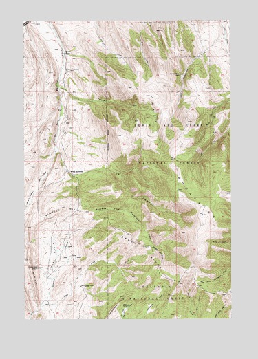
Rimrock Divide, MT USGS Topographic Map
Click on map above to begin viewing in our Map Viewer.

This topographic map contains these locations and features:
Feature Name Type Latitude Longitude GNIS ID View Map
06N13E01CDCB01 WellWellN46.2938°W110.5038°815157View Map
BaldRidgeN46.2813°W110.5583°779278View Map
Bill Bracket PlacePopulated PlaceN46.2638°W110.5913°779907View Map
Box CanyonValleyN46.3105°W110.5966°780324View Map
Glenns CabinLocaleN46.2719°W110.6177°783990View Map
Haypress MeadowFlatN46.3058°W110.6185°784667View Map
Hereim HomesteadLocaleN46.3522°W110.5296°784796View Map
Hoyem HomesteadLocaleN46.3547°W110.6005°785122View Map
Indian CreekStreamN46.3477°W110.6046°785245View Map
Little Cottonwood CreekStreamN46.3697°W110.5038°786274View Map
McKee HomesteadLocaleN46.3122°W110.5983°787078View Map
Pig CreekStreamN46.3744°W110.5524°767984View Map
Rimrock DivideRidgeN46.2966°W110.6027°789592View Map
Rostad RanchLocaleN46.3613°W110.6008°789799View Map
Sawmill GulchValleyN46.2563°W110.6152°790068View Map
Spruce SpringsSpringN46.2555°W110.5633°791351View Map
The BasinBasinN46.2766°W110.6071°792020View Map
The ParkFlatN46.2536°W110.5655°792047View Map
The ReefsAreaN46.3716°W110.5430°792050View Map
The RimrockRidgeN46.2699°W110.6216°792051View Map
Woodchuck RidgeRidgeN46.2516°W110.5763°793499View Map

Note: Coordinates in the location and feature list above are referenced to NAD83 datum.


Copyright (C) 2008-2025 Ryan Niemi / Sunset Dynamics ... All Rights Reserved