TopoQuest Logo
Do you find TopoQuest useful?
Help keep TopoQuest running and adding new maps/features by donating!
Bitcoin:  19c7KJd3qBynnjoSw5npx9KScwjBe4ifkT
Litecoin:  LXs6TkuXGGXo1vDsWCkWVdjQX94eUKd6ui
Home View Maps Find Maps Find Places Resources & Links


Rincon, Georgia Topographic Map

USGS Map Title: Rincon, GA
USGS Map MRC: 32081C2
DRG (GeoTIFF) Download: o32081c2.tif


Neighboring USGS Topographic Map Quads:


  Springfield North, GA  
32081D3
 

  Hardeeville NW, SC  
32081D2
 

  Tillman, SC  
32081D1
 

  Springfield South, GA  
32081C3
 

  Rincon, GA  
32081C2
 

  Hardeeville, SC  
32081C1
 

  Meldrim, GA  
32081B3
 

  Port Wentworth, GA  
32081B2


Map MRC Location:

N33°
W82°
N33°
W81°
H8 H7 H6 H5 H4 H3 H2 H1
G8 G7 G6 G5 G4 G3 G2 G1
F8 F7 F6 F5 F4 F3 F2 F1
E8 E7 E6 E5 E4 E3 E2 E1
D8 D7 D6 D5 D4 D3 D2 D1
C8 C7 C6 C5 C4 C3 C2 C1
B8 B7 B6 B5 B4 B3 B2 B1
A8 A7 A6 A5 A4 A3 A2 A1
N32°
W82°
N32°
W81°

Rincon, GA USGS 1:24K Topographic Map Preview:
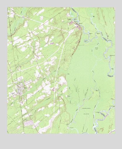
Rincon, GA USGS Topographic Map
Click on map above to begin viewing in our Map Viewer.

This topographic map contains these locations and features:
Feature Name Type Latitude Longitude GNIS ID View Map
Abercorn ChurchChurchN32.2588°W81.1796°310368View Map
Bay Bush PointCapeN32.3494°W81.1543°1220370View Map
Bear CreekStreamN32.2941°W81.1473°310927View Map
Becks Ferry (historical)CrossingN32.3499°W81.1301°350205View Map
Becks Ferry (historical)CrossingN32.3499°W81.1301°1241326View Map
Bethel ChapelChurchN32.2896°W81.2443°311153View Map
Big Collis CreekStreamN32.2541°W81.1484°311355View Map
Big Gayland CreekStreamN32.2513°W81.1598°311384View Map
Big Kiffer PointCapeN32.3630°W81.1726°1246881View Map
Big Patten LandingLocaleN32.2821°W81.1279°350206View Map
BirdsPopulated PlaceN32.3407°W81.2440°331170View Map
Birds BranchStreamN32.3435°W81.2201°311453View Map
Blandford Elementary SchoolSchoolN32.2614°W81.2432°2453175View Map
Church of GodChurchN32.3207°W81.2493°350208View Map
City of RinconCivilN32.2942°W81.2356°2407220View Map
Coleman LakeBayN32.3577°W81.1476°1247337View Map
Coleman RunStreamN32.3594°W81.1496°1221681View Map
Dasha LandingLocaleN32.3083°W81.1809°331513View Map
Dasher CreekStreamN32.3110°W81.1809°313321View Map
Ebenezer Elementary SchoolSchoolN32.3477°W81.2251°2453100View Map
Ebenezer Middle SchoolSchoolN32.3467°W81.2280°2453176View Map
Flat Ditch PointCapeN32.3413°W81.1583°1227809View Map
Forks LakeLakeN32.3452°W81.1340°1228113View Map
Fox LakeLakeN32.3436°W81.1338°1251578View Map
Gator HolesLakeN32.3656°W81.1509°1222662View Map
Glovers PointCapeN32.2705°W81.1334°350226View Map
Gnann CemeteryCemeteryN32.3605°W81.2462°314655View Map
Goshen VillaPopulated PlaceN32.2613°W81.2059°350228View Map
Green CemeteryCemeteryN32.2916°W81.1879°314826View Map
Gum Stump PointCapeN32.2702°W81.1429°314978View Map
Jones CemeteryCemeteryN32.2977°W81.1896°316210View Map
Lady Washington PointCapeN32.2763°W81.1251°316530View Map
Little Abercorn CreekStreamN32.2841°W81.1615°316926View Map
Little Collis CreekStreamN32.2808°W81.1443°316994View Map
Little Gayland CreekStreamN32.2513°W81.1576°317072View Map
Little Kiffer PointCapeN32.3591°W81.1668°1246405View Map
Lockner CreekStreamN32.3630°W81.1740°317275View Map
Meyer LakeLakeN32.3125°W81.1260°1246630View Map
Middle Kiffer PointCapeN32.3607°W81.1676°318081View Map
Mill CreekStreamN32.2783°W81.1690°318191View Map
Mosquito CreekStreamN32.2855°W81.1596°318525View Map
Newington LandingLocaleN32.2874°W81.1801°332498View Map
Northside ChurchChurchN32.3121°W81.2454°350252View Map
Old Wood LandingLocaleN32.3580°W81.1676°332569View Map
Pine Tree Camp PointCapeN32.3271°W81.1312°1225474View Map
Polly CreekStreamN32.3421°W81.2173°320984View Map
Raccoon CreekStreamN32.2771°W81.1659°321266View Map
Rahn CemeteryCemeteryN32.3124°W81.2462°321282View Map
RinconPopulated PlaceN32.2960°W81.2354°332857View Map
Rincon BranchStreamN32.2916°W81.2271°321614View Map
Rincon CemeteryCemeteryN32.3157°W81.2354°321615View Map
Rincon ChurchChurchN32.2588°W81.2179°350256View Map
Rincon Elementary SchoolSchoolN32.2957°W81.2344°350257View Map
Rincon Fire Department Station 1BuildingN32.2790°W81.2332°2603929View Map
Rincon Fire Department Station 2BuildingN32.3416°W81.2434°2603873View Map
Rincon Police DepartmentBuildingN32.2790°W81.2328°2733793View Map
Rincon South Shopping CenterLocaleN32.2808°W81.2329°350258View Map
Rincon Town HallBuildingN32.2944°W81.2365°350259View Map
Savannah Water WorksBuildingN32.2558°W81.1784°350262View Map
Silverwood PlantationPopulated PlaceN32.2655°W81.2137°350265View Map
Sweigoffer CreekStreamN32.2844°W81.1790°323842View Map
Symons LandingLocaleN32.3632°W81.1757°333178View Map
WillowpegPopulated PlaceN32.2780°W81.2240°350280View Map
Willowpeg CemeteryCemeteryN32.2675°W81.2235°325412View Map
Willowpeg CreekStreamN32.2760°W81.2151°325413View Map

Note: Coordinates in the location and feature list above are referenced to NAD83 datum.


Copyright (C) 2008-2025 Ryan Niemi / Sunset Dynamics ... All Rights Reserved