TopoQuest Logo
Do you find TopoQuest useful?
Help keep TopoQuest running and adding new maps/features by donating!
Bitcoin:  19c7KJd3qBynnjoSw5npx9KScwjBe4ifkT
Litecoin:  LXs6TkuXGGXo1vDsWCkWVdjQX94eUKd6ui
Home View Maps Find Maps Find Places Resources & Links


Springfield North, Georgia Topographic Map

USGS Map Title: Springfield North, GA
USGS Map MRC: 32081D3
DRG (GeoTIFF) Download: o32081d3.tif


Neighboring USGS Topographic Map Quads:


  Kildare, GA  
32081E4
 

  Brighton, SC  
32081E3
 

  Pineland, SC  
32081E2
 

  Egypt, GA  
32081D4
 

  Springfield North, GA  
32081D3
 

  Hardeeville NW, SC  
32081D2
 

  Guyton, GA  
32081C4
 

  Springfield South, GA  
32081C3
 

  Rincon, GA  
32081C2


Map MRC Location:

N33°
W82°
N33°
W81°
H8 H7 H6 H5 H4 H3 H2 H1
G8 G7 G6 G5 G4 G3 G2 G1
F8 F7 F6 F5 F4 F3 F2 F1
E8 E7 E6 E5 E4 E3 E2 E1
D8 D7 D6 D5 D4 D3 D2 D1
C8 C7 C6 C5 C4 C3 C2 C1
B8 B7 B6 B5 B4 B3 B2 B1
A8 A7 A6 A5 A4 A3 A2 A1
N32°
W82°
N32°
W81°

Springfield North, GA USGS 1:24K Topographic Map Preview:
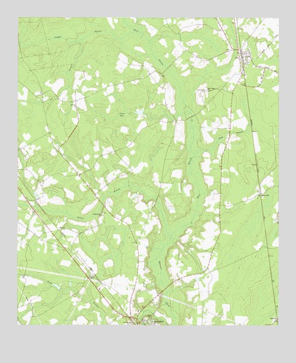
Springfield North, GA USGS Topographic Map
Click on map above to begin viewing in our Map Viewer.

This topographic map contains these locations and features:
Feature Name Type Latitude Longitude GNIS ID View Map
BerryvillePopulated PlaceN32.4285°W81.2587°354560View Map
Berryville Baptist ChurchChurchN32.4272°W81.2575°2502784View Map
BethelPopulated PlaceN32.4138°W81.3548°331144View Map
Bethel ChurchChurchN32.3952°W81.3398°311173View Map
Briar Patch AirportAirportN32.4486°W81.3373°2646211View Map
Cedar Grove CemeteryCemeteryN32.4707°W81.2845°312469View Map
ClyoPopulated PlaceN32.4841°W81.2671°312778View Map
Clyo Lutheran Parish ChurchChurchN32.4705°W81.2858°2502785View Map
Clyo Post OfficePost OfficeN32.4835°W81.2683°350209View Map
Cowpen BranchStreamN32.4943°W81.3198°313066View Map
Deep BranchStreamN32.4449°W81.2901°313405View Map
Effingham County Fire Rescue Station 1BuildingN32.4825°W81.2681°2603583View Map
Effingham County Fire Rescue Station 2BuildingN32.4286°W81.2582°2603953View Map
Green BaySwampN32.4609°W81.3249°314814View Map
Kieffer CemeteryCemeteryN32.3782°W81.3126°316410View Map
Laurel Hill ChurchChurchN32.4702°W81.2859°316676View Map
Lee BranchStreamN32.4905°W81.3443°316729View Map
Lee School (historical)SchoolN32.4674°W81.3429°334650View Map
Metzger CemeteryCemeteryN32.4871°W81.2737°350244View Map
Midway School (historical)SchoolN32.4288°W81.2773°334651View Map
Mill CreekStreamN32.4724°W81.3504°350245View Map
Morgan School (historical)SchoolN32.4460°W81.3284°334652View Map
Mount Pisgah ChurchChurchN32.4857°W81.2637°350249View Map
Runs BranchStreamN32.4155°W81.2984°322003View Map
Saint Mathews ChurchChurchN32.3763°W81.3201°322211View Map
Silver Hill ChurchChurchN32.4635°W81.3471°322988View Map
Springfield Elementary SchoolSchoolN32.3826°W81.3198°350268View Map
StillwellPopulated PlaceN32.3780°W81.2504°323623View Map
Stillwell Airport (historical)AirportN32.3757°W81.2571°350270View Map
Stillwell Post OfficePost OfficeN32.3777°W81.2512°350271View Map
Swaids FieldAirportN32.3937°W81.2808°351909View Map
Turkey BranchStreamN32.4155°W81.2984°324365View Map
Turkey Branch ChurchChurchN32.4196°W81.3346°324366View Map
Union Spring ChurchChurchN32.4271°W81.2576°350275View Map
Wesley Independent ChurchChurchN32.3980°W81.3173°350278View Map
Wheeler CemeteryCemeteryN32.4763°W81.3062°350279View Map

Note: Coordinates in the location and feature list above are referenced to NAD83 datum.


Copyright (C) 2008-2025 Ryan Niemi / Sunset Dynamics ... All Rights Reserved