TopoQuest Logo
Do you find TopoQuest useful?
Help keep TopoQuest running and adding new maps/features by donating!
Bitcoin:  19c7KJd3qBynnjoSw5npx9KScwjBe4ifkT
Litecoin:  LXs6TkuXGGXo1vDsWCkWVdjQX94eUKd6ui
Home View Maps Find Maps Find Places Resources & Links


Meldrim, Georgia Topographic Map

USGS Map Title: Meldrim, GA
USGS Map MRC: 32081B3
DRG (GeoTIFF) Download: o32081b3.tif


Neighboring USGS Topographic Map Quads:


  Guyton, GA  
32081C4
 

  Springfield South, GA  
32081C3
 

  Rincon, GA  
32081C2
 

  Eden, GA  
32081B4
 

  Meldrim, GA  
32081B3
 

  Port Wentworth, GA  
32081B2
 

  Meldrim SW, GA  
32081A4
 

  Meldrim SE, GA  
32081A3


Map MRC Location:

N33°
W82°
N33°
W81°
H8 H7 H6 H5 H4 H3 H2 H1
G8 G7 G6 G5 G4 G3 G2 G1
F8 F7 F6 F5 F4 F3 F2 F1
E8 E7 E6 E5 E4 E3 E2 E1
D8 D7 D6 D5 D4 D3 D2 D1
C8 C7 C6 C5 C4 C3 C2 C1
B8 B7 B6 B5 B4 B3 B2 B1
A8 A7 A6 A5 A4 A3 A2 A1
N32°
W82°
N32°
W81°

Meldrim, GA USGS 1:24K Topographic Map Preview:
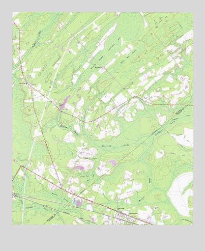
Meldrim, GA USGS Topographic Map
Click on map above to begin viewing in our Map Viewer.

This topographic map contains these locations and features:
Feature Name Type Latitude Longitude GNIS ID View Map
Alpha United Methodist ChurchChurchN32.1318°W81.3001°2502721View Map
Berea Southern Methodist ChurchChurchN32.1993°W81.2869°2502903View Map
Bethesda ChurchChurchN32.2174°W81.3129°311218View Map
BloomingdalePopulated PlaceN32.1324°W81.2990°331192View Map
Bloomingdale Alliance ChurchChurchN32.1340°W81.3081°2502348View Map
Bloomingdale City HallBuildingN32.1335°W81.3022°2502430View Map
Bloomingdale Elementary SchoolSchoolN32.1276°W81.3002°1694461View Map
Bloomingdale Municipal CourtBuildingN32.1336°W81.3019°2502427View Map
Bloomingdale Police DepartmentBuildingN32.1341°W81.3016°2733810View Map
Bloomingdale Volunteer Fire DepartmentBuildingN32.1339°W81.3027°2603607View Map
Church of ChristChurchN32.1892°W81.3123°2502904View Map
Country Side ChurchChurchN32.1894°W81.3334°350210View Map
Effingham Fire / Rescue Station 3BuildingN32.2187°W81.3694°2603634View Map
Effingham Fire / Rescue Station 8BuildingN32.1954°W81.3039°2603652View Map
Effingham Fire / Rescue Station 9BuildingN32.1722°W81.3309°2603573View Map
Falkville ChurchChurchN32.1466°W81.3365°350224View Map
Fetzer School (historical)SchoolN32.2094°W81.3548°350225View Map
Gadny BaySwampN32.1538°W81.3240°314471View Map
Hardin SwampSwampN32.1414°W81.3430°315121View Map
Hester CemeteryCemeteryN32.1933°W81.3379°350233View Map
Horning SwampSwampN32.2127°W81.3258°315676View Map
International Worship CenterChurchN32.1477°W81.3440°2502724View Map
Kingdom HallChurchN32.1516°W81.3429°350236View Map
Marlow Elementary SchoolSchoolN32.1982°W81.3626°317706View Map
Meldrim CemeteryCemeteryN32.1513°W81.3676°318007View Map
Miller Chapel ChurchChurchN32.1994°W81.2868°318259View Map
Monterey Park ChurchChurchN32.1477°W81.3443°350247View Map
Morgans PondReservoirN32.1937°W81.3407°318466View Map
Morgans Pond DamDamN32.1958°W81.3396°337767View Map
Old Hill CemeteryCemeteryN32.1400°W81.3729°350254View Map
Ottawa EstatesPopulated PlaceN32.1327°W81.2943°1694622View Map
Piney Grove ChurchChurchN32.1335°W81.3015°320707View Map
Pooler Fire and Rescue Station 2BuildingN32.1275°W81.2627°2604656View Map
Rincon DivisionCivilN32.2493°W81.2725°1936497View Map
River StyxStreamN32.1688°W81.3129°321631View Map
Scuffletown School (historical)SchoolN32.2194°W81.2609°350263View Map
Skinners BaySwampN32.2373°W81.2991°323058View Map
South Effingham Elementary SchoolSchoolN32.2104°W81.2797°2453131View Map
South Effingham High SchoolSchoolN32.1880°W81.3342°2442327View Map
South Effingham Middle SchoolSchoolN32.1887°W81.3368°2453095View Map
Spirit BranchStreamN32.1688°W81.3129°323345View Map
Three Men SwampSwampN32.2249°W81.2929°324142View Map
Union Church (historical)ChurchN32.2338°W81.3484°350274View Map
Walthour SwampSwampN32.1401°W81.2852°324819View Map
Walthour SwampSwampN32.1787°W81.2820°324820View Map
Zeigler PondReservoirN32.1586°W81.3285°337770View Map
Zeigler Pond DamDamN32.1585°W81.3265°337769View Map
Zion ChurchChurchN32.2077°W81.3621°325673View Map

Note: Coordinates in the location and feature list above are referenced to NAD83 datum.


Copyright (C) 2008-2025 Ryan Niemi / Sunset Dynamics ... All Rights Reserved