TopoQuest Logo
Do you find TopoQuest useful?
Help keep TopoQuest running and adding new maps/features by donating!
Bitcoin:  19c7KJd3qBynnjoSw5npx9KScwjBe4ifkT
Litecoin:  LXs6TkuXGGXo1vDsWCkWVdjQX94eUKd6ui
Home View Maps Find Maps Find Places Resources & Links


Ritch, Georgia Topographic Map

USGS Map Title: Ritch, GA
USGS Map MRC: 31082E1
DRG (GeoTIFF) Download: o31082e1.tif


Neighboring USGS Topographic Map Quads:


  Surrency, GA  
31082F2
 

  Odum, GA  
31082F1
 

  Jesup NW, GA  
31081F8
 

  K'Ville, GA  
31082E2
 

  Ritch, GA  
31082E1
 

  Jesup West, GA  
31081E8
 

  Patterson, GA  
31082D2
 

  Screven, GA  
31082D1
 

  McKinnon, GA  
31081D8


Map MRC Location:

N32°
W83°
N32°
W82°
H8 H7 H6 H5 H4 H3 H2 H1
G8 G7 G6 G5 G4 G3 G2 G1
F8 F7 F6 F5 F4 F3 F2 F1
E8 E7 E6 E5 E4 E3 E2 E1
D8 D7 D6 D5 D4 D3 D2 D1
C8 C7 C6 C5 C4 C3 C2 C1
B8 B7 B6 B5 B4 B3 B2 B1
A8 A7 A6 A5 A4 A3 A2 A1
N31°
W83°
N31°
W82°

Ritch, GA USGS 1:24K Topographic Map Preview:
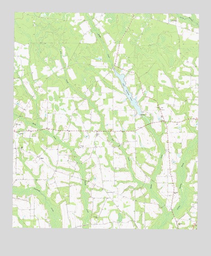
Ritch, GA USGS Topographic Map
Click on map above to begin viewing in our Map Viewer.

This topographic map contains these locations and features:
Feature Name Type Latitude Longitude GNIS ID View Map
Bennett CemeteryCemeteryN31.5213°W82.0157°311083View Map
Boggy CreekStreamN31.5083°W82.0204°311614View Map
Church of GodChurchN31.5213°W82.0573°350560View Map
Dry CreekStreamN31.5233°W82.0315°313666View Map
Farm Life School (historical)SchoolN31.5144°W82.0882°350568View Map
Lake Lindsay GraceReservoirN31.5783°W82.0465°338526View Map
Liberty ChurchChurchN31.5705°W82.0254°316803View Map
O'Quinn ChurchChurchN31.5541°W82.0679°319731View Map
Old Bethel ChurchChurchN31.6213°W82.0151°319941View Map
Old Ritch CemeteryCemeteryN31.5602°W82.1234°320015View Map
Reddishville School (historical)SchoolN31.5927°W82.0590°350602View Map
RitchPopulated PlaceN31.5399°W82.1062°332862View Map
Ritch ChurchChurchN31.5460°W82.1193°321621View Map
Screven CemeteryCemeteryN31.5033°W82.0126°322660View Map
Screven Church of GodChurchN31.5212°W82.0572°2502237View Map
Screven DivisionCivilN31.5027°W82.0230°1936532View Map
Smiths CemeteryCemeteryN31.5477°W82.0765°323156View Map
Thornton CemeteryCemeteryN31.5066°W82.0668°324133View Map
Wayne County Fire Department O'Quinn StationBuildingN31.5558°W82.0682°2604833View Map
Wesley ChurchChurchN31.5699°W82.0251°325025View Map

Note: Coordinates in the location and feature list above are referenced to NAD83 datum.


Copyright (C) 2008-2025 Ryan Niemi / Sunset Dynamics ... All Rights Reserved