TopoQuest Logo
Do you find TopoQuest useful?
Help keep TopoQuest running and adding new maps/features by donating!
Bitcoin:  19c7KJd3qBynnjoSw5npx9KScwjBe4ifkT
Litecoin:  LXs6TkuXGGXo1vDsWCkWVdjQX94eUKd6ui
Home View Maps Find Maps Find Places Resources & Links


Screven, Georgia Topographic Map

USGS Map Title: Screven, GA
USGS Map MRC: 31082D1
DRG (GeoTIFF) Download: o31082d1.tif


Neighboring USGS Topographic Map Quads:


  K'Ville, GA  
31082E2
 

  Ritch, GA  
31082E1
 

  Jesup West, GA  
31081E8
 

  Patterson, GA  
31082D2
 

  Screven, GA  
31082D1
 

  McKinnon, GA  
31081D8
 

  Blackshear East, GA  
31082C2
 

  Patterson SE, GA  
31082C1
 

  Hortense, GA  
31081C8


Map MRC Location:

N32°
W83°
N32°
W82°
H8 H7 H6 H5 H4 H3 H2 H1
G8 G7 G6 G5 G4 G3 G2 G1
F8 F7 F6 F5 F4 F3 F2 F1
E8 E7 E6 E5 E4 E3 E2 E1
D8 D7 D6 D5 D4 D3 D2 D1
C8 C7 C6 C5 C4 C3 C2 C1
B8 B7 B6 B5 B4 B3 B2 B1
A8 A7 A6 A5 A4 A3 A2 A1
N31°
W83°
N31°
W82°

Screven, GA USGS 1:24K Topographic Map Preview:
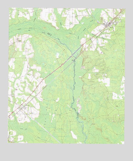
Screven, GA USGS Topographic Map
Click on map above to begin viewing in our Map Viewer.

This topographic map contains these locations and features:
Feature Name Type Latitude Longitude GNIS ID View Map
Big CreekStreamN31.4838°W82.1071°311366View Map
Big Satilla CreekStreamN31.4547°W82.0526°311408View Map
City of OffermanCivilN31.4088°W82.1132°2404421View Map
City of ScrevenCivilN31.4840°W82.0171°2405436View Map
Clay Hill CemeteryCemeteryN31.4702°W82.1157°312702View Map
Colemans CreekStreamN31.4810°W82.0921°312831View Map
Doctor McKee Hargrett BridgeBridgeN31.4572°W82.0562°349057View Map
First Baptist Church of ScrevenChurchN31.4844°W82.0207°1686420View Map
Foster CemeteryCemeteryN31.4694°W82.1140°314303View Map
Lions ParkParkN31.3777°W82.1221°316919View Map
Little Satilla CreekStreamN31.4547°W82.0528°310349View Map
Moody CemeteryCemeteryN31.4324°W82.0362°318411View Map
New Home CemeteryCemeteryN31.4388°W82.1048°349077View Map
New Home ChurchChurchN31.4388°W82.1040°319338View Map
Oak Grove School (historical)SchoolN31.4572°W82.1068°349079View Map
OffermanPopulated PlaceN31.4097°W82.1118°332558View Map
Offerman - Big Creek Volunteer Fire DepartmentBuildingN31.4082°W82.1153°2604906View Map
Offerman Baptist ChurchChurchN31.4074°W82.1137°349080View Map
Offerman CemeteryCemeteryN31.3960°W82.1137°319911View Map
Offerman Church of GodChurchN31.4072°W82.1137°2502343View Map
Patterson DivisionCivilN31.3754°W82.1061°1936462View Map
Reedy CreekStreamN31.4802°W82.0429°321461View Map
ScrevenPopulated PlaceN31.4863°W82.0171°332994View Map
Screven Elementary SchoolSchoolN31.4861°W82.0224°350605View Map
Screven Police DepartmentBuildingN31.4868°W82.0171°2733847View Map
Screven Post OfficePost OfficeN31.4861°W82.0178°2502494View Map
Screven Volunteer Fire DepartmentBuildingN31.4859°W82.0201°2603578View Map
Screven Water Pollution Control PlantLocaleN31.4770°W82.0149°2502469View Map
Tiger CreekStreamN31.4805°W82.0429°324167View Map
Zero BaySwampN31.4013°W82.0835°325662View Map

Note: Coordinates in the location and feature list above are referenced to NAD83 datum.


Copyright (C) 2008-2025 Ryan Niemi / Sunset Dynamics ... All Rights Reserved