TopoQuest Logo
Do you find TopoQuest useful?
Help keep TopoQuest running and adding new maps/features by donating!
Bitcoin:  19c7KJd3qBynnjoSw5npx9KScwjBe4ifkT
Litecoin:  LXs6TkuXGGXo1vDsWCkWVdjQX94eUKd6ui
Home View Maps Find Maps Find Places Resources & Links


Roads, Missouri Topographic Map

USGS Map Title: Roads, MO
USGS Map MRC: 39093D6
DRG (GeoTIFF) Download: o39093d6.tif


Neighboring USGS Topographic Map Quads:


  Braymer, MO  
39093E7
 

  Plymouth, MO  
39093E6
 

  Coloma, MO  
39093E5
 

  Stet, MO  
39093D7
 

  Roads, MO  
39093D6
 

  Bogard, MO  
39093D5
 

  Hardin, MO  
39093C7
 

  Norborne, MO  
39093C6
 

  Carrollton West, MO  
39093C5


Map MRC Location:

N40°
W94°
N40°
W93°
H8 H7 H6 H5 H4 H3 H2 H1
G8 G7 G6 G5 G4 G3 G2 G1
F8 F7 F6 F5 F4 F3 F2 F1
E8 E7 E6 E5 E4 E3 E2 E1
D8 D7 D6 D5 D4 D3 D2 D1
C8 C7 C6 C5 C4 C3 C2 C1
B8 B7 B6 B5 B4 B3 B2 B1
A8 A7 A6 A5 A4 A3 A2 A1
N39°
W94°
N39°
W93°

Roads, MO USGS 1:24K Topographic Map Preview:
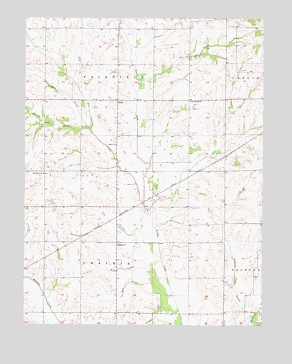
Roads, MO USGS Topographic Map
Click on map above to begin viewing in our Map Viewer.

This topographic map contains these locations and features:
Feature Name Type Latitude Longitude GNIS ID View Map
Amery LakeReservoirN39.4781°W93.7034°762522View Map
Amery Lake DamDamN39.4784°W93.7019°762521View Map
Antioch ChurchChurchN39.4083°W93.7010°713333View Map
Bee BranchStreamN39.4731°W93.6897°736275View Map
Burr Oak CreekStreamN39.4253°W93.6874°715096View Map
Davis BranchStreamN39.4553°W93.7174°716699View Map
Enterprise School (historical)SchoolN39.4695°W93.6638°746936View Map
Hawkins Airport (historical)AirportN39.4449°W93.6603°758626View Map
Hickory BranchStreamN39.4547°W93.7155°719436View Map
JuddPopulated PlaceN39.4231°W93.7399°740215View Map
Judd BranchStreamN39.4084°W93.6799°720445View Map
Judd School (historical)SchoolN39.4195°W93.7027°746935View Map
Lost BranchStreamN39.3872°W93.6719°721577View Map
Miles BranchStreamN39.3945°W93.6749°722312View Map
Mount Carmel ChurchChurchN39.4664°W93.6635°722736View Map
Mount Olive ChurchChurchN39.4367°W93.7402°722821View Map
Null LakeReservoirN39.4383°W93.7285°762524View Map
Null Lake DamDamN39.4383°W93.7285°762523View Map
Prairie Dell School (historical)SchoolN39.4164°W93.6633°746937View Map
RoadsPopulated PlaceN39.4667°W93.7013°730195View Map
Roads School (historical)SchoolN39.4686°W93.7022°746939View Map
Stamm School (historical)SchoolN39.3750°W93.6447°746938View Map
Township of FairfieldCivilN39.4812°W93.7020°766411View Map
Township of PrairieCivilN39.3942°W93.7020°766417View Map
Tweedie Farms LakeReservoirN39.4127°W93.7379°762526View Map
Tweedie Farms Lake DamDamN39.4117°W93.7369°762525View Map
Union ChurchChurchN39.4486°W93.7022°728001View Map

Note: Coordinates in the location and feature list above are referenced to NAD83 datum.


Copyright (C) 2008-2025 Ryan Niemi / Sunset Dynamics ... All Rights Reserved