TopoQuest Logo
Do you find TopoQuest useful?
Help keep TopoQuest running and adding new maps/features by donating!
Bitcoin:  19c7KJd3qBynnjoSw5npx9KScwjBe4ifkT
Litecoin:  LXs6TkuXGGXo1vDsWCkWVdjQX94eUKd6ui
Home View Maps Find Maps Find Places Resources & Links


Bogard, Missouri Topographic Map

USGS Map Title: Bogard, MO
USGS Map MRC: 39093D5
DRG (GeoTIFF) Download: o39093d5.tif


Neighboring USGS Topographic Map Quads:


  Plymouth, MO  
39093E6
 

  Coloma, MO  
39093E5
 

  Tina, MO  
39093E4
 

  Roads, MO  
39093D6
 

  Bogard, MO  
39093D5
 

  Standish, MO  
39093D4
 

  Norborne, MO  
39093C6
 

  Carrollton West, MO  
39093C5
 

  Carrollton East, MO  
39093C4


Map MRC Location:

N40°
W94°
N40°
W93°
H8 H7 H6 H5 H4 H3 H2 H1
G8 G7 G6 G5 G4 G3 G2 G1
F8 F7 F6 F5 F4 F3 F2 F1
E8 E7 E6 E5 E4 E3 E2 E1
D8 D7 D6 D5 D4 D3 D2 D1
C8 C7 C6 C5 C4 C3 C2 C1
B8 B7 B6 B5 B4 B3 B2 B1
A8 A7 A6 A5 A4 A3 A2 A1
N39°
W94°
N39°
W93°

Bogard, MO USGS 1:24K Topographic Map Preview:
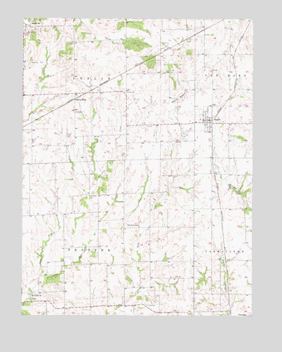
Bogard, MO USGS Topographic Map
Click on map above to begin viewing in our Map Viewer.

This topographic map contains these locations and features:
Feature Name Type Latitude Longitude GNIS ID View Map
Aalberg SidingLocaleN39.4661°W93.5969°736274View Map
Anderson LakeReservoirN39.4145°W93.5613°762398View Map
Anderson Lake DamDamN39.4134°W93.5619°762397View Map
Austin School (historical)SchoolN39.4184°W93.5835°746943View Map
Bingham (historical)Populated PlaceN39.4170°W93.6210°740163View Map
Bingham School (historical)SchoolN39.4175°W93.6205°746942View Map
BogardPopulated PlaceN39.4575°W93.5235°730060View Map
Bogard LakeReservoirN39.4695°W93.5360°761105View Map
Bogard Post OfficePost OfficeN39.4578°W93.5252°2782607View Map
Brown School (historical)SchoolN39.4772°W93.5588°746946View Map
Carroll CountyCivilN39.4270°W93.5052°758471View Map
Church of ChristChurchN39.4125°W93.5619°715836View Map
City of BogardCivilN39.4579°W93.5239°2394213View Map
Ebenezer CemeteryCemeteryN39.4692°W93.5694°717377View Map
Germann Lake DamDamN39.4700°W93.5369°761104View Map
Griffin LakeReservoirN39.4018°W93.5077°761878View Map
Griffin Lake DamDamN39.4017°W93.5085°761877View Map
Hartis School (historical)SchoolN39.4611°W93.5835°746940View Map
Hood School (historical)SchoolN39.4595°W93.6208°746941View Map
Jarvis LakeReservoirN39.4967°W93.5519°762402View Map
Jarvis Lake DamDamN39.4967°W93.5519°762401View Map
Knott LakeReservoirN39.4427°W93.5708°762400View Map
Knott Lake DamDamN39.4434°W93.5719°762399View Map
MandevillePopulated PlaceN39.4964°W93.6210°721787View Map
Mandeville School (historical)SchoolN39.4989°W93.6205°746949View Map
McCroskie ChurchChurchN39.3839°W93.6194°722067View Map
Mound BogardSummitN39.4670°W93.5388°730154View Map
Mount Zion CemeteryCemeteryN39.4353°W93.5216°722935View Map
North Central Carroll Fire Protection District Bogard Fire DepartmentBuildingN39.4557°W93.5233°2621600View Map
Plum BranchStreamN39.3864°W93.6227°724661View Map
Powell School (historical)SchoolN39.4128°W93.5513°746947View Map
Reynolds School (historical)SchoolN39.4322°W93.5133°746948View Map
Smith CemeteryCemeteryN39.4814°W93.6208°726602View Map
Star School (historical)SchoolN39.3806°W93.6091°746944View Map
Streets CemeteryCemeteryN39.4606°W93.5971°727177View Map
Township of LeslieCivilN39.4829°W93.5885°766414View Map
Township of TrotterCivilN39.3964°W93.5886°766422View Map
Trotter CemeteryCemeteryN39.3795°W93.5571°727805View Map
Trotter SchoolSchoolN39.3803°W93.5602°746945View Map

Note: Coordinates in the location and feature list above are referenced to NAD83 datum.


Copyright (C) 2008-2025 Ryan Niemi / Sunset Dynamics ... All Rights Reserved