TopoQuest Logo
Do you find TopoQuest useful?
Help keep TopoQuest running and adding new maps/features by donating!
Bitcoin:  19c7KJd3qBynnjoSw5npx9KScwjBe4ifkT
Litecoin:  LXs6TkuXGGXo1vDsWCkWVdjQX94eUKd6ui
Home View Maps Find Maps Find Places Resources & Links


Vergas, Minnesota Topographic Map

USGS Map Title: Vergas, MN
USGS Map MRC: 46095F7
DRG (GeoTIFF) Download: o46095f7.tif


Neighboring USGS Topographic Map Quads:


  Audubon, MN  
46095G8
 

  Detroit Lakes, MN  
46095G7
 

  Rochert, MN  
46095G6
 

  Lake Franklin, MN  
46095F8
 

  Vergas, MN  
46095F7
 

  Frazee, MN  
46095F6
 

  Lake Lida, MN  
46095E8
 

  Star Lake, MN  
46095E7
 

  Dent, MN  
46095E6


Map MRC Location:

N47°
W96°
N47°
W95°
H8 H7 H6 H5 H4 H3 H2 H1
G8 G7 G6 G5 G4 G3 G2 G1
F8 F7 F6 F5 F4 F3 F2 F1
E8 E7 E6 E5 E4 E3 E2 E1
D8 D7 D6 D5 D4 D3 D2 D1
C8 C7 C6 C5 C4 C3 C2 C1
B8 B7 B6 B5 B4 B3 B2 B1
A8 A7 A6 A5 A4 A3 A2 A1
N46°
W96°
N46°
W95°

Vergas, MN USGS 1:24K Topographic Map Preview:
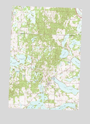
Vergas, MN USGS Topographic Map
Click on map above to begin viewing in our Map Viewer.

This topographic map contains these locations and features:
Feature Name Type Latitude Longitude GNIS ID View Map
Acorn LakeLakeN46.7453°W95.7552°639196View Map
Baker LakeLakeN46.6848°W95.8274°639580View Map
Bass LakeLakeN46.6724°W95.8724°639695View Map
Bradbury LakeLakeN46.6698°W95.8622°640414View Map
Bradbury Post OfficePost OfficeN46.6667°W95.8556°2072715View Map
Candor - Dora - Hobart - Vergas Fire and Rescue DepartmentBuildingN46.6556°W95.8060°2666698View Map
Candor LakeLakeN46.6999°W95.8265°640863View Map
City of VergasCivilN46.6548°W95.8039°2397125View Map
Coffee LakeLakeN46.6589°W95.8289°641380View Map
Cottage LakeLakeN46.7465°W95.8728°641522View Map
Cozy Corner CampgroundLocaleN46.7389°W95.8694°2108719View Map
Dahring DairyLocaleN46.7211°W95.8569°2635895View Map
Eagle LakeLakeN46.7270°W95.7507°643029View Map
Elbow LakeLakeN46.6759°W95.8337°643227View Map
Fairy Lake CemeteryCemeteryN46.6944°W95.7528°2072684View Map
Five LakeLakeN46.7067°W95.7621°643717View Map
Free Thought CemeteryCemeteryN46.6291°W95.8442°643913View Map
Gresham Post Office (historical)Post OfficeN46.6792°W95.8361°2073009View Map
Happ LakeLakeN46.6673°W95.8219°644653View Map
Heisler Manufactured Home ParkPopulated PlaceN46.6444°W95.8211°2072768View Map
Heisler's Country CampingLocaleN46.6444°W95.8211°2072767View Map
Horseshoe LakeLakeN46.6659°W95.8277°645235View Map
Johnson LakeLakeN46.7353°W95.8388°645701View Map
Lake IdaLakeN46.6863°W95.8415°645332View Map
Lake Sybil Post Office (historical)Post OfficeN46.6347°W95.7639°2073002View Map
Lakes Area Word FellowshipChurchN46.6569°W95.8056°2072773View Map
Lawrence LakeLakeN46.6512°W95.8184°646538View Map
Leek LakeLakeN46.6855°W95.8554°646580View Map
Lind LakeLakeN46.7414°W95.8705°646704View Map
Little Long LakeLakeN46.6625°W95.8164°646845View Map
Little Rose LakeLakeN46.6834°W95.7702°646918View Map
Long LakeLakeN46.6483°W95.7537°647119View Map
Long Lake - Vergas Rest AreaLocaleN46.6661°W95.7950°2073151View Map
Loon LakeLakeN46.6283°W95.8257°647175View Map
Loon Lake Lutheran ChurchChurchN46.6567°W95.8050°2072772View Map
Loon Lake Resort and CampgroundLocaleN46.6403°W95.8208°2072769View Map
Mike LakeLakeN46.6648°W95.8495°647832View Map
Nottage LakeLakeN46.7498°W95.8550°648767View Map
Pete LakeLakeN46.6626°W95.8329°649316View Map
Reeves LakeLakeN46.7425°W95.8390°649915View Map
Rose Shores CampgroundLocaleN46.6911°W95.7611°2072868View Map
Saint John's Lutheran ChurchChurchN46.6586°W95.8003°2072775View Map
Saint Johns CemeteryCemeteryN46.6588°W95.7948°650693View Map
Saint Paul's Lutheran CemeteryCemeteryN46.6333°W95.8403°2072716View Map
Saint Pauls ChurchChurchN46.6333°W95.8381°650999View Map
Scalp LakeLakeN46.6937°W95.7793°651256View Map
Schrams CemeteryCemeteryN46.7025°W95.8045°651782View Map
Schrams LakeLakeN46.7003°W95.8050°651783View Map
Six LakeLakeN46.7102°W95.7785°652099View Map
Sybil LakeLakeN46.6258°W95.7836°652958View Map
Sybil Lake CemeteryCemeteryN46.6336°W95.7609°652959View Map
Township of CandorCivilN46.6739°W95.8593°663739View Map
Trowbridge LakeLakeN46.6833°W95.8545°653350View Map
United Methodist ChurchChurchN46.6556°W95.8069°2072774View Map
VergasPopulated PlaceN46.6566°W95.8053°653630View Map
VergasLocaleN46.6569°W95.8036°2072770View Map
Vergas CemeteryCemeteryN46.6686°W95.7856°653631View Map
Vergas ParkParkN46.6647°W95.7987°653632View Map
Vergas Post Office (historical)Post OfficeN46.6567°W95.8050°2072771View Map

Note: Coordinates in the location and feature list above are referenced to NAD83 datum.


Copyright (C) 2008-2025 Ryan Niemi / Sunset Dynamics ... All Rights Reserved