TopoQuest Logo
Do you find TopoQuest useful?
Help keep TopoQuest running and adding new maps/features by donating!
Bitcoin:  19c7KJd3qBynnjoSw5npx9KScwjBe4ifkT
Litecoin:  LXs6TkuXGGXo1vDsWCkWVdjQX94eUKd6ui
Home View Maps Find Maps Find Places Resources & Links


Rocky Comfort, Missouri Topographic Map

USGS Map Title: Rocky Comfort, MO
USGS Map MRC: 36094F1
DRG (GeoTIFF) Download: o36094f1.tif


Neighboring USGS Topographic Map Quads:


  Stella, MO  
36094G2
 

  Wheaton, MO  
36094G1
 

  Purdy, MO  
36093G8
 

  Bethpage, MO  
36094F2
 

  Rocky Comfort, MO  
36094F1
 

  Exeter, MO  
36093F8
 

  Powell, MO  
36094E2
 

  Jacket, MO  
36094E1
 

  Seligman, MO  
36093E8


Map MRC Location:

N37°
W95°
N37°
W94°
H8 H7 H6 H5 H4 H3 H2 H1
G8 G7 G6 G5 G4 G3 G2 G1
F8 F7 F6 F5 F4 F3 F2 F1
E8 E7 E6 E5 E4 E3 E2 E1
D8 D7 D6 D5 D4 D3 D2 D1
C8 C7 C6 C5 C4 C3 C2 C1
B8 B7 B6 B5 B4 B3 B2 B1
A8 A7 A6 A5 A4 A3 A2 A1
N36°
W95°
N36°
W94°

Rocky Comfort, MO USGS 1:24K Topographic Map Preview:
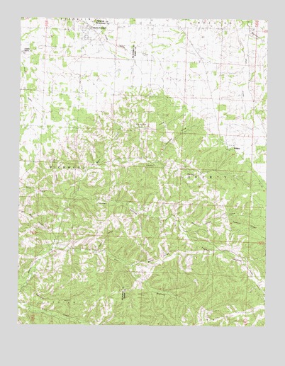
Rocky Comfort, MO USGS Topographic Map
Click on map above to begin viewing in our Map Viewer.

This topographic map contains these locations and features:
Feature Name Type Latitude Longitude GNIS ID View Map
Alma HollowValleyN36.6759°W94.1022°713243View Map
Barnett HollowValleyN36.6501°W94.0685°713680View Map
Bob Mikes HollowValleyN36.6631°W94.1091°714466View Map
Cave Springs School (historical)SchoolN36.6651°W94.1038°715556View Map
Chairbottom HollowValleyN36.7056°W94.0744°715699View Map
Chitwood CemeteryCemeteryN36.7317°W94.0599°715798View Map
Christian SpringSpringN36.7365°W94.1247°715820View Map
Clayton HollowValleyN36.6434°W94.1213°715918View Map
Creason CemeteryCemeteryN36.6903°W94.0527°716481View Map
Dogwood HollowValleyN36.6703°W94.0233°716962View Map
El Paso (historical)Populated PlaceN36.7103°W94.0255°732876View Map
Harrell School (historical)SchoolN36.7259°W94.0455°719138View Map
Houseman HollowValleyN36.6920°W94.0558°719893View Map
Kettle HollowValleyN36.6556°W94.0855°720559View Map
Layton HollowValleyN36.6893°W94.0871°720850View Map
NewvilleBuildingN36.6523°W94.0733°745865View Map
Oklahoma School (historical)SchoolN36.7248°W94.0088°723708View Map
Pigeon Roost HollowValleyN36.6298°W94.1049°724335View Map
Reed Springs HollowValleyN36.6678°W94.0458°725192View Map
RidgleyPopulated PlaceN36.6973°W94.0202°735819View Map
Ridgley School (historical)SchoolN36.6970°W94.0199°732877View Map
Rocky ComfortPopulated PlaceN36.7465°W94.0905°725507View Map
Rocky Comfort Post OfficePost OfficeN36.7466°W94.0892°2782651View Map
Rocky Comfort School (historical)SchoolN36.7445°W94.0935°746455View Map
Seven Star School (historical)SchoolN36.6370°W94.0446°735847View Map
Smith HollowValleyN36.6792°W94.1058°726619View Map
Snider HollowValleyN36.6526°W94.0121°726665View Map
Solid Rock ChurchChurchN36.7359°W94.0094°726686View Map
Star HollowValleyN36.6576°W94.1074°727016View Map
Sugarcamp HollowValleyN36.6415°W94.1222°727256View Map
Thomas HollowValleyN36.6773°W94.0988°727588View Map
Township of LibertyCivilN36.6910°W94.0179°766258View Map
Township of RichwoodCivilN36.6989°W94.1188°766956View Map
Union Church (historical)ChurchN36.7462°W94.0102°727984View Map
Union Valley School (historical)SchoolN36.6676°W94.0438°728050View Map
Wheaton Fire Department SubstationBuildingN36.6992°W94.0220°2621358View Map
Woodward CreekStreamN36.7492°W94.0130°729136View Map

Note: Coordinates in the location and feature list above are referenced to NAD83 datum.


Copyright (C) 2008-2024 Ryan Niemi / Sunset Dynamics ... All Rights Reserved