TopoQuest Logo
Do you find TopoQuest useful?
Help keep TopoQuest running and adding new maps/features by donating!
Bitcoin:  19c7KJd3qBynnjoSw5npx9KScwjBe4ifkT
Litecoin:  LXs6TkuXGGXo1vDsWCkWVdjQX94eUKd6ui
Home View Maps Find Maps Find Places Resources & Links


Exeter, Missouri Topographic Map

USGS Map Title: Exeter, MO
USGS Map MRC: 36093F8
DRG (GeoTIFF) Download: o36093f8.tif


Neighboring USGS Topographic Map Quads:


  Wheaton, MO  
36094G1
 

  Purdy, MO  
36093G8
 

  McDowell, MO  
36093G7
 

  Rocky Comfort, MO  
36094F1
 

  Exeter, MO  
36093F8
 

  Cassville, MO  
36093F7
 

  Jacket, MO  
36094E1
 

  Seligman, MO  
36093E8
 

  Eagle Rock, MO  
36093E7


Map MRC Location:

N37°
W94°
N37°
W93°
H8 H7 H6 H5 H4 H3 H2 H1
G8 G7 G6 G5 G4 G3 G2 G1
F8 F7 F6 F5 F4 F3 F2 F1
E8 E7 E6 E5 E4 E3 E2 E1
D8 D7 D6 D5 D4 D3 D2 D1
C8 C7 C6 C5 C4 C3 C2 C1
B8 B7 B6 B5 B4 B3 B2 B1
A8 A7 A6 A5 A4 A3 A2 A1
N36°
W94°
N36°
W93°

Exeter, MO USGS 1:24K Topographic Map Preview:
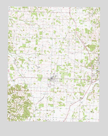
Exeter, MO USGS Topographic Map
Click on map above to begin viewing in our Map Viewer.

This topographic map contains these locations and features:
Feature Name Type Latitude Longitude GNIS ID View Map
Antioch ChurchChurchN36.6995°W93.9133°713322View Map
Buffalo BogBasinN36.6359°W93.8844°715001View Map
Butterfield Fire Protection DistrictBuildingN36.7474°W93.9015°2620603View Map
Butterfield School (historical)SchoolN36.7452°W93.9082°732878View Map
Calvary ChurchChurchN36.6981°W93.9585°715216View Map
Candy HollowValleyN36.7367°W93.9994°715335View Map
Cassville Municipal AirportAirportN36.6974°W93.8958°758630View Map
City of ExeterCivilN36.6707°W93.9400°2394719View Map
Concord CemeteryCemeteryN36.7040°W93.9991°716169View Map
Concord Church (historical)ChurchN36.7040°W93.9991°742311View Map
Crow Pond CemeteryCemeteryN36.6551°W93.9485°716545View Map
Doss School (historical)SchoolN36.7228°W93.9546°742312View Map
ExeterPopulated PlaceN36.6723°W93.9410°717713View Map
Exeter Elementary SchoolSchoolN36.6739°W93.9378°2710073View Map
Exeter Fire Protection DistrictBuildingN36.6725°W93.9358°2620323View Map
Exeter High SchoolSchoolN36.6745°W93.9380°732879View Map
Exeter Police DepartmentBuildingN36.6717°W93.9407°2752377View Map
Exeter Post OfficePost OfficeN36.6720°W93.9403°2782559View Map
Hazel Dell School (historical)SchoolN36.6995°W93.9766°742310View Map
House School (historical)SchoolN36.6995°W93.9085°742305View Map
Independence School (historical)SchoolN36.6661°W93.9815°742303View Map
Maplewood CemeteryCemeteryN36.6640°W93.9435°721847View Map
McCary CemeteryCemeteryN36.6448°W93.9119°722038View Map
McMurtry SpringSpringN36.6503°W93.8991°754129View Map
Packwood CemeteryCemeteryN36.6906°W93.9899°723953View Map
PasleyPopulated PlaceN36.6281°W93.8885°724066View Map
Pasley School (historical)SchoolN36.6278°W93.8841°742309View Map
Russell CemeteryCemeteryN36.7339°W93.8852°725682View Map
Shady Grove School (historical)SchoolN36.7281°W93.8899°742304View Map
Stony Point School (historical)SchoolN36.6706°W93.9094°742306View Map
Talbert BranchStreamN36.6987°W93.9999°727439View Map
Talbert SpringSpringN36.6833°W93.9586°727440View Map
Township of ButterfieldCivilN36.7445°W93.9227°766250View Map
Township of ExeterCivilN36.6713°W93.9365°766254View Map
True Love CemeteryCemeteryN36.6259°W93.9471°727812View Map
Van Zandt School (historical)SchoolN36.6398°W93.9160°742308View Map
Village of ButterfieldCivilN36.7468°W93.9043°2397515View Map
Vineyard CemeteryCemeteryN36.7298°W93.9696°728208View Map
WaynePopulated PlaceN36.6376°W93.9621°728435View Map
Wayne School (historical)SchoolN36.6303°W93.9621°742307View Map

Note: Coordinates in the location and feature list above are referenced to NAD83 datum.


Copyright (C) 2008-2025 Ryan Niemi / Sunset Dynamics ... All Rights Reserved