TopoQuest Logo
Do you find TopoQuest useful?
Help keep TopoQuest running and adding new maps/features by donating!
Bitcoin:  19c7KJd3qBynnjoSw5npx9KScwjBe4ifkT
Litecoin:  LXs6TkuXGGXo1vDsWCkWVdjQX94eUKd6ui
Home View Maps Find Maps Find Places Resources & Links


Stella, Missouri Topographic Map

USGS Map Title: Stella, MO
USGS Map MRC: 36094G2
DRG (GeoTIFF) Download: o36094g2.tif


Neighboring USGS Topographic Map Quads:


  Granby, MO  
36094H3
 

  Newtonia, MO  
36094H2
 

  Pierce City, MO  
36094H1
 

  Neosho East, MO  
36094G3
 

  Stella, MO  
36094G2
 

  Wheaton, MO  
36094G1
 

  McNatt, MO  
36094F3
 

  Bethpage, MO  
36094F2
 

  Rocky Comfort, MO  
36094F1


Map MRC Location:

N37°
W95°
N37°
W94°
H8 H7 H6 H5 H4 H3 H2 H1
G8 G7 G6 G5 G4 G3 G2 G1
F8 F7 F6 F5 F4 F3 F2 F1
E8 E7 E6 E5 E4 E3 E2 E1
D8 D7 D6 D5 D4 D3 D2 D1
C8 C7 C6 C5 C4 C3 C2 C1
B8 B7 B6 B5 B4 B3 B2 B1
A8 A7 A6 A5 A4 A3 A2 A1
N36°
W95°
N36°
W94°

Stella, MO USGS 1:24K Topographic Map Preview:
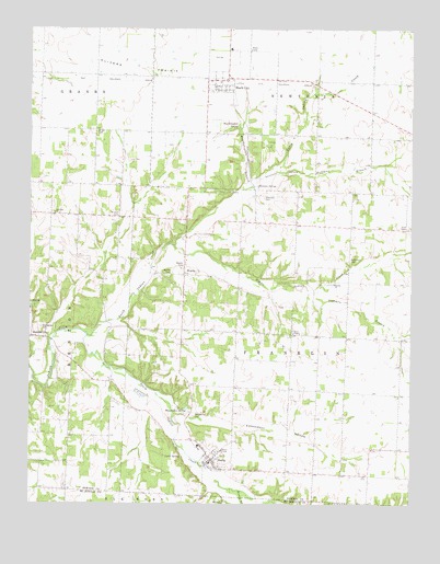
Stella, MO USGS Topographic Map
Click on map above to begin viewing in our Map Viewer.

This topographic map contains these locations and features:
Feature Name Type Latitude Longitude GNIS ID View Map
Boulder CityPopulated PlaceN36.7940°W94.2494°714559View Map
Brown CemeteryCemeteryN36.8481°W94.2285°714762View Map
Cartmell (historical)Populated PlaceN36.8103°W94.2244°740563View Map
Chester (historical)Populated PlaceN36.8562°W94.1463°740564View Map
Dalbom Airport (historical)AirportN36.7690°W94.2124°758957View Map
Diamond Hall School (historical)SchoolN36.8488°W94.2335°746356View Map
Dice CemeteryCemeteryN36.8234°W94.1263°716879View Map
Edmondson HollowValleyN36.7723°W94.1991°717408View Map
Hazel Green School (historical)SchoolN36.7936°W94.2453°2709597View Map
Hazelgreen CemeteryCemeteryN36.7965°W94.2466°719302View Map
Huffman BranchStreamN36.8340°W94.1777°719959View Map
Independence School (historical)SchoolN36.8154°W94.1459°746359View Map
Ivie CemeteryCemeteryN36.8406°W94.2177°720188View Map
Jones ChapelChurchN36.7951°W94.1638°720412View Map
Kenny BranchStreamN36.7540°W94.1816°720542View Map
KentBuildingN36.7748°W94.2147°745830View Map
Lentz SpringSpringN36.7624°W94.2003°720911View Map
Liberty School (historical)SchoolN36.7641°W94.2378°2709552View Map
Liberty School (historical)SchoolN36.8536°W94.1386°746358View Map
Lone Star ChurchChurchN36.8265°W94.2422°721468View Map
Lone Star School (historical)SchoolN36.8265°W94.2430°746357View Map
Macedonia CemeteryCemeteryN36.7734°W94.1966°721713View Map
Macedonia SpringSpringN36.7753°W94.1985°721725View Map
Middle Indian CreekStreamN36.8184°W94.2035°722282View Map
Midway School (historical)SchoolN36.8698°W94.1847°2709554View Map
Mount Zion CemeteryCemeteryN36.8253°W94.2213°722926View Map
North Indian CreekStreamN36.7948°W94.2322°723475View Map
Olivers PrairieAreaN36.8678°W94.2305°723813View Map
Oshkosh School (historical)SchoolN36.7579°W94.1391°2709553View Map
Robertson CemeteryCemeteryN36.8145°W94.1452°725407View Map
Shannon CemeteryCemeteryN36.8312°W94.1735°726267View Map
Shannon HollowValleyN36.8345°W94.1769°726268View Map
Shannon SpringSpringN36.8340°W94.1758°726269View Map
South Indian CreekStreamN36.7948°W94.2308°726763View Map
Stark CityPopulated PlaceN36.8623°W94.1858°727032View Map
Stark City Post OfficePost OfficeN36.8606°W94.1902°2783028View Map
Stark City Volunteer Fire DepartmentBuildingN36.8605°W94.1902°2621184View Map
Stedman BranchStreamN36.8065°W94.1616°727045View Map
StellaPopulated PlaceN36.7615°W94.1913°727063View Map
Stella Post OfficePost OfficeN36.7607°W94.1921°2782617View Map
Stella Rural Volunteer Fire Department Station 3 StellaBuildingN36.7600°W94.1916°2621140View Map
Town of Stark CityCivilN36.8626°W94.1864°2397678View Map
Town of StellaCivilN36.7623°W94.1909°2397681View Map
Township of FranklinCivilN36.8011°W94.1342°767075View Map
Township of NewtoniaCivilN36.8716°W94.1705°767079View Map
Triway Elementary and Junior High SchoolSchoolN36.7653°W94.1947°746316View Map
Union School (historical)SchoolN36.7799°W94.1646°746360View Map
WadellPopulated PlaceN36.7798°W94.1558°739497View Map
WandaPopulated PlaceN36.8106°W94.1997°729980View Map
Wanda CemeteryCemeteryN36.8109°W94.2035°728335View Map
Wanda School (historical)SchoolN36.8128°W94.1992°745842View Map
Weatherspoon BranchStreamN36.8340°W94.1777°728441View Map
Weatherspoon SpringSpringN36.8498°W94.1822°728442View Map
Weems CemeteryCemeteryN36.8128°W94.1997°728473View Map

Note: Coordinates in the location and feature list above are referenced to NAD83 datum.


Copyright (C) 2008-2025 Ryan Niemi / Sunset Dynamics ... All Rights Reserved