TopoQuest Logo
Do you find TopoQuest useful?
Help keep TopoQuest running and adding new maps/features by donating!
Bitcoin:  19c7KJd3qBynnjoSw5npx9KScwjBe4ifkT
Litecoin:  LXs6TkuXGGXo1vDsWCkWVdjQX94eUKd6ui
Home View Maps Find Maps Find Places Resources & Links


Purdy, Missouri Topographic Map

USGS Map Title: Purdy, MO
USGS Map MRC: 36093G8
DRG (GeoTIFF) Download: o36093g8.tif


Neighboring USGS Topographic Map Quads:


  Pierce City, MO  
36094H1
 

  Monett, MO  
36093H8
 

  Verona, MO  
36093H7
 

  Wheaton, MO  
36094G1
 

  Purdy, MO  
36093G8
 

  McDowell, MO  
36093G7
 

  Rocky Comfort, MO  
36094F1
 

  Exeter, MO  
36093F8
 

  Cassville, MO  
36093F7


Map MRC Location:

N37°
W94°
N37°
W93°
H8 H7 H6 H5 H4 H3 H2 H1
G8 G7 G6 G5 G4 G3 G2 G1
F8 F7 F6 F5 F4 F3 F2 F1
E8 E7 E6 E5 E4 E3 E2 E1
D8 D7 D6 D5 D4 D3 D2 D1
C8 C7 C6 C5 C4 C3 C2 C1
B8 B7 B6 B5 B4 B3 B2 B1
A8 A7 A6 A5 A4 A3 A2 A1
N36°
W94°
N36°
W93°

Purdy, MO USGS 1:24K Topographic Map Preview:
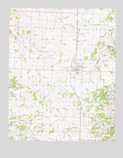
Purdy, MO USGS Topographic Map
Click on map above to begin viewing in our Map Viewer.

This topographic map contains these locations and features:
Feature Name Type Latitude Longitude GNIS ID View Map
Arnhart ChurchChurchN36.8051°W93.8785°713399View Map
Arnhart School (historical)SchoolN36.8044°W93.8788°731932View Map
Burton CemeteryCemeteryN36.7528°W93.9741°715100View Map
BurtonvillePopulated PlaceN36.7517°W93.9705°740712View Map
ButterfieldPopulated PlaceN36.7501°W93.9077°735546View Map
Central School (historical)SchoolN36.8167°W93.9722°731936View Map
City of PurdyCivilN36.8188°W93.9206°2396294View Map
Clark CemeteryCemeteryN36.7667°W93.9752°715874View Map
Clark School (historical)SchoolN36.7667°W93.9741°732863View Map
CorsicanaPopulated PlaceN36.7990°W93.9949°740769View Map
Corsicana School (historical)SchoolN36.7987°W93.9974°732862View Map
East PurdyPopulated PlaceN36.8153°W93.8785°717340View Map
Eden School (historical)SchoolN36.8450°W93.9353°731942View Map
Fly SpringSpringN36.7970°W93.9666°718046View Map
Gibbons Air Park (historical)AirportN36.8292°W93.9224°758882View Map
Goodnight CemeteryCemeteryN36.8509°W93.9163°718567View Map
Gunter ChurchChurchN36.7665°W93.8760°718939View Map
Gunter School (historical)SchoolN36.7653°W93.8800°731946View Map
Henderson CemeteryCemeteryN36.8551°W93.8835°719370View Map
Henneman School (historical)SchoolN36.8451°W93.9930°732861View Map
Hopedale School (historical)SchoolN36.8419°W93.9621°2710102View Map
Ingram Private AirportAirportN36.7958°W93.8986°758881View Map
Long School (historical)SchoolN36.8014°W93.9279°2710104View Map
Long View ChurchChurchN36.7795°W93.9158°721557View Map
Macedonia ChurchChurchN36.8395°W93.8830°721718View Map
Matty CemeteryCemeteryN36.8201°W93.9502°721984View Map
Mount Joy ChurchChurchN36.8028°W93.9680°722776View Map
Mount Pisgah ChurchChurchN36.8742°W93.9083°722841View Map
Mount Pleasant ChurchChurchN36.7581°W93.9333°722858View Map
New Salem ChurchChurchN36.8456°W93.9244°723304View Map
Ozark School (historical)SchoolN36.8483°W93.8982°2710112View Map
Pleasant Valley School (historical)SchoolN36.7655°W93.9341°731957View Map
PurdyPopulated PlaceN36.8173°W93.9208°735813View Map
Purdy Elementary SchoolSchoolN36.8146°W93.9201°732864View Map
Purdy Fire DepartmentBuildingN36.8166°W93.9219°2621360View Map
Purdy High SchoolSchoolN36.8150°W93.9201°2710083View Map
Purdy Middle SchoolSchoolN36.8143°W93.9197°2710085View Map
Purdy Police DepartmentBuildingN36.8163°W93.9213°2752536View Map
Purdy Post OfficePost OfficeN36.8172°W93.9206°2782765View Map
Saint Johns ChurchChurchN36.8456°W93.9613°725778View Map
Saint Johns School (historical)SchoolN36.8452°W93.9622°2710103View Map
Stinett CemeteryCemeteryN36.8345°W93.9624°727113View Map
Township of CorsicanaCivilN36.7910°W93.9855°766252View Map
Township of PurdyCivilN36.8222°W93.9330°766267View Map

Note: Coordinates in the location and feature list above are referenced to NAD83 datum.


Copyright (C) 2008-2025 Ryan Niemi / Sunset Dynamics ... All Rights Reserved