TopoQuest Logo
Do you find TopoQuest useful?
Help keep TopoQuest running and adding new maps/features by donating!
Bitcoin:  19c7KJd3qBynnjoSw5npx9KScwjBe4ifkT
Litecoin:  LXs6TkuXGGXo1vDsWCkWVdjQX94eUKd6ui
Home View Maps Find Maps Find Places Resources & Links


Rolla, Missouri Topographic Map

USGS Map Title: Rolla, MO
USGS Map MRC: 37091H7
DRG (GeoTIFF) Download: o37091h7.tif


Neighboring USGS Topographic Map Quads:


  Nagogami Lodge, MO  
38091A8
 

  Vichy, MO  
38091A7
 

  Safe, MO  
38091A6
 

  Newburg, MO  
37091H8
 

  Rolla, MO  
37091H7
 

  Dillon, MO  
37091H6
 

  Kaintuck Hollow, MO  
37091G8
 

  Yancy Mills, MO  
37091G7
 

  Lecoma, MO  
37091G6


Map MRC Location:

N38°
W92°
N38°
W91°
H8 H7 H6 H5 H4 H3 H2 H1
G8 G7 G6 G5 G4 G3 G2 G1
F8 F7 F6 F5 F4 F3 F2 F1
E8 E7 E6 E5 E4 E3 E2 E1
D8 D7 D6 D5 D4 D3 D2 D1
C8 C7 C6 C5 C4 C3 C2 C1
B8 B7 B6 B5 B4 B3 B2 B1
A8 A7 A6 A5 A4 A3 A2 A1
N37°
W92°
N37°
W91°

Rolla, MO USGS 1:24K Topographic Map Preview:
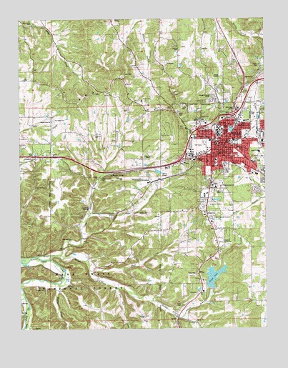
Rolla, MO USGS Topographic Map
Click on map above to begin viewing in our Map Viewer.

This topographic map contains these locations and features:
Feature Name Type Latitude Longitude GNIS ID View Map
Abbott BranchStreamN37.8792°W91.7938°748551View Map
Ames CemeteryCemeteryN37.9884°W91.8382°2571464View Map
B W Robinson State SchoolSchoolN37.9323°W91.7729°753449View Map
Barnitz ParkParkN37.9475°W91.7638°748683View Map
Beaver CemeteryCemeteryN37.8781°W91.7860°748745View Map
Beaver Church (historical)ChurchN37.8795°W91.7860°753808View Map
Beaver CreekStreamN37.9031°W91.8610°748749View Map
Beaver Creek MineMineN37.8800°W91.8146°748750View Map
Benton SchoolSchoolN37.9481°W91.7671°748791View Map
Ber Juan ParkParkN37.9539°W91.7560°748792View Map
Blues PondReservoirN37.9385°W91.8043°748942View Map
Blues Pond DamDamN37.9384°W91.8068°765308View Map
Boyd LakeReservoirN37.8907°W91.7843°765307View Map
Boyd Lake DamDamN37.8902°W91.7848°765306View Map
Brainard CemeteryCemeteryN37.9992°W91.8229°748993View Map
Brays LakeReservoirN37.8951°W91.7777°749005View Map
Brays Lake DamDamN37.8915°W91.7783°763710View Map
Bridge SchoolSchoolN37.9220°W91.8343°753167View Map
Buckland MineMineN37.9120°W91.8357°744563View Map
Buehler ParkParkN37.9439°W91.7885°741511View Map
Burgher BranchStreamN37.9467°W91.7502°749117View Map
Butledge CemeteryCemeteryN37.9364°W91.8432°2724084View Map
Camp Creek CemeteryCemeteryN37.9984°W91.8685°753456View Map
Camp Creek ChurchChurchN37.9968°W91.8723°2571487View Map
Camp Creek School (historical)SchoolN37.9984°W91.8685°753171View Map
Campbell CemeteryCemeteryN37.9249°W91.8165°2723632View Map
Cerebral Palsy SchoolSchoolN37.9606°W91.7529°753447View Map
Christ Episcopal ChurchChurchN37.9518°W91.7732°744600View Map
Christ Episcopal Church ColumbariumCemeteryN37.9518°W91.7732°2723733View Map
Church of ChristChurchN37.9129°W91.7755°2562766View Map
City of RollaCivilN37.9458°W91.7608°2396418View Map
Coolbrook Swimming Pool (historical)ReservoirN37.8781°W91.7963°753809View Map
Corinth SchoolSchoolN37.9948°W91.8035°741513View Map
Falkenrath CemeteryCemeteryN37.9359°W91.8227°753453View Map
Forbes Clay Pit (historical)MineN37.9806°W91.7782°753805View Map
Frisco LakeLakeN37.9553°W91.7671°750003View Map
Goggins CemeteryCemeteryN37.9884°W91.7938°753455View Map
Gollahon SpringSpringN37.9236°W91.8402°750067View Map
Green Acres ParkParkN37.9412°W91.7668°750134View Map
Hirsche School (historical)SchoolN37.9009°W91.7768°753168View Map
Hoss-Ray-Miller CemeteryCemeteryN37.9111°W91.8490°753452View Map
Hudgens CemeteryCemeteryN37.8911°W91.8627°750413View Map
Hurricane PointLocaleN37.9709°W91.7963°753804View Map
Immanuel SchoolSchoolN37.9520°W91.7796°750444View Map
Iron Ore CreekStreamN37.8917°W91.8260°750464View Map
Joshau Light CemeteryCemeteryN37.9182°W91.8460°2724167View Map
KCLU-FM (Rolla)TowerN37.9639°W91.7652°759063View Map
KMNR-FM (Rolla)TowerN37.9531°W91.7746°754225View Map
KMOZ-AM (Rolla)TowerN37.9448°W91.8113°754316View Map
Kolb CemeteryCemeteryN37.9925°W91.8311°2724170View Map
Light CemeteryCemeteryN37.9880°W91.7824°750715View Map
Line CemeteryCemeteryN37.9509°W91.8163°753454View Map
Lions ParkParkN37.9256°W91.7754°753450View Map
Little Beaver CreekStreamN37.9048°W91.8596°750733View Map
Lula Yowell CemeteryCemeteryN37.9058°W91.8661°2724118View Map
Mark Twain National Forest Interagency OfficeBuildingN37.9473°W91.7882°753943View Map
Mark Twain National Forest Ranger District Rolla Office (historical)BuildingN37.9446°W91.7877°2620730View Map
Mark Twain SchoolSchoolN37.9423°W91.7568°750935View Map
Martin SpringSpringN37.9378°W91.8275°750950View Map
Middle SchoolSchoolN37.9464°W91.7532°753448View Map
Milldam HollowValleyN37.8814°W91.8732°751090View Map
Missouri Department of Conservation Forestry Ozark Regional Field Fire Office RollaBuildingN37.9637°W91.7973°2621599View Map
Missouri Department of Conservation HeadquartersLocaleN37.9625°W91.7993°753942View Map
Missouri School of Mines MineMineN37.9373°W91.7904°753807View Map
Missouri State Highway Patrol Troop I HeadquartersBuildingN37.9540°W91.7879°2752598View Map
Missouri Trachoma HospitalHospitalN37.9473°W91.7793°741510View Map
Missouri University of Science and TechnologySchoolN37.9536°W91.7755°755665View Map
NorthwyePopulated PlaceN37.9750°W91.7557°751361View Map
Oak Grove School (historical)SchoolN37.9753°W91.8724°753170View Map
Ozark Hills Memorial GardensCemeteryN37.9198°W91.7779°751465View Map
Pea RidgeRidgeN37.9506°W91.8588°751519View Map
Pea Ridge CemeteryCemeteryN37.9592°W91.8579°751521View Map
Pershing SchoolSchoolN37.9481°W91.7738°751554View Map
Phelps CountyCivilN37.8771°W91.7924°758535View Map
Phelps County Regional Medical CenterHospitalN37.9520°W91.7856°753165View Map
Phelps County Sheriff's OfficeBuildingN37.9457°W91.7751°2752210View Map
Point Bluff SchoolSchoolN37.8945°W91.8352°741512View Map
Ray CemeteryCemeteryN37.9886°W91.7917°2724031View Map
Regional FairgroundParkN37.9106°W91.7732°753451View Map
Ridgeview ParkParkN37.9414°W91.7832°751873View Map
Roach Union ChurchChurchN37.9587°W91.8585°751904View Map
Rock Mechanics CenterBuildingN37.9472°W91.7794°2099952View Map
RollaPopulated PlaceN37.9514°W91.7713°751949View Map
Rolla CemeteryCemeteryN37.9394°W91.7700°751950View Map
Rolla Downtown AirportAirportN37.9361°W91.8137°758896View Map
Rolla Fire and Rescue Station 2BuildingN37.9472°W91.7739°2620814View Map
Rolla Police DepartmentBuildingN37.9521°W91.7712°2752472View Map
Rolla Post OfficePost OfficeN37.9496°W91.7747°2768065View Map
Rolla Ranger StationLocaleN37.9417°W91.7907°753965View Map
Rolla Technical InstituteSchoolN37.9506°W91.7514°751951View Map
Russell Brothers Circus (historical)LocaleN37.9417°W91.7752°753806View Map
Saint Patrick Catholic SchoolSchoolN37.9573°W91.7738°752003View Map
Schuman ParkParkN37.9545°W91.7682°752058View Map
Strawhun CemeteryCemeteryN37.9528°W91.8365°752394View Map
Strawhun School (historical)SchoolN37.9509°W91.8338°753169View Map
The Church of Jesus Christ of Latter Day SaintsChurchN37.9482°W91.7528°2070693View Map
Township of RollaCivilN37.9219°W91.8039°767183View Map
Treable CreekStreamN37.8937°W91.8579°752579View Map
Truman Elementary SchoolSchoolN37.9585°W91.7602°752585View Map
Wiese CemeteryCemeteryN37.9675°W91.8121°752880View Map
Wolf CreekStreamN37.8987°W91.8404°752948View Map
Wyman SchoolSchoolN37.9317°W91.7754°752988View Map

Note: Coordinates in the location and feature list above are referenced to NAD83 datum.


Copyright (C) 2008-2025 Ryan Niemi / Sunset Dynamics ... All Rights Reserved