TopoQuest Logo
Do you find TopoQuest useful?
Help keep TopoQuest running and adding new maps/features by donating!
Bitcoin:  19c7KJd3qBynnjoSw5npx9KScwjBe4ifkT
Litecoin:  LXs6TkuXGGXo1vDsWCkWVdjQX94eUKd6ui
Home View Maps Find Maps Find Places Resources & Links


Lecoma, Missouri Topographic Map

USGS Map Title: Lecoma, MO
USGS Map MRC: 37091G6
DRG (GeoTIFF) Download: o37091g6.tif


Neighboring USGS Topographic Map Quads:


  Rolla, MO  
37091H7
 

  Dillon, MO  
37091H6
 

  Maramec Spring, MO  
37091H5
 

  Yancy Mills, MO  
37091G7
 

  Lecoma, MO  
37091G6
 

  Seaton, MO  
37091G5
 

  Edgar Springs, MO  
37091F7
 

  Anutt, MO  
37091F6
 

  Salem, MO  
37091F5


Map MRC Location:

N38°
W92°
N38°
W91°
H8 H7 H6 H5 H4 H3 H2 H1
G8 G7 G6 G5 G4 G3 G2 G1
F8 F7 F6 F5 F4 F3 F2 F1
E8 E7 E6 E5 E4 E3 E2 E1
D8 D7 D6 D5 D4 D3 D2 D1
C8 C7 C6 C5 C4 C3 C2 C1
B8 B7 B6 B5 B4 B3 B2 B1
A8 A7 A6 A5 A4 A3 A2 A1
N37°
W92°
N37°
W91°

Lecoma, MO USGS 1:24K Topographic Map Preview:
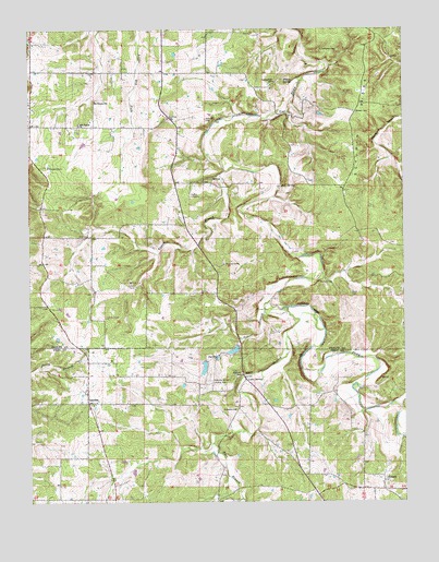
Lecoma, MO USGS Topographic Map
Click on map above to begin viewing in our Map Viewer.

This topographic map contains these locations and features:
Feature Name Type Latitude Longitude GNIS ID View Map
Bell SpringSpringN37.8338°W91.6658°755473View Map
Benton CemeteryCemeteryN37.8531°W91.6413°755474View Map
Bubbling Springs DamDamN37.7867°W91.6918°763567View Map
Bubbling Springs Landing Strip (historical)AirportN37.7834°W91.6890°743211View Map
Carson Store (historical)LocaleN37.8167°W91.7449°744585View Map
Central School (historical)SchoolN37.8342°W91.6918°744584View Map
Coppage BankMineN37.7825°W91.6327°746816View Map
Coppedge CemeteryCemeteryN37.7864°W91.6423°2725615View Map
Elk PrairieAreaN37.8642°W91.7049°738934View Map
Elk Prairie CemeteryCemeteryN37.8499°W91.7333°2723839View Map
Elk Prairie ChurchChurchN37.8500°W91.7332°729477View Map
Elk Prairie SchoolSchoolN37.8564°W91.7277°717462View Map
Fabick LakeReservoirN37.7855°W91.6919°763568View Map
Harrison Private AirportAirportN37.8535°W91.6475°2679382View Map
Highway LakeReservoirN37.7900°W91.6821°763577View Map
Highway Lake DamDamN37.7917°W91.6818°763576View Map
HobsonPopulated PlaceN37.7556°W91.6321°719652View Map
Hyer BranchStreamN37.8013°W91.6645°736016View Map
KUMR-FM (Rolla)TowerN37.7989°W91.7246°759011View Map
Lake SpringPopulated PlaceN37.7825°W91.6788°720757View Map
LecomaPopulated PlaceN37.7762°W91.7310°720877View Map
Lecoma School (historical)SchoolN37.7759°W91.7285°735457View Map
Lennox CemeteryCemeteryN37.8209°W91.6815°2724155View Map
Linville School (historical)SchoolN37.7687°W91.6568°746817View Map
Matlock CemeteryCemeteryN37.8514°W91.6913°721973View Map
Peters BranchStreamN37.8031°W91.6702°724256View Map
Primitive ChurchChurchN37.7745°W91.6824°724934View Map
Ragan BranchStreamN37.8375°W91.6849°725059View Map
Schuman RidgeRidgeN37.8492°W91.6418°726125View Map
Scott CemeteryCemeteryN37.8048°W91.6429°2061711View Map
Spring Hill SchoolSchoolN37.8612°W91.6679°726926View Map
Township of Cold SpringCivilN37.8347°W91.7487°767177View Map
Williams CemeteryCemeteryN37.7986°W91.7276°2724156View Map
Wilson SpringSpringN37.8612°W91.6618°728985View Map
Wishon School (historical)SchoolN37.8125°W91.7271°744586View Map

Note: Coordinates in the location and feature list above are referenced to NAD83 datum.


Copyright (C) 2008-2024 Ryan Niemi / Sunset Dynamics ... All Rights Reserved