TopoQuest Logo
Do you find TopoQuest useful?
Help keep TopoQuest running and adding new maps/features by donating!
Bitcoin:  19c7KJd3qBynnjoSw5npx9KScwjBe4ifkT
Litecoin:  LXs6TkuXGGXo1vDsWCkWVdjQX94eUKd6ui
Home View Maps Find Maps Find Places Resources & Links


Rome Center, Michigan Topographic Map

USGS Map Title: Rome Center, MI
USGS Map MRC: 41084H2
DRG (GeoTIFF) Download: o41084h2.tif


Neighboring USGS Topographic Map Quads:


  Cement City, MI  
42084A3
 

  Onsted, MI  
42084A2
 

  Tipton, MI  
42084A1
 

  Addison, MI  
41084H3
 

  Rome Center, MI  
41084H2
 

  Adrian, MI  
41084H1
 

  Hudson, MI  
41084G3
 

  Clayton, MI  
41084G2
 

  Jasper, MI  
41084G1


Map MRC Location:

N42°
W85°
N42°
W84°
H8 H7 H6 H5 H4 H3 H2 H1
G8 G7 G6 G5 G4 G3 G2 G1
F8 F7 F6 F5 F4 F3 F2 F1
E8 E7 E6 E5 E4 E3 E2 E1
D8 D7 D6 D5 D4 D3 D2 D1
C8 C7 C6 C5 C4 C3 C2 C1
B8 B7 B6 B5 B4 B3 B2 B1
A8 A7 A6 A5 A4 A3 A2 A1
N41°
W85°
N41°
W84°

Rome Center, MI USGS 1:24K Topographic Map Preview:
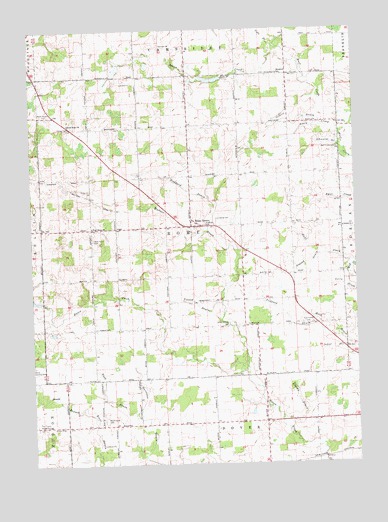
Rome Center, MI USGS Topographic Map
Click on map above to begin viewing in our Map Viewer.

This topographic map contains these locations and features:
Feature Name Type Latitude Longitude GNIS ID View Map
Atwood DrainStreamN41.9350°W84.1369°620318View Map
Bates Farm CemeteryCemeteryN41.9583°W84.1764°2465687View Map
Cole DrainStreamN41.9950°W84.1549°623587View Map
Dover Post Office (historical)Post OfficeN41.8778°W84.1361°2435689View Map
East Rome CemeteryCemeteryN41.9156°W84.1455°625251View Map
Four Towns Grange HallBuildingN41.8864°W84.2469°1625566View Map
Fouty CreekStreamN41.9703°W84.1308°626353View Map
Gilbert DrainStreamN41.9731°W84.1377°626805View Map
Halstead Farm CemeteryCemeteryN41.9444°W84.1583°2465686View Map
Hunt CreekStreamN41.9317°W84.1263°628815View Map
Loars Field Airport (historical)AirportN41.9937°W84.1874°1624085View Map
Lowery DrainStreamN41.8853°W84.1511°631190View Map
Nash DrainStreamN41.8898°W84.2102°633220View Map
North Dover CemeteryCemeteryN41.8884°W84.2222°633564View Map
North Rome CemeteryCemeteryN41.9756°W84.2455°633637View Map
North Rome ChurchChurchN41.9731°W84.2349°633638View Map
Penrod DrainStreamN41.9020°W84.1674°634604View Map
Pickford DrainStreamN41.9170°W84.1413°634812View Map
Rollin Center United Methodist ChurchChurchN41.8883°W84.2375°2465614View Map
Rome CemeteryCemeteryN41.9456°W84.1777°636143View Map
Rome CenterPopulated PlaceN41.9437°W84.1877°636144View Map
Rome Grange HallBuildingN41.9148°W84.1744°1625571View Map
Rome Post Office (historical)Post OfficeN41.9456°W84.1778°2435599View Map
Rome Township HallBuildingN41.9458°W84.1878°2436154View Map
Schnieral DrainStreamN41.9664°W84.1305°637354View Map
School Number 2SchoolN41.9428°W84.1294°637393View Map
Shepherd SchoolSchoolN41.9870°W84.1538°637741View Map
Squaw CreekStreamN41.9945°W84.1538°638668View Map
Stoddard DrainStreamN41.9425°W84.1813°638858View Map
Stoddard Post Office (historical)Post OfficeN41.9833°W84.2458°2435595View Map
Township of RomeCivilN41.9433°W84.1882°1626999View Map
Wallace DrainStreamN41.9217°W84.1761°1615713View Map
West Rome CemeteryCemeteryN41.9400°W84.2258°1616166View Map
West Rome ChurchChurchN41.9434°W84.2261°1616167View Map
Wolf Creek CemeteryCemeteryN41.9653°W84.1316°1616689View Map
Wolfcreek Post Office (historical)Post OfficeN41.9722°W84.1306°2435591View Map

Note: Coordinates in the location and feature list above are referenced to NAD83 datum.


Copyright (C) 2008-2025 Ryan Niemi / Sunset Dynamics ... All Rights Reserved