TopoQuest Logo
Do you find TopoQuest useful?
Help keep TopoQuest running and adding new maps/features by donating!
Bitcoin:  19c7KJd3qBynnjoSw5npx9KScwjBe4ifkT
Litecoin:  LXs6TkuXGGXo1vDsWCkWVdjQX94eUKd6ui
Home View Maps Find Maps Find Places Resources & Links


Jasper, Michigan Topographic Map

USGS Map Title: Jasper, MI
USGS Map MRC: 41084G1
DRG (GeoTIFF) Download: o41084g1.tif


Neighboring USGS Topographic Map Quads:


  Rome Center, MI  
41084H2
 

  Adrian, MI  
41084H1
 

  Tecumseh South, MI  
41083H8
 

  Clayton, MI  
41084G2
 

  Jasper, MI  
41084G1
 

  Palmyra, MI  
41083G8
 

  Morenci, MI  
41084F2
 

  Lyons, OH  
41084F1
 

  Assumption, OH  
41083F8


Map MRC Location:

N42°
W85°
N42°
W84°
H8 H7 H6 H5 H4 H3 H2 H1
G8 G7 G6 G5 G4 G3 G2 G1
F8 F7 F6 F5 F4 F3 F2 F1
E8 E7 E6 E5 E4 E3 E2 E1
D8 D7 D6 D5 D4 D3 D2 D1
C8 C7 C6 C5 C4 C3 C2 C1
B8 B7 B6 B5 B4 B3 B2 B1
A8 A7 A6 A5 A4 A3 A2 A1
N41°
W85°
N41°
W84°

Jasper, MI USGS 1:24K Topographic Map Preview:
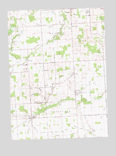
Jasper, MI USGS Topographic Map
Click on map above to begin viewing in our Map Viewer.

This topographic map contains these locations and features:
Feature Name Type Latitude Longitude GNIS ID View Map
Abbott DrainStreamN41.7764°W84.0380°619786View Map
Anderson DrainStreamN41.7934°W84.0861°620096View Map
Apple Hill CemeteryCemeteryN41.8555°W84.0181°2465706View Map
Baker and May DrainStreamN41.7789°W84.0813°620470View Map
Brock CemeteryCemeteryN41.7855°W84.0403°2465700View Map
Charter Township of MadisonCivilN41.8535°W84.0646°1626662View Map
Complex DrainStreamN41.8148°W84.1236°623666View Map
County Poor House CemeteryCemeteryN41.8744°W84.0833°2465701View Map
Deland DrainCanalN41.7714°W84.0191°624518View Map
FairfieldPopulated PlaceN41.8128°W84.0411°625749View Map
Fairfield Baptist ChurchChurchN41.8100°W84.0461°2435709View Map
Fairfield CemeteryCemeteryN41.8164°W84.0403°2465699View Map
Fairfield Post Office (historical)Post OfficeN41.8128°W84.0411°2435687View Map
Fairfield Township Fire DepartmentBuildingN41.7707°W84.1006°2620085View Map
Fruit Ridge Post Office (historical)Post OfficeN41.7986°W84.1083°2435686View Map
Gorman Post Office (historical)Post OfficeN41.8250°W84.0028°2435684View Map
Hagaman CemeteryCemeteryN41.8017°W84.0802°627591View Map
Hall DrainStreamN41.7603°W84.0411°627643View Map
Hoadley DrainStreamN41.7853°W84.0786°628357View Map
Holmes DrainStreamN41.7873°W84.0174°628452View Map
Hough DrainStreamN41.7631°W84.0980°628657View Map
Hunt CemeteryCemeteryN41.8239°W84.0230°628814View Map
JasperPopulated PlaceN41.7934°W84.0405°629217View Map
Jasper Bible ChurchChurchN41.7969°W84.0417°2463808View Map
Jasper Census Designated PlaceCensusN41.7859°W84.0403°2628667View Map
Jasper DrainStreamN41.7917°W84.0336°629218View Map
Jasper Post OfficePost OfficeN41.7931°W84.0414°2463809View Map
Jasper Station (historical)LocaleN41.7933°W84.0403°2463807View Map
Knapp DrainStreamN41.7584°W84.0311°629804View Map
Lenawee County AirportAirportN41.8729°W84.0731°1623768View Map
Madison CenterPopulated PlaceN41.8600°W84.0424°631308View Map
Madison Center CemeteryCemeteryN41.8600°W84.0383°2465707View Map
Madison Church of the NazareneChurchN41.8611°W84.0183°2435730View Map
Madison SchoolSchoolN41.8678°W84.0194°631316View Map
Madison Township Fire DepartmentBuildingN41.8595°W84.0433°2619948View Map
Madison Township Police DepartmentBuildingN41.8597°W84.0431°2737439View Map
Mitchell DrainStreamN41.8164°W84.0499°632512View Map
Morse Lord DrainStreamN41.7917°W84.0338°632734View Map
Nelson DrainStreamN41.7587°W84.0311°633281View Map
New Weston CemeteryCemeteryN41.7703°W84.0947°2465696View Map
Old Weston CemeteryCemeteryN41.7708°W84.0972°2465697View Map
Porter DrainStreamN41.8600°W84.0527°635303View Map
Raymond DrainStreamN41.7556°W84.0236°635684View Map
Reed GraveCemeteryN41.8000°W84.0028°2465698View Map
RidgevillePopulated PlaceN41.7573°W84.0216°1617818View Map
Ridgeville Bible ChurchChurchN41.7567°W84.0219°2463806View Map
Ridgeville CemeteryCemeteryN41.7567°W84.0225°2465695View Map
Ridgeville Post Office (historical)Post OfficeN41.7572°W84.0217°2435600View Map
Sand CreekPopulated PlaceN41.8259°W84.1016°637163View Map
Sand Creek CemeteryCemeteryN41.8156°W84.1038°637174View Map
Sand Creek Community ChurchChurchN41.8272°W84.1008°2436127View Map
Sand Creek Community SchoolsSchoolN41.8184°W84.1024°637173View Map
Sand Creek Post OfficePost OfficeN41.8250°W84.1014°2436126View Map
Sand Creek SchoolSchoolN41.8184°W84.1024°637175View Map
Sand Creek StationLocaleN41.8264°W84.1000°2436128View Map
Savage DrainStreamN41.8725°W84.0516°637285View Map
Scharer DrainStreamN41.7826°W84.0836°637324View Map
South Branch Stony CreekStreamN41.8209°W84.1194°638316View Map
Southgate Mobile ParkPopulated PlaceN41.8742°W84.0167°2435769View Map
Stony CreekStreamN41.8284°W84.1019°638896View Map
Township of FairfieldCivilN41.7659°W84.0591°1626263View Map
Walker DrainStreamN41.7867°W84.0316°1615695View Map
Warren DrainStreamN41.8425°W84.1211°1615783View Map
West Madison CemeteryCemeteryN41.8553°W84.1066°1616146View Map
WestonPopulated PlaceN41.7703°W84.0977°1616220View Map
Weston Baptist ChurchChurchN41.7714°W84.0997°2436123View Map
Weston DrainStreamN41.7751°W84.0913°1616223View Map
Weston Methodist ChurchChurchN41.7700°W84.1017°2436124View Map
Weston Post OfficePost OfficeN41.7703°W84.1003°2436125View Map
Weston Station (historical)LocaleN41.7681°W84.0967°2436122View Map
Woodlawn Golf ClubLocaleN41.8544°W84.0214°2435786View Map
WQTE-FM (Adrian)TowerN41.8042°W84.0902°1625333View Map

Note: Coordinates in the location and feature list above are referenced to NAD83 datum.


Copyright (C) 2008-2025 Ryan Niemi / Sunset Dynamics ... All Rights Reserved