TopoQuest Logo
Do you find TopoQuest useful?
Help keep TopoQuest running and adding new maps/features by donating!
Bitcoin:  19c7KJd3qBynnjoSw5npx9KScwjBe4ifkT
Litecoin:  LXs6TkuXGGXo1vDsWCkWVdjQX94eUKd6ui
Home View Maps Find Maps Find Places Resources & Links


Rondo, Arkansas Topographic Map

USGS Map Title: Rondo, AR
USGS Map MRC: 34090F7
DRG (GeoTIFF) Download: o34090f7.tif


Neighboring USGS Topographic Map Quads:


  Moro, AR  
34090G8
 

  Marianna, AR  
34090G7
 

  Soudan, AR  
34090G6
 

  Aubrey, AR  
34090F8
 

  Rondo, AR  
34090F7
 

  La Grange, AR  
34090F6
 

  Marvell, AR  
34090E8
 

  Lexa, AR  
34090E7
 

  West Helena, AR  
34090E6


Map MRC Location:

N35°
W91°
N35°
W90°
H8 H7 H6 H5 H4 H3 H2 H1
G8 G7 G6 G5 G4 G3 G2 G1
F8 F7 F6 F5 F4 F3 F2 F1
E8 E7 E6 E5 E4 E3 E2 E1
D8 D7 D6 D5 D4 D3 D2 D1
C8 C7 C6 C5 C4 C3 C2 C1
B8 B7 B6 B5 B4 B3 B2 B1
A8 A7 A6 A5 A4 A3 A2 A1
N34°
W91°
N34°
W90°

Rondo, AR USGS 1:24K Topographic Map Preview:
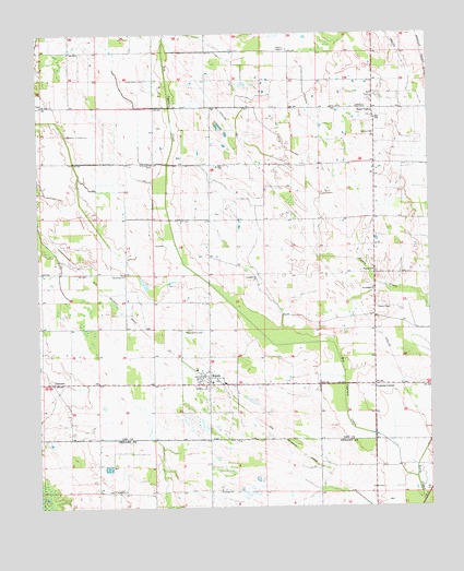
Rondo, AR USGS Topographic Map
Click on map above to begin viewing in our Map Viewer.

This topographic map contains these locations and features:
Feature Name Type Latitude Longitude GNIS ID View Map
Big Cypress CreekStreamN34.6326°W90.7548°45733View Map
Calvary ChurchChurchN34.7237°W90.7679°47301View Map
Chappelle (historical)Populated PlaceN34.6995°W90.8746°75250View Map
Cypress CornerPopulated PlaceN34.6570°W90.7679°56980View Map
EdgewoodPopulated PlaceN34.6354°W90.7857°65565View Map
First Friendship Baptist ChurchChurchN34.6829°W90.7679°76983View Map
Friendship CemeteryCemeteryN34.6304°W90.8176°65566View Map
Friendship ChurchChurchN34.6295°W90.8171°49262View Map
KZOT-AM (Marianna)TowerN34.7462°W90.7957°85320View Map
Mount Sinai ChurchChurchN34.7312°W90.8737°52415View Map
Mount Zion CemeteryCemeteryN34.7154°W90.8154°59565View Map
Mount Zion ChurchChurchN34.7154°W90.8165°52471View Map
New Life ChurchChurchN34.7304°W90.7812°52713View Map
Paradise CemeteryCemeteryN34.6848°W90.8057°59568View Map
Paradise ChurchChurchN34.6851°W90.8057°53179View Map
Pilgrim CemeteryCemeteryN34.6881°W90.7682°59570View Map
Pilgrim ChurchChurchN34.6873°W90.7679°53372View Map
Pilgrim School (historical)SchoolN34.6870°W90.7682°59571View Map
Possum Trot CemeteryCemeteryN34.6720°W90.8271°53712View Map
Rehoboth CemeteryCemeteryN34.6295°W90.8518°65567View Map
Rehoboth ChurchChurchN34.6295°W90.8512°53981View Map
RondoPopulated PlaceN34.6593°W90.8207°54180View Map
Rondo Fire StationBuildingN34.6602°W90.8229°2117045View Map
Rondo School (historical)SchoolN34.6612°W90.8248°59574View Map
Saint Holmes ChurchChurchN34.7159°W90.8382°54335View Map
Scott ValleyPopulated PlaceN34.7301°W90.7679°54648View Map
Scott Valley Church (historical)ChurchN34.7307°W90.7762°59576View Map
Scott Valley School (historical)SchoolN34.7307°W90.7759°59577View Map
Sequell ChurchChurchN34.6576°W90.8168°59578View Map
Third Zion ChurchChurchN34.6865°W90.8473°55518View Map
Town of RondoCivilN34.6575°W90.8209°2407239View Map
Township of RichlandCivilN34.6772°W90.7667°66813View Map
Tyner (historical)Populated PlaceN34.6298°W90.8565°65568View Map
University of Arkansas Cotton Branch Experiment StationLocaleN34.7334°W90.7654°59581View Map
VineyardPopulated PlaceN34.6579°W90.8701°57224View Map

Note: Coordinates in the location and feature list above are referenced to NAD83 datum.


Copyright (C) 2008-2024 Ryan Niemi / Sunset Dynamics ... All Rights Reserved