TopoQuest Logo
Do you find TopoQuest useful?
Help keep TopoQuest running and adding new maps/features by donating!
Bitcoin:  19c7KJd3qBynnjoSw5npx9KScwjBe4ifkT
Litecoin:  LXs6TkuXGGXo1vDsWCkWVdjQX94eUKd6ui
Home View Maps Find Maps Find Places Resources & Links


Soudan, Arkansas Topographic Map

USGS Map Title: Soudan, AR
USGS Map MRC: 34090G6
DRG (GeoTIFF) Download: o34090g6.tif


Neighboring USGS Topographic Map Quads:


  Haynes, AR  
34090H7
 

  Dansby, AR  
34090H6
 

  Mud Lake, AR  
34090H5
 

  Marianna, AR  
34090G7
 

  Soudan, AR  
34090G6
 

  Brickeys, AR  
34090G5
 

  Rondo, AR  
34090F7
 

  La Grange, AR  
34090F6
 

  Stubbs Island, MS  
34090F5


Map MRC Location:

N35°
W91°
N35°
W90°
H8 H7 H6 H5 H4 H3 H2 H1
G8 G7 G6 G5 G4 G3 G2 G1
F8 F7 F6 F5 F4 F3 F2 F1
E8 E7 E6 E5 E4 E3 E2 E1
D8 D7 D6 D5 D4 D3 D2 D1
C8 C7 C6 C5 C4 C3 C2 C1
B8 B7 B6 B5 B4 B3 B2 B1
A8 A7 A6 A5 A4 A3 A2 A1
N34°
W91°
N34°
W90°

Soudan, AR USGS 1:24K Topographic Map Preview:
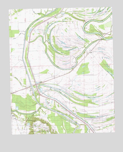
Soudan, AR USGS Topographic Map
Click on map above to begin viewing in our Map Viewer.

This topographic map contains these locations and features:
Feature Name Type Latitude Longitude GNIS ID View Map
Bald Point Church (historical)ChurchN34.8509°W90.6279°70029View Map
Bald Point School (historical)SchoolN34.8518°W90.6279°70030View Map
Ball PointCapeN34.8540°W90.6598°46059View Map
Baynes SpurLocaleN34.8023°W90.7071°59524View Map
Big Twin LakeLakeN34.8584°W90.6993°75646View Map
Big Yancopin LakeLakeN34.8326°W90.6794°75647View Map
Blue LakeLakeN34.8714°W90.6374°75655View Map
CodyPopulated PlaceN34.8440°W90.6398°57562View Map
Cody School (historical)SchoolN34.8679°W90.6773°59520View Map
Corner PlaceLocaleN34.8445°W90.6418°59516View Map
Cow BayouGutN34.8143°W90.6862°48113View Map
Cow BayouStreamN34.8682°W90.7071°48114View Map
Cow Bayou BarBarN34.8459°W90.6384°48115View Map
Crowley RidgeRidgeN34.7626°W90.7176°48235View Map
Crystal LakeReservoirN34.7618°W90.7251°80751View Map
Crystal Lake DamDamN34.7618°W90.7251°80750View Map
Ellison LakeLakeN34.7650°W90.6493°75704View Map
Greer PlacePopulated PlaceN34.7529°W90.6726°57850View Map
Holly Grove ChurchChurchN34.7807°W90.6751°59523View Map
Johnson LakeLakeN34.7856°W90.6562°50703View Map
KVNZ-FM (Marianna)TowerN34.7615°W90.7207°85222View Map
L'Anguille LakeLakeN34.7863°W90.7194°59526View Map
Larkin LakeLakeN34.7894°W90.6877°75755View Map
Little Twin LakeLakeN34.8559°W90.7048°75766View Map
Little Yancopin LakeLakeN34.8357°W90.6809°75767View Map
Long LakeLakeN34.7951°W90.6964°51431View Map
Long LakeLakeN34.8451°W90.6644°51435View Map
Long LakeLakeN34.8729°W90.6304°75775View Map
Madison-Marianna DiversionChannelN34.8404°W90.7321°51601View Map
Mossy Lake BayouStreamN34.7529°W90.6509°52243View Map
Mount Olive Church (historical)ChurchN34.7987°W90.7237°59525View Map
Mount Zion ChurchChurchN34.8251°W90.6496°52472View Map
Mount Zion Church (historical)ChurchN34.8248°W90.6504°70037View Map
New Bethel ChurchChurchN34.8493°W90.6590°59519View Map
New Hope Church (historical)ChurchN34.8593°W90.7218°81644View Map
New Mount Olive Church (historical)ChurchN34.7990°W90.7187°81643View Map
Patterson CreekStreamN34.7704°W90.7226°53225View Map
Pleasant Valley Missionary Baptist ChurchChurchN34.8479°W90.6329°78063View Map
Poinsett SpurLocaleN34.8137°W90.6737°59521View Map
Rowing LakeLakeN34.7790°W90.7047°75841View Map
Saint Francis FloodwayCanalN34.8129°W90.7298°83265View Map
Sandy SloughStreamN34.8495°W90.7309°54583View Map
Shady Grove ChurchChurchN34.8304°W90.7071°54712View Map
Shenship LakeLakeN34.7620°W90.6573°74621View Map
Skidmore RidgeRidgeN34.7751°W90.6787°54889View Map
Skidmore School (historical)SchoolN34.7804°W90.6746°59522View Map
SoudanPopulated PlaceN34.8262°W90.6593°78404View Map
Soudan CemeteryCemeteryN34.8290°W90.6612°55007View Map
Soudan LandingLocaleN34.8423°W90.6329°59515View Map
Soudan School (historical)SchoolN34.8251°W90.6501°59517View Map
Three Mile SloughGutN34.8090°W90.7484°78550View Map
Tongin School (historical)SchoolN34.8493°W90.6296°59514View Map
Township of IndependenceCivilN34.7651°W90.7053°66810View Map
Township of Liberty (historical)CivilN34.8001°W90.6390°66811View Map
Township of UnionCivilN34.8720°W90.7302°66817View Map
True Love BarBarN34.8490°W90.6540°55668View Map
True Love CrossingCrossingN34.8495°W90.6482°59518View Map
Vanness CrossingPopulated PlaceN34.8620°W90.6523°58795View Map
Westwood School (historical)SchoolN34.8012°W90.6351°70042View Map
Willow School (historical)SchoolN34.8501°W90.6598°70044View Map

Note: Coordinates in the location and feature list above are referenced to NAD83 datum.


Copyright (C) 2008-2025 Ryan Niemi / Sunset Dynamics ... All Rights Reserved