TopoQuest Logo
Do you find TopoQuest useful?
Help keep TopoQuest running and adding new maps/features by donating!
Bitcoin:  19c7KJd3qBynnjoSw5npx9KScwjBe4ifkT
Litecoin:  LXs6TkuXGGXo1vDsWCkWVdjQX94eUKd6ui
Home View Maps Find Maps Find Places Resources & Links


Roscoe NW, Montana Topographic Map

USGS Map Title: Roscoe NW, MT
USGS Map MRC: 45109D4
DRG (GeoTIFF) Download: o45109d4.tif


Neighboring USGS Topographic Map Quads:


  Sandborn Creek, MT  
45109E5
 

  Absarokee, MT  
45109E4
 

  Whitebird School, MT  
45109E3
 

  Fishtail, MT  
45109D5
 

  Roscoe NW, MT  
45109D4
 

  Roscoe NE, MT  
45109D3
 

  Mackay Ranch, MT  
45109C5
 

  Roscoe, MT  
45109C4
 

  Castagne, MT  
45109C3


Map MRC Location:

N46°
W110°
N46°
W109°
H8 H7 H6 H5 H4 H3 H2 H1
G8 G7 G6 G5 G4 G3 G2 G1
F8 F7 F6 F5 F4 F3 F2 F1
E8 E7 E6 E5 E4 E3 E2 E1
D8 D7 D6 D5 D4 D3 D2 D1
C8 C7 C6 C5 C4 C3 C2 C1
B8 B7 B6 B5 B4 B3 B2 B1
A8 A7 A6 A5 A4 A3 A2 A1
N45°
W110°
N45°
W109°

Roscoe NW, MT USGS 1:24K Topographic Map Preview:
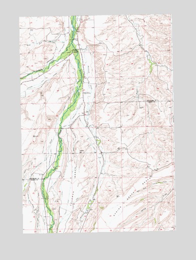
Roscoe NW, MT USGS Topographic Map
Click on map above to begin viewing in our Map Viewer.

This topographic map contains these locations and features:
Feature Name Type Latitude Longitude GNIS ID View Map
04S18E13DCBC01 WellWellN45.4811°W109.4479°809699View Map
04S18E14BBDA01 WellWellN45.4911°W109.4757°809763View Map
04S18E22DCAA01 WellWellN45.4672°W109.4854°809641View Map
04S18E23AADB01 WellWellN45.4758°W109.4604°809681View Map
04S18E23BDCD01 WellWellN45.4716°W109.4735°809663View Map
05S18E03ABBB01 WellWellN45.3930°W109.4891°809274View Map
Antelope CreekStreamN45.4408°W109.4663°779065View Map
Butcher CreekStreamN45.4849°W109.4566°780675View Map
Butcher Creek DitchCanalN45.4627°W109.4382°769437View Map
Butcher Creek Rosebud Ditch CountyCanalN45.4386°W109.4585°769438View Map
Chimney CreekStreamN45.4374°W109.4602°769833View Map
Coleman BenchBenchN45.3761°W109.4671°781504View Map
East Rosebud CreekStreamN45.4833°W109.4568°782949View Map
Eggen-Piper DitchCanalN45.4433°W109.4557°771151View Map
Horse CreekStreamN45.4958°W109.4574°772539View Map
Johnson DitchCanalN45.4611°W109.4549°772868View Map
Jorgen Elesius Madson Historical MarkerParkN45.4555°W109.4482°775730View Map
Kyle Ferster-Seely DitchCanalN45.4152°W109.4774°773152View Map
Olson DitchCanalN45.3919°W109.4632°788451View Map
Olson DitchCanalN45.4199°W109.4391°774964View Map
Rosebud Community CenterLocaleN45.4802°W109.4563°775946View Map
Ross-Flannigan DitchCanalN45.4855°W109.4638°768080View Map
Rudd School (historical)SchoolN45.4213°W109.4341°1726847View Map
Selleck-Espeland DitchCanalN45.3836°W109.4871°790209View Map
Selleck-Scott DitchCanalN45.3758°W109.4879°790210View Map
Smith BridgeBridgeN45.4863°W109.4563°776657View Map
Sylvester-Beasly DitchCanalN45.4961°W109.4504°777385View Map
Tuttle Luther DitchCanalN45.4030°W109.4746°777822View Map
Waterman DitchCanalN45.4447°W109.4666°778138View Map
West Rosebud CreekStreamN45.4836°W109.4574°793123View Map
Woodard DitchCanalN45.4586°W109.4941°778669View Map
Yances School (historical)SchoolN45.4277°W109.4674°1726957View Map
Yancey HillSummitN45.4219°W109.4541°778719View Map

Note: Coordinates in the location and feature list above are referenced to NAD83 datum.


Copyright (C) 2008-2025 Ryan Niemi / Sunset Dynamics ... All Rights Reserved