TopoQuest Logo
Do you find TopoQuest useful?
Help keep TopoQuest running and adding new maps/features by donating!
Bitcoin:  19c7KJd3qBynnjoSw5npx9KScwjBe4ifkT
Litecoin:  LXs6TkuXGGXo1vDsWCkWVdjQX94eUKd6ui
Home View Maps Find Maps Find Places Resources & Links


Fishtail, Montana Topographic Map

USGS Map Title: Fishtail, MT
USGS Map MRC: 45109D5
DRG (GeoTIFF) Download: o45109d5.tif


Neighboring USGS Topographic Map Quads:


  Cow Face Hill, MT  
45109E6
 

  Sandborn Creek, MT  
45109E5
 

  Absarokee, MT  
45109E4
 

  Beehive, MT  
45109D6
 

  Fishtail, MT  
45109D5
 

  Roscoe NW, MT  
45109D4
 

  Emerald Lake, MT  
45109C6
 

  Mackay Ranch, MT  
45109C5
 

  Roscoe, MT  
45109C4


Map MRC Location:

N46°
W110°
N46°
W109°
H8 H7 H6 H5 H4 H3 H2 H1
G8 G7 G6 G5 G4 G3 G2 G1
F8 F7 F6 F5 F4 F3 F2 F1
E8 E7 E6 E5 E4 E3 E2 E1
D8 D7 D6 D5 D4 D3 D2 D1
C8 C7 C6 C5 C4 C3 C2 C1
B8 B7 B6 B5 B4 B3 B2 B1
A8 A7 A6 A5 A4 A3 A2 A1
N45°
W110°
N45°
W109°

Fishtail, MT USGS 1:24K Topographic Map Preview:
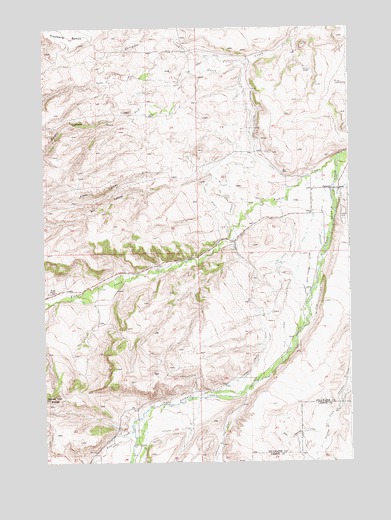
Fishtail, MT USGS Topographic Map
Click on map above to begin viewing in our Map Viewer.

This topographic map contains these locations and features:
Feature Name Type Latitude Longitude GNIS ID View Map
04S18E18ADAA01 WellWellN45.4911°W109.5424°809764View Map
04S18E20CCCC01 WellWellN45.4649°W109.5410°809626View Map
04S18E28CABB01 WellWellN45.4569°W109.5146°809575View Map
04S18E28DADD01 WellWellN45.4538°W109.5004°809553View Map
04S18E28DCAA01 WellWellN45.4533°W109.5054°809550View Map
04S18E32BCDC01 WellWellN45.4424°W109.5388°809510View Map
05S17E02CBBD01 WellWellN45.4272°W109.6007°809427View Map
05S17E13CDDB01 WellWellN45.3933°W109.5743°809279View Map
05S17E23ABBC01 WellWellN45.3899°W109.5924°809251View Map
05S18E04CBDC01 WellWellN45.4249°W109.5174°809417View Map
05S18E06BBBD01 WellWellN45.3927°W109.5602°809271View Map
05S18E17DAAA01 WellWellN45.3897°W109.5210°809248View Map
Arney CanyonValleyN45.4699°W109.5563°779138View Map
Box CanyonValleyN45.4586°W109.5566°780326View Map
Cushing DitchCanalN45.4066°W109.5363°770383View Map
Davidson CreekStreamN45.4899°W109.5402°770469View Map
Dempster DitchCanalN45.4458°W109.5110°770601View Map
Fiddler CreekStreamN45.3855°W109.5896°783367View Map
FishtailPopulated PlaceN45.4536°W109.5043°771405View Map
Fishtail CreekStreamN45.4630°W109.5043°783464View Map
Fishtail Post OfficePost OfficeN45.4532°W109.5070°1726881View Map
Fishtail SchoolSchoolN45.4516°W109.5032°1726953View Map
Fladberg BenchBenchN45.4991°W109.6141°771422View Map
Hogan DitchCanalN45.4319°W109.5310°772451View Map
Ingersoll CreekStreamN45.3966°W109.5416°785292View Map
Magee DitchCanalN45.4916°W109.5579°773801View Map
Miller DitchCanalN45.3813°W109.5774°787414View Map
Murphy CanyonValleyN45.4749°W109.5885°787855View Map
Nellies Twin ButtesSummitN45.3933°W109.6249°774568View Map
Nels Thomas DitchCanalN45.4286°W109.5171°774569View Map
North Fork Grove CreekStreamN45.4838°W109.5691°788175View Map
Phillips DitchCanalN45.3844°W109.5735°788819View Map
Riswalds Ranch (historical)LocaleN45.4944°W109.5943°1726975View Map
Rosebud Isle Fishing Access SiteLocaleN45.4549°W109.5129°1744528View Map
South Fork Grove CreekStreamN45.4838°W109.5688°790975View Map
Spray Garwin DitchCanalN45.4127°W109.5354°776949View Map
Twin Butte School (historical)SchoolN45.4241°W109.6204°777833View Map
West Antelope CreekStreamN45.3866°W109.5096°778188View Map
West Rosebud DitchCanalN45.4497°W109.5485°778307View Map
Yates DitchCanalN45.4413°W109.5532°778727View Map

Note: Coordinates in the location and feature list above are referenced to NAD83 datum.


Copyright (C) 2008-2025 Ryan Niemi / Sunset Dynamics ... All Rights Reserved