TopoQuest Logo
Do you find TopoQuest useful?
Help keep TopoQuest running and adding new maps/features by donating!
Bitcoin:  19c7KJd3qBynnjoSw5npx9KScwjBe4ifkT
Litecoin:  LXs6TkuXGGXo1vDsWCkWVdjQX94eUKd6ui
Home View Maps Find Maps Find Places Resources & Links


Sandborn Creek, Montana Topographic Map

USGS Map Title: Sandborn Creek, MT
USGS Map MRC: 45109E5
DRG (GeoTIFF) Download: o45109e5.tif


Neighboring USGS Topographic Map Quads:


  Work Creek, MT  
45109F6
 

  Reed Point, MT  
45109F5
 

  Springtime, MT  
45109F4
 

  Cow Face Hill, MT  
45109E6
 

  Sandborn Creek, MT  
45109E5
 

  Absarokee, MT  
45109E4
 

  Beehive, MT  
45109D6
 

  Fishtail, MT  
45109D5
 

  Roscoe NW, MT  
45109D4


Map MRC Location:

N46°
W110°
N46°
W109°
H8 H7 H6 H5 H4 H3 H2 H1
G8 G7 G6 G5 G4 G3 G2 G1
F8 F7 F6 F5 F4 F3 F2 F1
E8 E7 E6 E5 E4 E3 E2 E1
D8 D7 D6 D5 D4 D3 D2 D1
C8 C7 C6 C5 C4 C3 C2 C1
B8 B7 B6 B5 B4 B3 B2 B1
A8 A7 A6 A5 A4 A3 A2 A1
N45°
W110°
N45°
W109°

Sandborn Creek, MT USGS 1:24K Topographic Map Preview:
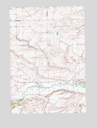
Sandborn Creek, MT USGS Topographic Map
Click on map above to begin viewing in our Map Viewer.

This topographic map contains these locations and features:
Feature Name Type Latitude Longitude GNIS ID View Map
03S18E33BDAB01 WellWellN45.5330°W109.5127°810006View Map
Arthun DitchCanalN45.5116°W109.5207°768354View Map
Barrons Corner (historical)LocaleN45.5222°W109.5779°1726936View Map
Brey Riddle DitchCanalN45.5227°W109.5860°769211View Map
Cow CreekStreamN45.5311°W109.5732°770217View Map
Jack Stone CreekStreamN45.5344°W109.5188°772770View Map
Kent Lake School (historical)SchoolN45.6166°W109.6143°772998View Map
Kiehl Post Office (historical)Post OfficeN45.5208°W109.5313°1726882View Map
Larson-Johnson DitchCanalN45.5341°W109.5788°773238View Map
Little Spring CreekStreamN45.5424°W109.6141°773493View Map
Madison GradeSummitN45.5163°W109.6074°773797View Map
Phelps DitchCanalN45.5269°W109.5602°775191View Map
Rosann Rosanna Dana DamDamN45.6116°W109.5991°796564View Map
Sandborn CreekStreamN45.5269°W109.5585°776206View Map
Spring CreekStreamN45.5305°W109.5757°791263View Map
Spring Creek School (historical)SchoolN45.5319°W109.5771°777071View Map
Stillwater DitchCanalN45.5322°W109.6052°777215View Map
Tintinger DitchCanalN45.5369°W109.5388°777679View Map
Weir-Crawford DitchCanalN45.5347°W109.5171°778174View Map

Note: Coordinates in the location and feature list above are referenced to NAD83 datum.


Copyright (C) 2008-2025 Ryan Niemi / Sunset Dynamics ... All Rights Reserved