TopoQuest Logo
Do you find TopoQuest useful?
Help keep TopoQuest running and adding new maps/features by donating!
Bitcoin:  19c7KJd3qBynnjoSw5npx9KScwjBe4ifkT
Litecoin:  LXs6TkuXGGXo1vDsWCkWVdjQX94eUKd6ui
Home View Maps Find Maps Find Places Resources & Links


Rossman Creek, Wisconsin Topographic Map

USGS Map Title: Rossman Creek, WI
USGS Map MRC: 44091E5
DRG (GeoTIFF) Download: o44091e5.tif


Neighboring USGS Topographic Map Quads:


  Rock Falls, WI  
44091F6
 

  Mondovi NE, WI  
44091F5
 

  Cleghorn, WI  
44091F4
 

  Mondovi, WI  
44091E6
 

  Rossman Creek, WI  
44091E5
 

  Strum, WI  
44091E4
 

  Gilmanton, WI  
44091D6
 

  Lookout, WI  
44091D5
 

  Elk Creek, WI  
44091D4


Map MRC Location:

N45°
W92°
N45°
W91°
H8 H7 H6 H5 H4 H3 H2 H1
G8 G7 G6 G5 G4 G3 G2 G1
F8 F7 F6 F5 F4 F3 F2 F1
E8 E7 E6 E5 E4 E3 E2 E1
D8 D7 D6 D5 D4 D3 D2 D1
C8 C7 C6 C5 C4 C3 C2 C1
B8 B7 B6 B5 B4 B3 B2 B1
A8 A7 A6 A5 A4 A3 A2 A1
N44°
W92°
N44°
W91°

Rossman Creek, WI USGS 1:24K Topographic Map Preview:
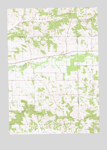
Rossman Creek, WI USGS Topographic Map
Click on map above to begin viewing in our Map Viewer.

This topographic map contains these locations and features:
Feature Name Type Latitude Longitude GNIS ID View Map
Adams CreekStreamN44.5656°W91.6110°2760559View Map
Bennett RidgeRidgeN44.5194°W91.5743°1561566View Map
Davy ValleyValleyN44.5758°W91.5191°1563741View Map
Gibson School (historical)SchoolN44.5819°W91.5085°1851105View Map
Hemlock School (historical)SchoolN44.6105°W91.6093°1578428View Map
Hilliard School (historical)SchoolN44.5800°W91.5432°1578378View Map
Lindsay CreekStreamN44.6002°W91.5002°1568141View Map
Log Cabin AirportAirportN44.5745°W91.5472°2444144View Map
Mondovi Airfield (historical)AirportN44.5672°W91.5743°1837532View Map
Naples SchoolSchoolN44.5550°W91.5904°1570101View Map
Norden School (historical)SchoolN44.5389°W91.5493°1578379View Map
Norden Trinity ChurchChurchN44.5439°W91.5296°1570334View Map
Pace School (historical)SchoolN44.5602°W91.5777°1578380View Map
Plainview School (historical)SchoolN44.5327°W91.5032°1851153View Map
Rossman CreekStreamN44.5725°W91.5604°1572625View Map
Sands School (historical)SchoolN44.6244°W91.5157°1578439View Map
Session ValleyValleyN44.5815°W91.5467°1573905View Map
Seyforth School (historical)SchoolN44.5533°W91.6188°1578382View Map
Silver CreekStreamN44.5761°W91.5500°2760560View Map
Town of NaplesCivilN44.5528°W91.5891°1583777View Map

Note: Coordinates in the location and feature list above are referenced to NAD83 datum.


Copyright (C) 2008-2025 Ryan Niemi / Sunset Dynamics ... All Rights Reserved