TopoQuest Logo
Do you find TopoQuest useful?
Help keep TopoQuest running and adding new maps/features by donating!
Bitcoin:  19c7KJd3qBynnjoSw5npx9KScwjBe4ifkT
Litecoin:  LXs6TkuXGGXo1vDsWCkWVdjQX94eUKd6ui
Home View Maps Find Maps Find Places Resources & Links


Strum, Wisconsin Topographic Map

USGS Map Title: Strum, WI
USGS Map MRC: 44091E4
DRG (GeoTIFF) Download: o44091e4.tif


Neighboring USGS Topographic Map Quads:


  Mondovi NE, WI  
44091F5
 

  Cleghorn, WI  
44091F4
 

  Brackett, WI  
44091F3
 

  Rossman Creek, WI  
44091E5
 

  Strum, WI  
44091E4
 

  Strum SE, WI  
44091E3
 

  Lookout, WI  
44091D5
 

  Elk Creek, WI  
44091D4
 

  Pleasantville, WI  
44091D3


Map MRC Location:

N45°
W92°
N45°
W91°
H8 H7 H6 H5 H4 H3 H2 H1
G8 G7 G6 G5 G4 G3 G2 G1
F8 F7 F6 F5 F4 F3 F2 F1
E8 E7 E6 E5 E4 E3 E2 E1
D8 D7 D6 D5 D4 D3 D2 D1
C8 C7 C6 C5 C4 C3 C2 C1
B8 B7 B6 B5 B4 B3 B2 B1
A8 A7 A6 A5 A4 A3 A2 A1
N44°
W92°
N44°
W91°

Strum, WI USGS 1:24K Topographic Map Preview:
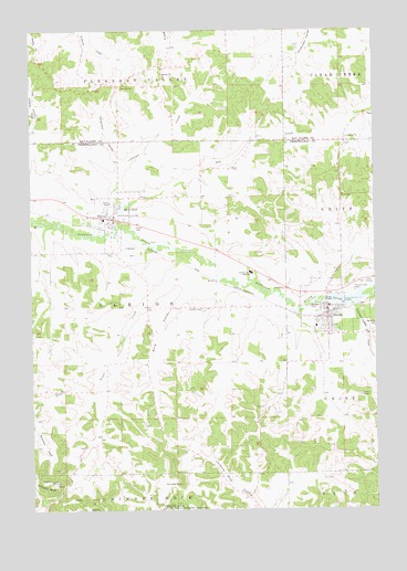
Strum, WI USGS Topographic Map
Click on map above to begin viewing in our Map Viewer.

This topographic map contains these locations and features:
Feature Name Type Latitude Longitude GNIS ID View Map
Adams CreekStreamN44.5739°W91.4688°1560684View Map
Berg ValleyValleyN44.5572°W91.4426°1561584View Map
Big CreekStreamN44.5794°W91.4657°1561700View Map
Big Creek School (historical)SchoolN44.5861°W91.4385°1851064View Map
Carters CreekStreamN44.5545°W91.3942°2760860View Map
Chimney RockSummitN44.5066°W91.4465°1563028View Map
Crystal Lake ParkParkN44.5572°W91.3829°1563599View Map
ElevaPopulated PlaceN44.5758°W91.4702°1564504View Map
Eleva - Strum High SchoolSchoolN44.5613°W91.4205°1562896View Map
Eleva CemeteryCemeteryN44.5736°W91.4627°1564505View Map
Eleva Elementary SchoolSchoolN44.5756°W91.4738°1851093View Map
Eleva Police DepartmentBuildingN44.5758°W91.4677°2759914View Map
Eleva PondReservoirN44.5780°W91.4673°1564506View Map
Eleva Volunteer Fire DepartmentBuildingN44.5758°W91.4676°2698023View Map
Hamlin CemeteryCemeteryN44.5522°W91.4382°1566017View Map
Hamlin School (historical)SchoolN44.5522°W91.4349°1851109View Map
Hillside School (historical)SchoolN44.5283°W91.4374°1851113View Map
Johnson Valley CreekStreamN44.5533°W91.3829°1567251View Map
Norwegian High School (historical)SchoolN44.6105°W91.4682°1846719View Map
StrumPopulated PlaceN44.5497°W91.3927°1574988View Map
Strum - Unity Fire and RescueBuildingN44.5498°W91.3918°2697511View Map
Strum 2WP338 DamDamN44.5547°W91.3924°1792058View Map
Strum Elementary SchoolSchoolN44.5475°W91.3969°1851180View Map
Strum LakeReservoirN44.5546°W91.3856°1574989View Map
Strum Lake 125ReservoirN44.5550°W91.3935°1792059View Map
Strum Police DepartmentBuildingN44.5497°W91.3922°2759408View Map
Tolleston ValleyValleyN44.5901°W91.4671°1575486View Map
Town of AlbionCivilN44.5524°W91.4684°1582670View Map
Trout CreekStreamN44.5680°W91.4474°1575663View Map
Village of ElevaCivilN44.5763°W91.4701°1583146View Map
Village of StrumCivilN44.5531°W91.3867°1584237View Map

Note: Coordinates in the location and feature list above are referenced to NAD83 datum.


Copyright (C) 2008-2025 Ryan Niemi / Sunset Dynamics ... All Rights Reserved