TopoQuest Logo
Do you find TopoQuest useful?
Help keep TopoQuest running and adding new maps/features by donating!
Bitcoin:  19c7KJd3qBynnjoSw5npx9KScwjBe4ifkT
Litecoin:  LXs6TkuXGGXo1vDsWCkWVdjQX94eUKd6ui
Home View Maps Find Maps Find Places Resources & Links


Rowena, Missouri Topographic Map

USGS Map Title: Rowena, MO
USGS Map MRC: 39092C1
DRG (GeoTIFF) Download: o39092c1.tif


Neighboring USGS Topographic Map Quads:


  Madison, MO  
39092D2
 

  Paris West, MO  
39092D1
 

  Paris East, MO  
39091D8
 

  Tulip, MO  
39092C2
 

  Rowena, MO  
39092C1
 

  Molino, MO  
39091C8
 

  Centralia, MO  
39092B2
 

  Centralia NE, MO  
39092B1
 

  Mexico West, MO  
39091B8


Map MRC Location:

N40°
W93°
N40°
W92°
H8 H7 H6 H5 H4 H3 H2 H1
G8 G7 G6 G5 G4 G3 G2 G1
F8 F7 F6 F5 F4 F3 F2 F1
E8 E7 E6 E5 E4 E3 E2 E1
D8 D7 D6 D5 D4 D3 D2 D1
C8 C7 C6 C5 C4 C3 C2 C1
B8 B7 B6 B5 B4 B3 B2 B1
A8 A7 A6 A5 A4 A3 A2 A1
N39°
W93°
N39°
W92°

Rowena, MO USGS 1:24K Topographic Map Preview:
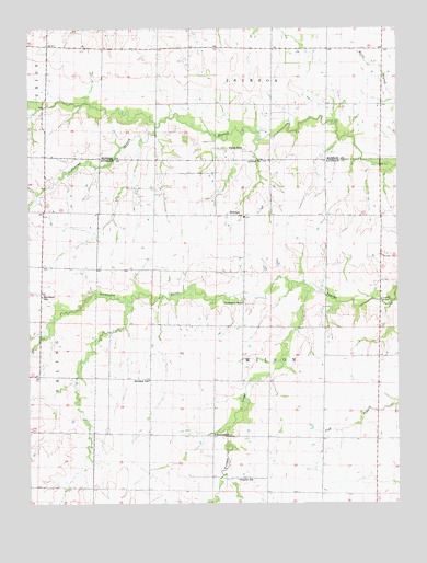
Rowena, MO USGS Topographic Map
Click on map above to begin viewing in our Map Viewer.

This topographic map contains these locations and features:
Feature Name Type Latitude Longitude GNIS ID View Map
Antioch ChurchChurchN39.3406°W92.0460°729271View Map
Bethlehem ChurchChurchN39.2681°W92.0630°729439View Map
Central School (historical)SchoolN39.3253°W92.0054°744310View Map
Cook Lake DamDamN39.2967°W92.0585°762099View Map
Donaldson Lake DamDamN39.3317°W92.0885°761817View Map
Excelsior School (historical)SchoolN39.3045°W92.1207°717706View Map
Fuller School (historical)SchoolN39.3437°W92.0530°718289View Map
Goodwater CreekStreamN39.3048°W92.0252°718572View Map
Goodwater School (historical)SchoolN39.3028°W92.0530°718573View Map
Henry Lake DamDamN39.2817°W92.1068°762100View Map
Naylor School (historical)SchoolN39.2564°W92.0544°723135View Map
RowenaPopulated PlaceN39.3259°W92.0577°729634View Map
Scattering BranchStreamN39.3492°W92.0818°726089View Map
Short Scattering CreekStreamN39.3459°W92.0865°738794View Map
Sprock Farms Incorporated Lake DamDamN39.3234°W92.0552°762174View Map
Starr School (historical)SchoolN39.3659°W92.1180°744000View Map
Strother School (historical)SchoolN39.2825°W92.0846°727188View Map
Sudbrock Lake DamDamN39.3017°W92.0568°762171View Map

Note: Coordinates in the location and feature list above are referenced to NAD83 datum.


Copyright (C) 2008-2024 Ryan Niemi / Sunset Dynamics ... All Rights Reserved