TopoQuest Logo
Do you find TopoQuest useful?
Help keep TopoQuest running and adding new maps/features by donating!
Bitcoin:  19c7KJd3qBynnjoSw5npx9KScwjBe4ifkT
Litecoin:  LXs6TkuXGGXo1vDsWCkWVdjQX94eUKd6ui
Home View Maps Find Maps Find Places Resources & Links


Charles City, Virginia Topographic Map

USGS Map Title: Charles City, VA
USGS Map MRC: 37077C1
DRG (GeoTIFF) Download: o37077c1.tif


Neighboring USGS Topographic Map Quads:


  Roxbury, VA  
37077D2
 

  Providence Forge, VA  
37077D1
 

  Walkers, VA  
37076D8
 

  Westover, VA  
37077C2
 

  Charles City, VA  
37077C1
 

  Brandon, VA  
37076C8
 

  Disputanta North, VA  
37077B2
 

  Savedge, VA  
37077B1
 

  Claremont, VA  
37076B8


Map MRC Location:

N38°
W78°
N38°
W77°
H8 H7 H6 H5 H4 H3 H2 H1
G8 G7 G6 G5 G4 G3 G2 G1
F8 F7 F6 F5 F4 F3 F2 F1
E8 E7 E6 E5 E4 E3 E2 E1
D8 D7 D6 D5 D4 D3 D2 D1
C8 C7 C6 C5 C4 C3 C2 C1
B8 B7 B6 B5 B4 B3 B2 B1
A8 A7 A6 A5 A4 A3 A2 A1
N37°
W78°
N37°
W77°

Charles City, VA USGS 1:24K Topographic Map Preview:
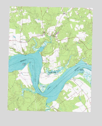
Charles City, VA USGS Topographic Map
Click on map above to begin viewing in our Map Viewer.

This topographic map contains these locations and features:
Feature Name Type Latitude Longitude GNIS ID View Map
Blanks TavernLocaleN37.3729°W77.0047°1478235View Map
Bowens StoreLocaleN37.3321°W77.1077°1478251View Map
Buckland CreekStreamN37.3176°W77.1094°1478285View Map
Cerneys DamDamN37.2635°W77.0147°1490708View Map
Cerneys PondReservoirN37.2661°W77.0162°1490709View Map
Charles CityPopulated PlaceN37.3435°W77.0730°1498561View Map
Charles City Census Designated PlaceCensusN37.3441°W77.0688°2628832View Map
Charles City CountyCivilN37.3544°W77.0591°1480109View Map
Charles City County Sheriff's OfficeBuildingN37.3416°W77.0721°2086328View Map
Charles City County Sheriff's OfficeBuildingN37.3413°W77.0719°2332053View Map
Charles City Elementary SchoolSchoolN37.3475°W77.0763°1739756View Map
Charles City High SchoolSchoolN37.3510°W77.0763°1739757View Map
Charles City Middle SchoolSchoolN37.3523°W77.0762°2465049View Map
Charles City Post OfficePost OfficeN37.3412°W77.0732°2519597View Map
Courthouse CreekStreamN37.3351°W77.0611°1478429View Map
DunnmorePopulated PlaceN37.2746°W77.0425°1478055View Map
Eiam CemeteryCemeteryN37.3640°W77.0177°1478546View Map
Elam ChurchChurchN37.3671°W77.0427°1478547View Map
Flowerdew HundredFlatN37.2940°W77.0983°1466738View Map
Flowerdew Hundred CreekStreamN37.2729°W77.0819°1466739View Map
Flowerdew Hundred PlantationLocaleN37.2960°W77.1041°1739885View Map
Fort PowhatanPopulated PlaceN37.2710°W77.0800°1492969View Map
Glebe CreekStreamN37.3440°W77.0700°1478663View Map
GreenwayPopulated PlaceN37.3410°W77.0816°1493037View Map
Gunns RunStreamN37.3249°W77.0780°1478711View Map
Kennon MarshSwampN37.2903°W77.0081°1468959View Map
Kittewan CreekStreamN37.3007°W77.0361°1478899View Map
Mapsico CemeteryCemeteryN37.3240°W77.0380°1479040View Map
Mapsico CreekStreamN37.3032°W77.0402°1479041View Map
Memorial United Methodist ChurchChurchN37.3408°W77.0755°2520417View Map
MiltonPopulated PlaceN37.3074°W77.0244°1493297View Map
Nelhassett CampLocaleN37.2960°W77.1186°1471375View Map
New HopePopulated PlaceN37.3413°W77.0614°1493342View Map
Olds PointCapeN37.3215°W77.0783°1479268View Map
Parrish Hill ChurchChurchN37.3393°W77.0544°1479294View Map
Parrish Hill CreekStreamN37.3351°W77.0611°1479295View Map
Queens CreekStreamN37.3199°W77.0814°1502805View Map
Ruffins WharfLocaleN37.2924°W77.0783°1478061View Map
RuthvillePopulated PlaceN37.3674°W77.0411°1493517View Map
Ruthville Post OfficePost OfficeN37.3672°W77.0414°2519649View Map
Sevenmile ReachChannelN37.2815°W77.0439°1478062View Map
Sherwood ForestPopulated PlaceN37.3340°W77.0200°1493579View Map
Sturgeon PointCapeN37.3074°W77.0072°1479689View Map
Threemile ReachChannelN37.2896°W77.0861°1477973View Map
Tyler CreekStreamN37.3124°W77.0155°1479773View Map
Tyler Magisterial DistrictCivilN37.3518°W77.0611°1927542View Map
Upper BrandonPopulated PlaceN37.2888°W77.0269°1477832View Map
Upper Brandon Farms WharfLocaleN37.2874°W77.0350°1478063View Map
Wards CreekStreamN37.2640°W77.0611°1476313View Map
WeyanokePopulated PlaceN37.2915°W77.0655°1496396View Map
Weyanoke PointCapeN37.2774°W77.0727°1479873View Map
Willcox WharfLocaleN37.3168°W77.0980°1479886View Map
Willow HillPopulated PlaceN37.2551°W77.0577°1493810View Map
Windmill PointCapeN37.3076°W77.0933°1476848View Map
Wyanoke NeckAreaN37.3001°W77.0608°1739782View Map
Wyanoke WharfLocaleN37.2924°W77.0783°1739783View Map

Note: Coordinates in the location and feature list above are referenced to NAD83 datum.


Copyright (C) 2008-2025 Ryan Niemi / Sunset Dynamics ... All Rights Reserved