TopoQuest Logo
Do you find TopoQuest useful?
Help keep TopoQuest running and adding new maps/features by donating!
Bitcoin:  19c7KJd3qBynnjoSw5npx9KScwjBe4ifkT
Litecoin:  LXs6TkuXGGXo1vDsWCkWVdjQX94eUKd6ui
Home View Maps Find Maps Find Places Resources & Links


Russellville, Ohio Topographic Map

USGS Map Title: Russellville, OH
USGS Map MRC: 38083G7
DRG (GeoTIFF) Download: o38083g7.tif


Neighboring USGS Topographic Map Quads:


  Hamersville, OH  
38083H8
 

  Ash Ridge, OH  
38083H7
 

  Winchester, OH  
38083H6
 

  Higginsport, OH  
38083G8
 

  Russellville, OH  
38083G7
 

  Decatur, OH  
38083G6
 

  Germantown, KY  
38083F8
 

  Maysville West, KY  
38083F7
 

  Maysville East, KY  
38083F6


Map MRC Location:

N39°
W84°
N39°
W83°
H8 H7 H6 H5 H4 H3 H2 H1
G8 G7 G6 G5 G4 G3 G2 G1
F8 F7 F6 F5 F4 F3 F2 F1
E8 E7 E6 E5 E4 E3 E2 E1
D8 D7 D6 D5 D4 D3 D2 D1
C8 C7 C6 C5 C4 C3 C2 C1
B8 B7 B6 B5 B4 B3 B2 B1
A8 A7 A6 A5 A4 A3 A2 A1
N38°
W84°
N38°
W83°

Russellville, OH USGS 1:24K Topographic Map Preview:
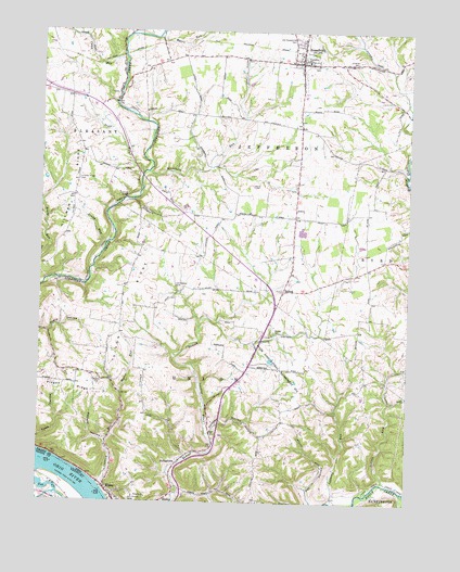
Russellville, OH USGS Topographic Map
Click on map above to begin viewing in our Map Viewer.

This topographic map contains these locations and features:
Feature Name Type Latitude Longitude GNIS ID View Map
Associated Reformed ChurchyardCemeteryN38.8659°W83.7821°1699117View Map
Beechwood School (historical)SchoolN38.8223°W83.7563°1053032View Map
Brady RunStreamN38.8181°W83.8524°1038257View Map
Bull RunStreamN38.8381°W83.8213°1053040View Map
Camp RunStreamN38.8662°W83.8469°1038746View Map
Chicken HollowValleyN38.7692°W83.8155°1039065View Map
Conn School (historical)SchoolN38.8506°W83.8252°1053048View Map
Cornick RunStreamN38.7551°W83.8535°1066662View Map
Devore Family CemeteryCemeteryN38.8053°W83.8199°1699123View Map
Dixon RidgeRidgeN38.8053°W83.8438°1063472View Map
Donaldson School (historical)SchoolN38.8206°W83.7894°1053054View Map
Dye CemeteryCemeteryN38.8587°W83.8516°1699124View Map
Faith in God FellowshipChurchN38.8608°W83.7869°2375049View Map
Flaugher School (historical)SchoolN38.7853°W83.8427°1053061View Map
Fox HollowValleyN38.7512°W83.7821°1040632View Map
Glaze CemeteryCemeteryN38.8337°W83.8027°1040892View Map
Hillman (historical)Populated PlaceN38.8306°W83.8741°1053075View Map
Hillman RidgeRidgeN38.8334°W83.8627°1048334View Map
Hillman Ridge CemeteryCemeteryN38.8353°W83.8621°1041592View Map
Indian LickStreamN38.7556°W83.7577°1041961View Map
Iron Bridge School (historical)SchoolN38.7504°W83.7730°1053079View Map
John Rankin HomeBuildingN38.7503°W83.8430°1042110View Map
Kinkead School (historical)SchoolN38.7623°W83.8008°1053087View Map
Lafferty RunStreamN38.7506°W83.7760°1063473View Map
Lee CreekStreamN38.7581°W83.8741°496166View Map
Linwood CemeteryCemeteryN38.8673°W83.7671°1042606View Map
Martin CemeteryCemeteryN38.7820°W83.8546°1043020View Map
Mefford HollowValleyN38.7659°W83.8527°1043208View Map
Mefford School (historical)SchoolN38.8478°W83.7780°1053095View Map
Mount Ayr School (historical)SchoolN38.7828°W83.7638°1053102View Map
Myers HollowValleyN38.7945°W83.8713°1043759View Map
Myers RunStreamN38.7790°W83.8469°1043762View Map
Myers RunStreamN38.8742°W83.8344°1043763View Map
Old Redoak CemeteryCemeteryN38.8073°W83.8288°1048354View Map
Old Russellville CemeteryCemeteryN38.8515°W83.7877°1699139View Map
Old Russellville CemeteryCemeteryN38.8737°W83.7896°1048355View Map
Pisgah RidgeRidgeN38.7817°W83.8688°1044509View Map
Port Chardon Mobile Home ParkPopulated PlaceN38.7517°W83.8506°2507833View Map
Presbyterian CemeteryCemeteryN38.7967°W83.7955°1699142View Map
Rankin House State MemorialParkN38.7506°W83.8435°1961127View Map
Red Oak Post Office (historical)Post OfficeN38.8070°W83.7916°1965848View Map
Red Oak Presbyterian ChurchChurchN38.7953°W83.7955°1071527View Map
RedoakPopulated PlaceN38.8065°W83.7921°1057947View Map
Rocky RunStreamN38.8742°W83.8344°1045130View Map
Rossman School (historical)SchoolN38.7640°W83.8510°1053117View Map
RussellvillePopulated PlaceN38.8665°W83.7869°1065263View Map
Russellville Elementary SchoolSchoolN38.8673°W83.7849°1055968View Map
Russellville Fire DepartmentBuildingN38.8659°W83.7898°2550265View Map
Russellville Police DepartmentBuildingN38.8670°W83.7852°2732826View Map
Russelville Post OfficePost OfficeN38.8667°W83.7874°1965580View Map
Salisbury School (historical)SchoolN38.8006°W83.8227°1053118View Map
School Number 4 (historical)SchoolN38.8265°W83.8227°1053122View Map
School Number 6 (historical)SchoolN38.8684°W83.8188°1053123View Map
Scott RunStreamN38.8373°W83.8405°1046065View Map
StringtownPopulated PlaceN38.7606°W83.8266°1049217View Map
Sutherland RunStreamN38.8003°W83.8083°1053133View Map
Township of JeffersonCivilN38.8485°W83.7934°1085799View Map
Township of UnionCivilN38.7699°W83.8232°1085806View Map
Village of RussellvilleCivilN38.8673°W83.7878°2399147View Map
Washburn RunStreamN38.8373°W83.8383°1047584View Map
WAXZ-FM (Georgetown)TowerN38.8676°W83.8121°1085363View Map
West Fork Redoak CreekStreamN38.7976°W83.8144°1053137View Map
Western Mills (historical)LocaleN38.7553°W83.8541°1067484View Map

Note: Coordinates in the location and feature list above are referenced to NAD83 datum.


Copyright (C) 2008-2025 Ryan Niemi / Sunset Dynamics ... All Rights Reserved