TopoQuest Logo
Do you find TopoQuest useful?
Help keep TopoQuest running and adding new maps/features by donating!
Bitcoin:  19c7KJd3qBynnjoSw5npx9KScwjBe4ifkT
Litecoin:  LXs6TkuXGGXo1vDsWCkWVdjQX94eUKd6ui
Home View Maps Find Maps Find Places Resources & Links


Decatur, Ohio Topographic Map

USGS Map Title: Decatur, OH
USGS Map MRC: 38083G6
DRG (GeoTIFF) Download: o38083g6.tif


Neighboring USGS Topographic Map Quads:


  Ash Ridge, OH  
38083H7
 

  Winchester, OH  
38083H6
 

  Seaman, OH  
38083H5
 

  Russellville, OH  
38083G7
 

  Decatur, OH  
38083G6
 

  West Union, OH  
38083G5
 

  Maysville West, KY  
38083F7
 

  Maysville East, KY  
38083F6
 

  Manchester Islands, KY  
38083F5


Map MRC Location:

N39°
W84°
N39°
W83°
H8 H7 H6 H5 H4 H3 H2 H1
G8 G7 G6 G5 G4 G3 G2 G1
F8 F7 F6 F5 F4 F3 F2 F1
E8 E7 E6 E5 E4 E3 E2 E1
D8 D7 D6 D5 D4 D3 D2 D1
C8 C7 C6 C5 C4 C3 C2 C1
B8 B7 B6 B5 B4 B3 B2 B1
A8 A7 A6 A5 A4 A3 A2 A1
N38°
W84°
N38°
W83°

Decatur, OH USGS 1:24K Topographic Map Preview:
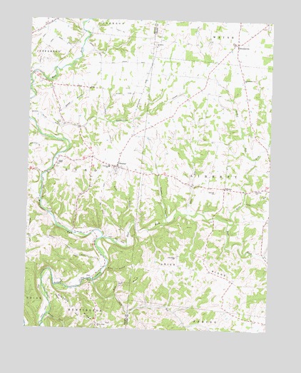
Decatur, OH USGS Topographic Map
Click on map above to begin viewing in our Map Viewer.

This topographic map contains these locations and features:
Feature Name Type Latitude Longitude GNIS ID View Map
Adas RunStreamN38.7973°W83.6674°1065892View Map
Baird School (historical)SchoolN38.8728°W83.7421°1053030View Map
Bethlehem ChurchChurchN38.8642°W83.6846°1037966View Map
Bissinger CemeteryCemeteryN38.8059°W83.6527°1038065View Map
Brier RidgeRidgeN38.7748°W83.6655°1038309View Map
Brier Ridge ChurchChurchN38.7790°W83.6730°1038310View Map
Brier Ridge School (historical)SchoolN38.7790°W83.6724°1055819View Map
Brushy ForkStreamN38.7556°W83.7385°1083187View Map
Brushy Fork Eagle CreekStreamN38.7556°W83.7385°1038435View Map
Bunker Hill School (historical)SchoolN38.8431°W83.6380°1055823View Map
Byrd Township Fire DepartmentBuildingN38.8149°W83.7023°2549459View Map
Campbell School (historical)SchoolN38.7948°W83.7483°1053043View Map
Decan HollowValleyN38.8378°W83.7341°1039633View Map
DecaturPopulated PlaceN38.8156°W83.7038°1064517View Map
Decatur CemeteryCemeteryN38.8181°W83.7010°1699122View Map
Decatur Elementary SchoolSchoolN38.8156°W83.7083°1055954View Map
Decatur Post OfficePost OfficeN38.8153°W83.7041°1965568View Map
Eagle Chapel School (historical)SchoolN38.7748°W83.7102°1053056View Map
Eagle Creek BridgeBridgeN38.7698°W83.7149°1053057View Map
East Fork Eagle CreekStreamN38.7870°W83.7108°1066700View Map
EckmansvillePopulated PlaceN38.8659°W83.6427°1048688View Map
Eckmansville ChurchChurchN38.8509°W83.6391°1040068View Map
Eckmansville Post Office (historical)Post OfficeN38.8651°W83.6430°1956165View Map
FairviewPopulated PlaceN38.8073°W83.6480°1064633View Map
Fountain School (historical)SchoolN38.8537°W83.7027°1053064View Map
George Miller Road BridgeBridgeN38.8128°W83.7405°1053068View Map
Gordon RunStreamN38.8195°W83.6330°1066020View Map
Hickory RidgeRidgeN38.7587°W83.7233°1041529View Map
Hickory Ridge CemeteryCemeteryN38.7512°W83.7127°1699131View Map
Hickory Ridge ChurchChurchN38.7517°W83.7127°1041530View Map
Hickory School (historical)SchoolN38.8740°W83.6763°1055854View Map
Hills ForkStreamN38.7934°W83.6458°1041596View Map
Hilltop School (historical)SchoolN38.8053°W83.7305°1053076View Map
Joint School Number 1 (historical)SchoolN38.8473°W83.7385°1053082View Map
Joint School Number 2 (historical)SchoolN38.7692°W83.7321°1053083View Map
Kirker HollowValleyN38.7942°W83.6774°1042301View Map
Liberty ChapelChurchN38.8170°W83.7352°1042506View Map
Liberty Chapel CemeteryCemeteryN38.8173°W83.7349°1699135View Map
Liberty Elementary SchoolSchoolN38.8065°W83.6321°1055870View Map
Lick RunStreamN38.8020°W83.6383°1042544View Map
McKahn HollowValleyN38.7920°W83.6794°1063838View Map
NeelPopulated PlaceN38.7706°W83.7152°1065097View Map
Neel Post Office (historical)Post OfficeN38.7709°W83.7152°1965842View Map
Northwest Fork Eagle CreekStreamN38.8490°W83.7483°1053099View Map
Oakland School (historical)SchoolN38.8159°W83.6294°1065542View Map
Pike School (historical)SchoolN38.8431°W83.6685°1055905View Map
Rattlesnake CreekStreamN38.8262°W83.7319°1066921View Map
Sodom School (historical)SchoolN38.8106°W83.6716°1055922View Map
Stony HollowValleyN38.7748°W83.7080°1046730View Map
Suck RunStreamN38.7695°W83.7152°1046789View Map
Suck Run School (historical)SchoolN38.7570°W83.6952°1055927View Map
Sunshine School (historical)SchoolN38.7726°W83.6333°1055930View Map
Town BranchStreamN38.7895°W83.6966°1047102View Map
Township of ByrdCivilN38.8168°W83.7271°1085792View Map
Township of LibertyCivilN38.8056°W83.6333°1085679View Map
Washburn RunStreamN38.7931°W83.6769°1065796View Map
West CemeteryCemeteryN38.8334°W83.7333°1047743View Map
West Fork Eagle CreekStreamN38.7870°W83.7108°1047720View Map
Wild Duck BranchStreamN38.7637°W83.7041°1047901View Map
Woods CemeteryCemeteryN38.7790°W83.7224°1048102View Map

Note: Coordinates in the location and feature list above are referenced to NAD83 datum.


Copyright (C) 2008-2024 Ryan Niemi / Sunset Dynamics ... All Rights Reserved