TopoQuest Logo
Do you find TopoQuest useful?
Help keep TopoQuest running and adding new maps/features by donating!
Bitcoin:  19c7KJd3qBynnjoSw5npx9KScwjBe4ifkT
Litecoin:  LXs6TkuXGGXo1vDsWCkWVdjQX94eUKd6ui
Home View Maps Find Maps Find Places Resources & Links


Cow Creek, Wyoming Topographic Map

USGS Map Title: Cow Creek, WY
USGS Map MRC: 41106C6
DRG (GeoTIFF) Download: o41106c6.tif


Neighboring USGS Topographic Map Quads:


  Saratoga, WY  
41106D7
 

  Finley Reservoir, WY  
41106D6
 

  Kennaday Peak, WY  
41106D5
 

  Cow Creek Ranch, WY  
41106C7
 

  Cow Creek, WY  
41106C6
 

  Ryan Park, WY  
41106C5
 

  Encampment, WY  
41106B7
 

  Gunst Reservoir, WY  
41106B6
 

  Barcus Peak, WY  
41106B5


Map MRC Location:

N42°
W107°
N42°
W106°
H8 H7 H6 H5 H4 H3 H2 H1
G8 G7 G6 G5 G4 G3 G2 G1
F8 F7 F6 F5 F4 F3 F2 F1
E8 E7 E6 E5 E4 E3 E2 E1
D8 D7 D6 D5 D4 D3 D2 D1
C8 C7 C6 C5 C4 C3 C2 C1
B8 B7 B6 B5 B4 B3 B2 B1
A8 A7 A6 A5 A4 A3 A2 A1
N41°
W107°
N41°
W106°

Cow Creek, WY USGS 1:24K Topographic Map Preview:
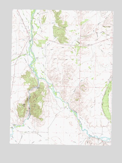
Cow Creek, WY USGS Topographic Map
Click on map above to begin viewing in our Map Viewer.

This topographic map contains these locations and features:
Feature Name Type Latitude Longitude GNIS ID View Map
Antelope DrawValleyN41.3466°W106.6714°1584865View Map
Baggot RocksSummitN41.2908°W106.7211°1585048View Map
Beaver CreekStreamN41.2580°W106.6503°1598055View Map
Big Springs DrawValleyN41.3558°W106.6481°1598174View Map
Brush Creek Supply DitchCanalN41.2936°W106.6289°1598426View Map
CanyonLocaleN41.2672°W106.7459°1586342View Map
Cherokee CreekStreamN41.2586°W106.7470°1598709View Map
Cornerstone DrawValleyN41.3539°W106.6453°1586985View Map
Cow CreekStreamN41.3366°W106.7284°1598965View Map
Cyclops DitchCanalN41.2552°W106.7364°1599100View Map
DaysLocaleN41.3591°W106.7339°1597280View Map
Donzelman and Tilton DitchCanalN41.2694°W106.6561°1587718View Map
Elk Hollow CreekStreamN41.3408°W106.7250°1599584View Map
Elk Hollow DitchCanalN41.3711°W106.6367°1599586View Map
Elk Hollow RanchLocaleN41.3300°W106.7200°1588226View Map
Encampment Platte Valley DitchCanalN41.3508°W106.7306°1599617View Map
Encampment RiverStreamN41.3114°W106.7164°1596818View Map
Flying Diamond RanchLocaleN41.2650°W106.7459°1588595View Map
Harrison CreekStreamN41.2891°W106.6798°1589340View Map
Hopkins Number 1 DitchCanalN41.2852°W106.6850°1605313View Map
Loski DitchCanalN41.3305°W106.7486°1591014View Map
McCold DrawValleyN41.3255°W106.7075°1591303View Map
Needle PeakSummitN41.2858°W106.7336°1591975View Map
North DrawValleyN41.3622°W106.6420°1601737View Map
Paine DepositMineN41.2661°W106.7308°1726281View Map
Pearce DrawValleyN41.3391°W106.7095°1592638View Map
Rainbow CanyonValleyN41.3111°W106.7164°1593128View Map
Rainbow RanchLocaleN41.3166°W106.7092°1593135View Map
Reynolds RunStreamN41.3080°W106.6273°1602514View Map
Ridding Number 1 DitchCanalN41.3219°W106.7086°1605449View Map
Ryan RanchLocaleN41.3711°W106.7175°1593723View Map
Shipper ClaimsMineN41.3547°W106.7500°1726280View Map
Sixteen GulchValleyN41.2708°W106.7306°1602941View Map
Windall DitchCanalN41.2883°W106.6453°1596518View Map
Wood DrawValleyN41.3602°W106.7161°1604275View Map
Wyco ClubLocaleN41.3033°W106.7173°1596643View Map

Note: Coordinates in the location and feature list above are referenced to NAD83 datum.


Copyright (C) 2008-2025 Ryan Niemi / Sunset Dynamics ... All Rights Reserved