TopoQuest Logo
Do you find TopoQuest useful?
Help keep TopoQuest running and adding new maps/features by donating!
Bitcoin:  19c7KJd3qBynnjoSw5npx9KScwjBe4ifkT
Litecoin:  LXs6TkuXGGXo1vDsWCkWVdjQX94eUKd6ui
Home View Maps Find Maps Find Places Resources & Links


Snell, Mississippi Topographic Map

USGS Map Title: Snell, MS
USGS Map MRC: 32088B5
DRG (GeoTIFF) Download: o32088b5.tif


Neighboring USGS Topographic Map Quads:


  Meridian South, MS  
32088C6
 

  Vimville, MS  
32088C5
 

  Whynot, MS  
32088C4
 

  Sable, MS  
32088B6
 

  Snell, MS  
32088B5
 

  Yantley, AL  
32088B4
 

  Quitman, MS  
32088A6
 

  Sykes, MS  
32088A5
 

  Hinton, AL  
32088A4


Map MRC Location:

N33°
W89°
N33°
W88°
H8 H7 H6 H5 H4 H3 H2 H1
G8 G7 G6 G5 G4 G3 G2 G1
F8 F7 F6 F5 F4 F3 F2 F1
E8 E7 E6 E5 E4 E3 E2 E1
D8 D7 D6 D5 D4 D3 D2 D1
C8 C7 C6 C5 C4 C3 C2 C1
B8 B7 B6 B5 B4 B3 B2 B1
A8 A7 A6 A5 A4 A3 A2 A1
N32°
W89°
N32°
W88°

Snell, MS USGS 1:24K Topographic Map Preview:
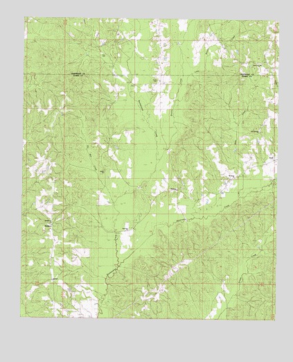
Snell, MS USGS Topographic Map
Click on map above to begin viewing in our Map Viewer.

This topographic map contains these locations and features:
Feature Name Type Latitude Longitude GNIS ID View Map
Bean CreekStreamN32.1799°W88.5170°666628View Map
Bethel ChurchChurchN32.1854°W88.5870°666916View Map
Browns CreekStreamN32.1826°W88.5667°667646View Map
Bucatunna ChurchChurchN32.1838°W88.5214°667715View Map
Carr School (historical)SchoolN32.1518°W88.5236°687498View Map
Center Grove ChurchChurchN32.2313°W88.5098°668233View Map
Elizabeth ChurchChurchN32.1407°W88.6117°669720View Map
EnergyPopulated PlaceN32.1796°W88.5498°669778View Map
Energy Lookout TowerTowerN32.1371°W88.5581°711230View Map
Haney School (historical)SchoolN32.2029°W88.5081°687520View Map
Harvard School (historical)SchoolN32.1257°W88.6084°687522View Map
Hays CemeteryCemeteryN32.2360°W88.5886°671030View Map
Hurricane CreekStreamN32.1454°W88.5798°671623View Map
Irby Mill CreekStreamN32.1732°W88.5803°671717View Map
Little Browns CreekStreamN32.2268°W88.5450°672560View Map
Martin CemeteryCemeteryN32.2243°W88.5595°690801View Map
McRae CemeteryCemeteryN32.1357°W88.6023°673434View Map
MiddletonPopulated PlaceN32.1638°W88.6123°692070View Map
Molpus School (historical)SchoolN32.2054°W88.5750°687539View Map
Open Door ChurchChurchN32.1621°W88.5742°675293View Map
Shady Grove ChurchChurchN32.1646°W88.6095°690809View Map
Shady Grove School (historical)SchoolN32.1813°W88.6031°687553View Map
SnellPopulated PlaceN32.1918°W88.5017°677961View Map
Snell Apostolic ChurchChurchN32.2035°W88.5086°666344View Map
Snell School (historical)SchoolN32.2032°W88.5089°709474View Map
Snell Volunteer Fire DepartmentBuildingN32.1919°W88.5020°2667904View Map
Supervisor District 4CivilN32.1457°W88.5589°711816View Map

Note: Coordinates in the location and feature list above are referenced to NAD83 datum.


Copyright (C) 2008-2025 Ryan Niemi / Sunset Dynamics ... All Rights Reserved