TopoQuest Logo
Do you find TopoQuest useful?
Help keep TopoQuest running and adding new maps/features by donating!
Bitcoin:  19c7KJd3qBynnjoSw5npx9KScwjBe4ifkT
Litecoin:  LXs6TkuXGGXo1vDsWCkWVdjQX94eUKd6ui
Home View Maps Find Maps Find Places Resources & Links


Saint Anne, Illinois Topographic Map

USGS Map Title: Saint Anne, IL
USGS Map MRC: 41087A6
DRG (GeoTIFF) Download: o41087a6.tif


Neighboring USGS Topographic Map Quads:


  Bradley, IL  
41087B7
 

  Momence, IL  
41087B6
 

  Illiana Heights, IL  
41087B5
 

  Kankakee, IL  
41087A7
 

  Saint Anne, IL  
41087A6
 

  Leesville, IL  
41087A5
 

  L'Erable, IL  
40087H7
 

  Beaverville, IL  
40087H6
 

  Donovan, IL  
40087H5


Map MRC Location:

N42°
W88°
N42°
W87°
H8 H7 H6 H5 H4 H3 H2 H1
G8 G7 G6 G5 G4 G3 G2 G1
F8 F7 F6 F5 F4 F3 F2 F1
E8 E7 E6 E5 E4 E3 E2 E1
D8 D7 D6 D5 D4 D3 D2 D1
C8 C7 C6 C5 C4 C3 C2 C1
B8 B7 B6 B5 B4 B3 B2 B1
A8 A7 A6 A5 A4 A3 A2 A1
N41°
W88°
N41°
W87°

Saint Anne, IL USGS 1:24K Topographic Map Preview:
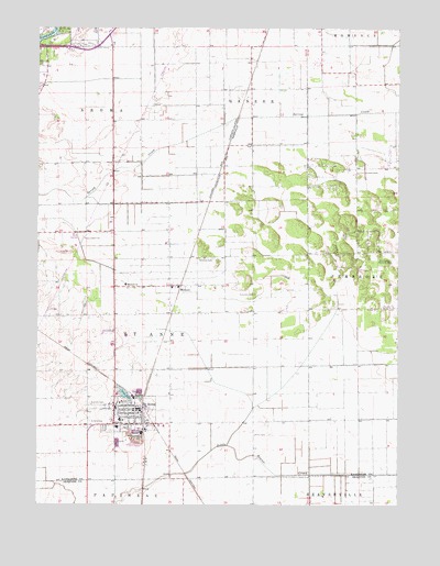
Saint Anne, IL USGS Topographic Map
Click on map above to begin viewing in our Map Viewer.

This topographic map contains these locations and features:
Feature Name Type Latitude Longitude GNIS ID View Map
Aroma Township Fire Protection District Station 2BuildingN41.1074°W87.7445°2682534View Map
Bible CampLocaleN41.0914°W87.6250°404367View Map
Collins (historical)Populated PlaceN41.0650°W87.6973°1810623View Map
Concordia CemeteryCemeteryN41.0553°W87.6753°406453View Map
Cote LakeLakeN41.0293°W87.7201°406611View Map
DoneyPopulated PlaceN41.0667°W87.6250°407303View Map
Frogtown School (historical)SchoolN41.0795°W87.7139°1720106View Map
Giasson School (historical)SchoolN41.0489°W87.7473°1720108View Map
Guiding Star ChurchChurchN41.0825°W87.6250°409553View Map
Guiding Star Memorial CemeteryCemeteryN41.0631°W87.6286°409554View Map
Hanen School (historical)SchoolN41.0145°W87.6745°1720115View Map
Hopkins ParkPopulated PlaceN41.0634°W87.6250°410532View Map
KosterPopulated PlaceN41.0917°W87.6850°1719162View Map
Koster School (historical)SchoolN41.0781°W87.6850°1719161View Map
LeesvillePopulated PlaceN41.0248°W87.6250°411920View Map
Little Tabernacle ChurchChurchN41.0831°W87.6250°412423View Map
Mathers School (historical)SchoolN41.1011°W87.6395°1720132View Map
Oak Springs Golf CourseLocaleN41.0695°W87.7373°1810668View Map
Oakwood CemeteryCemeteryN41.0648°W87.6898°414931View Map
Old Baptist CemeteryCemeteryN41.0428°W87.7064°1810669View Map
Pembroke ChurchChurchN41.0525°W87.6250°415519View Map
Pembroke SchoolSchoolN41.0656°W87.6250°415520View Map
Rehoboth ChurchChurchN41.0831°W87.6250°416510View Map
Saint AnnePopulated PlaceN41.0250°W87.7139°417153View Map
Saint Anne Catholic CemeteryCemeteryN41.0264°W87.7311°417162View Map
Saint Anne CemeteryCemeteryN41.0223°W87.7317°417155View Map
Saint Anne Community High SchoolSchoolN41.0203°W87.7223°1810678View Map
Saint Anne Elementary SchoolSchoolN41.0225°W87.7214°1810679View Map
Saint Anne Fire Protection DistrictBuildingN41.0258°W87.7156°2681858View Map
Saint Anne Police DepartmentBuildingN41.0244°W87.7138°2757084View Map
Saint Anne Post OfficePost OfficeN41.0238°W87.7142°2788887View Map
Saint Anne WoodsPopulated PlaceN41.0375°W87.6250°417160View Map
Smamrock Golf ClubLocaleN41.1223°W87.7431°1810697View Map
TallmadgePopulated PlaceN41.1114°W87.6250°423229View Map
Township of Saint AnneCivilN41.0430°W87.7141°429693View Map
Union ChurchChurchN41.0528°W87.6250°420060View Map
Village of Saint AnneCivilN41.0233°W87.7184°2399157View Map
WichertPopulated PlaceN41.0573°W87.7042°421125View Map
Wichert ChurchChurchN41.0578°W87.7195°421126View Map
Wiltse School (historical)SchoolN41.1086°W87.6809°1720158View Map
Wingerter School (historical)SchoolN41.0511°W87.6748°1720159View Map

Note: Coordinates in the location and feature list above are referenced to NAD83 datum.


Copyright (C) 2008-2025 Ryan Niemi / Sunset Dynamics ... All Rights Reserved