TopoQuest Logo
Do you find TopoQuest useful?
Help keep TopoQuest running and adding new maps/features by donating!
Bitcoin:  19c7KJd3qBynnjoSw5npx9KScwjBe4ifkT
Litecoin:  LXs6TkuXGGXo1vDsWCkWVdjQX94eUKd6ui
Home View Maps Find Maps Find Places Resources & Links


Donovan, Illinois Topographic Map

USGS Map Title: Donovan, IL
USGS Map MRC: 40087H5
DRG (GeoTIFF) Download: o40087h5.tif


Neighboring USGS Topographic Map Quads:


  Saint Anne, IL  
41087A6
 

  Leesville, IL  
41087A5
 

  Enos, IN  
41087A4
 

  Beaverville, IL  
40087H6
 

  Donovan, IL  
40087H5
 

  Morocco, IN  
40087H4
 

  Watseka, IL  
40087G6
 

  Sheldon, IL  
40087G5
 

  Kentland, IN  
40087G4


Map MRC Location:

N41°
W88°
N41°
W87°
H8 H7 H6 H5 H4 H3 H2 H1
G8 G7 G6 G5 G4 G3 G2 G1
F8 F7 F6 F5 F4 F3 F2 F1
E8 E7 E6 E5 E4 E3 E2 E1
D8 D7 D6 D5 D4 D3 D2 D1
C8 C7 C6 C5 C4 C3 C2 C1
B8 B7 B6 B5 B4 B3 B2 B1
A8 A7 A6 A5 A4 A3 A2 A1
N40°
W88°
N40°
W87°

Donovan, IL USGS 1:24K Topographic Map Preview:
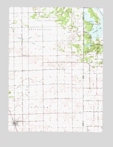
Donovan, IL USGS Topographic Map
Click on map above to begin viewing in our Map Viewer.

This topographic map contains these locations and features:
Feature Name Type Latitude Longitude GNIS ID View Map
Beaver CemeteryCemeteryN40.9225°W87.5403°404050View Map
Beaver ChurchChurchN40.9089°W87.5603°404051View Map
Beaver Ditch Number 1CanalN40.9175°W87.6164°424619View Map
Beaver Ditch Number 2CanalN40.9086°W87.6189°424620View Map
Beaver Fire Protection DistrictBuildingN40.8828°W87.6154°2682567View Map
College Corner School (historical)SchoolN40.9067°W87.5986°1719347View Map
DonovanPopulated PlaceN40.8834°W87.6161°407312View Map
Donovan Junior High SchoolSchoolN40.8853°W87.6128°1815557View Map
Donovan Post OfficePost OfficeN40.8829°W87.6168°2788222View Map
Donovan Senior High SchoolSchoolN40.8853°W87.6134°1815558View Map
Fairview School (historical)SchoolN40.9945°W87.6053°1719349View Map
Frigon School (historical)SchoolN40.9650°W87.6181°1719351View Map
HooperPopulated PlaceN40.9359°W87.6067°422820View Map
Hooper BranchStreamN40.9667°W87.6028°410492View Map
Independence School (historical)SchoolN40.9367°W87.5795°1719354View Map
Iroquois County State Conservation AreaParkN40.9881°W87.5695°410925View Map
J C Murphey LakeLakeN40.9795°W87.5030°436867View Map
J C Murphy Lake DamDamN40.9747°W87.5185°447429View Map
J H Grant Memorial CemeteryCemeteryN40.9164°W87.5417°1951728View Map
Loy Airport (historical)AirportN40.9331°W87.5959°427226View Map
Maple Grove School (historical)SchoolN40.9336°W87.5509°1719359View Map
North HooperPopulated PlaceN40.9506°W87.6070°423027View Map
Pleasant Valley School (historical)SchoolN40.8809°W87.5789°1719367View Map
Russell AirportAirportN40.9263°W87.6176°427227View Map
Salem School (historical)SchoolN40.9081°W87.5478°1719369View Map
Township of BeaverCivilN40.9002°W87.5900°428647View Map
Township of BeavervilleCivilN40.9734°W87.5986°428649View Map
Village of DonovanCivilN40.8851°W87.6140°2398739View Map
West Grove School (historical)SchoolN40.9661°W87.5684°1719374View Map

Note: Coordinates in the location and feature list above are referenced to NAD83 datum.


Copyright (C) 2008-2025 Ryan Niemi / Sunset Dynamics ... All Rights Reserved