TopoQuest Logo
Do you find TopoQuest useful?
Help keep TopoQuest running and adding new maps/features by donating!
Bitcoin:  19c7KJd3qBynnjoSw5npx9KScwjBe4ifkT
Litecoin:  LXs6TkuXGGXo1vDsWCkWVdjQX94eUKd6ui
Home View Maps Find Maps Find Places Resources & Links


Leesville, Illinois Topographic Map

USGS Map Title: Leesville, IL
USGS Map MRC: 41087A5
DRG (GeoTIFF) Download: o41087a5.tif


Neighboring USGS Topographic Map Quads:


  Momence, IL  
41087B6
 

  Illiana Heights, IL  
41087B5
 

  Schneider, IN  
41087B4
 

  Saint Anne, IL  
41087A6
 

  Leesville, IL  
41087A5
 

  Enos, IN  
41087A4
 

  Beaverville, IL  
40087H6
 

  Donovan, IL  
40087H5
 

  Morocco, IN  
40087H4


Map MRC Location:

N42°
W88°
N42°
W87°
H8 H7 H6 H5 H4 H3 H2 H1
G8 G7 G6 G5 G4 G3 G2 G1
F8 F7 F6 F5 F4 F3 F2 F1
E8 E7 E6 E5 E4 E3 E2 E1
D8 D7 D6 D5 D4 D3 D2 D1
C8 C7 C6 C5 C4 C3 C2 C1
B8 B7 B6 B5 B4 B3 B2 B1
A8 A7 A6 A5 A4 A3 A2 A1
N41°
W88°
N41°
W87°

Leesville, IL USGS 1:24K Topographic Map Preview:
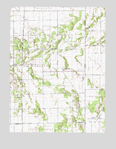
Leesville, IL USGS Topographic Map
Click on map above to begin viewing in our Map Viewer.

This topographic map contains these locations and features:
Feature Name Type Latitude Longitude GNIS ID View Map
Eyler School (historical)SchoolN41.0664°W87.6198°1719165View Map
Hooper Branch Savanna Nature PreserveParkN41.0017°W87.5534°1993297View Map
Hopkins Park Post OfficePost OfficeN41.0684°W87.5824°2788848View Map
Johnson DitchCanalN41.1061°W87.5123°437045View Map
Kankakee National Wildlife Refuge and Conservation AreaParkN41.0081°W87.5390°2781818View Map
Morgan CemeteryCemeteryN41.0252°W87.5077°439428View Map
North Hopkins School (historical)SchoolN41.0831°W87.5650°1719164View Map
Pembroke (historical)LocaleN41.0314°W87.6086°1719163View Map
Pembroke Township Fire Protection DistrictBuildingN41.0536°W87.6193°2682335View Map
Redden DitchCanalN41.0795°W87.5217°441827View Map
Riner Houseworth DitchCanalN41.0186°W87.5056°442047View Map
Township of PembrokeCivilN41.0650°W87.5916°429543View Map
Village of Hopkins ParkCivilN41.0689°W87.6064°2398544View Map
Whittemore School (historical)SchoolN41.0395°W87.6234°1719166View Map
Willow Slough State Game PreserveParkN41.0075°W87.5039°446111View Map

Note: Coordinates in the location and feature list above are referenced to NAD83 datum.


Copyright (C) 2008-2024 Ryan Niemi / Sunset Dynamics ... All Rights Reserved