TopoQuest Logo
Do you find TopoQuest useful?
Help keep TopoQuest running and adding new maps/features by donating!
Bitcoin:  19c7KJd3qBynnjoSw5npx9KScwjBe4ifkT
Litecoin:  LXs6TkuXGGXo1vDsWCkWVdjQX94eUKd6ui
Home View Maps Find Maps Find Places Resources & Links


Saint Johns South, Michigan Topographic Map

USGS Map Title: Saint Johns South, MI
USGS Map MRC: 42084H5
DRG (GeoTIFF) Download: o42084h5.tif


Neighboring USGS Topographic Map Quads:


  Maple Rapids, MI  
43084A6
 

  Saint Johns North, MI  
43084A5
 

  Ovid West, MI  
43084A4
 

  Riley, MI  
42084H6
 

  Saint Johns South, MI  
42084H5
 

  Price, MI  
42084H4
 

  Wacousta, MI  
42084G6
 

  Lansing North, MI  
42084G5
 

  Bath, MI  
42084G4


Map MRC Location:

N43°
W85°
N43°
W84°
H8 H7 H6 H5 H4 H3 H2 H1
G8 G7 G6 G5 G4 G3 G2 G1
F8 F7 F6 F5 F4 F3 F2 F1
E8 E7 E6 E5 E4 E3 E2 E1
D8 D7 D6 D5 D4 D3 D2 D1
C8 C7 C6 C5 C4 C3 C2 C1
B8 B7 B6 B5 B4 B3 B2 B1
A8 A7 A6 A5 A4 A3 A2 A1
N42°
W85°
N42°
W84°

Saint Johns South, MI USGS 1:24K Topographic Map Preview:
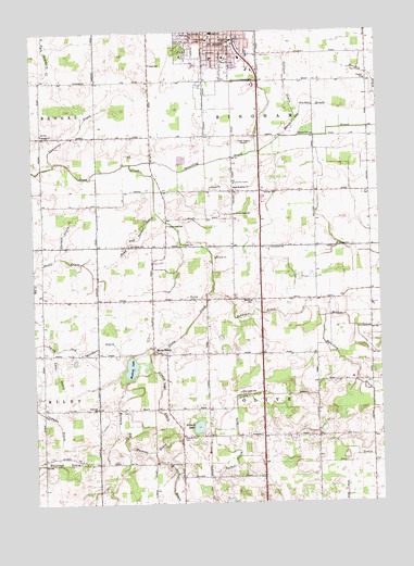
Saint Johns South, MI USGS Topographic Map
Click on map above to begin viewing in our Map Viewer.

This topographic map contains these locations and features:
Feature Name Type Latitude Longitude GNIS ID View Map
Alward LakeLakeN42.8953°W84.5664°620036View Map
Alward Lake CemeteryCemeteryN42.8926°W84.5716°620037View Map
Alward Lake DrainCanalN42.9031°W84.5805°620038View Map
Bailey FarmsLocaleN42.9444°W84.6047°2725134View Map
Baldwin and Muskrat DrainCanalN42.8975°W84.5953°620508View Map
Baugh Gachter DrainCanalN42.9778°W84.5275°620766View Map
Bengal ChurchChurchN42.9731°W84.6211°621093View Map
Blizzard DrainCanalN42.8809°W84.5755°621594View Map
Bond and Palmer DrainCanalN42.9464°W84.5855°621701View Map
Central School (historical)SchoolN42.9978°W84.5603°623017View Map
Church of Jesus Christ of Latter Day SaintsChurchN42.9869°W84.5556°2573705View Map
Clavey DrainCanalN42.9025°W84.5525°623387View Map
Clinton Area Ambulance Service AuthorityBuildingN42.9918°W84.5555°2662032View Map
Clinton Area Fire and Rescue Station 2BuildingN42.9720°W84.5697°2636124View Map
Clinton CountyCivilN42.9437°W84.6015°1622961View Map
Clinton County Greenhaven HomeBuildingN42.9925°W84.5531°2573734View Map
Clinton County Medical CenterHospitalN42.9911°W84.5444°2573735View Map
Clinton County Sheriff's OfficeBuildingN42.9889°W84.5345°2737513View Map
Clinton Memorial HospitalHospitalN42.9931°W84.5555°2573731View Map
Coffman DrainCanalN42.8989°W84.6214°623540View Map
Corkin Post Office (historical)Post OfficeN42.9044°W84.5425°2573859View Map
County Farm SchoolSchoolN42.9520°W84.5517°623882View Map
Cramer SchoolSchoolN42.9870°W84.5039°623956View Map
Crosby Mint FarmLocaleN42.9714°W84.5367°2725200View Map
DeWitt Rest AreaLocaleN42.8993°W84.5194°2569716View Map
East Olive Elementary SchoolSchoolN42.9078°W84.5103°2573650View Map
First Baptist ChurchChurchN42.9967°W84.5517°2573708View Map
First Baptist Church SweglesChurchN42.9978°W84.5522°2573710View Map
Free Methodist ChurchChurchN42.9978°W84.5508°2573709View Map
Geller Beef FarmsLocaleN42.9278°W84.5942°2725195View Map
Gillison DrainCanalN42.9836°W84.5325°626832View Map
Grange HallBuildingN42.9575°W84.5408°1625568View Map
Hamilton DrainStreamN42.9245°W84.5200°627677View Map
Harte FarmsLocaleN42.9300°W84.5694°2725124View Map
Highland Hills Golf ClubLocaleN42.8917°W84.5417°2573827View Map
Holden DrainStreamN42.9311°W84.5605°628414View Map
Krepps SchoolSchoolN42.9431°W84.5144°629875View Map
Lamb SchoolSchoolN42.9914°W84.5814°630088View Map
Lancaster DrainCanalN42.9731°W84.6092°630117View Map
Latchaw FarmsLocaleN42.9692°W84.5047°2725206View Map
Locher DrainCanalN42.8884°W84.5541°630850View Map
Meadows of Saint Johns Mobile Home ParkPopulated PlaceN42.9681°W84.5667°2573755View Map
Merihew CemeteryCemeteryN42.9295°W84.5665°632122View Map
Merihew SchoolSchoolN42.9286°W84.5461°632123View Map
Merle BeachLocaleN42.9161°W84.5817°632124View Map
Merlebeach Post Office (historical)Post OfficeN42.9161°W84.5817°1926611View Map
Muskrat LakeLakeN42.9111°W84.5902°633174View Map
Oakview South Elementary SchoolSchoolN42.9886°W84.5594°2573733View Map
Olive Center SchoolSchoolN42.9042°W84.5508°634030View Map
Olive Post Office (historical)Post OfficeN42.9217°W84.5825°2573858View Map
Pectil DrainCanalN42.9392°W84.6078°634555View Map
Pilgrim United Methodist ChurchChurchN42.9722°W84.5806°2573683View Map
Plowman SchoolSchoolN42.9003°W84.6025°635140View Map
Saint John's Onion FarmLocaleN42.9228°W84.5025°2725205View Map
Saint Johns Family Health CenterHospitalN42.9869°W84.5581°2573732View Map
Saint Johns High SchoolSchoolN42.9917°W84.5656°2573730View Map
Saint Johns Lutheran ChurchChurchN42.9944°W84.5508°2573707View Map
Saint Johns Middle SchoolSchoolN42.9867°W84.5642°2573729View Map
Seventh-Day Adventist ChurchChurchN42.9878°W84.5561°2573706View Map
Sheldon DrainCanalN42.9453°W84.6139°637718View Map
Smith and Merchant DrainCanalN42.9164°W84.6111°638128View Map
South Bingham CemeteryCemeteryN42.9580°W84.5513°2573878View Map
South Bingham ChurchChurchN42.9581°W84.5517°638266View Map
South Point MallLocaleN42.9925°W84.5444°2573728View Map
Spaulding DrainStreamN42.9650°W84.5892°638477View Map
Sperry FarmLocaleN42.9319°W84.6011°2725216View Map
Stony Creek SchoolSchoolN42.9486°W84.5761°638907View Map
Swanson FarmsLocaleN42.9422°W84.5928°2725217View Map
Swegles Saint SchoolSchoolN42.9978°W84.5517°1614498View Map
Township of BinghamCivilN42.9853°W84.5413°1625937View Map
Township of OliveCivilN42.8998°W84.5431°1626840View Map
WGOR-FM (Saint Johns)TowerN42.8914°W84.5742°1625506View Map
WWSJ-AM (Saint Johns)TowerN42.9706°W84.5497°1625306View Map
Yanz DrainCanalN42.9111°W84.6175°1616872View Map

Note: Coordinates in the location and feature list above are referenced to NAD83 datum.


Copyright (C) 2008-2024 Ryan Niemi / Sunset Dynamics ... All Rights Reserved