TopoQuest Logo
Do you find TopoQuest useful?
Help keep TopoQuest running and adding new maps/features by donating!
Bitcoin:  19c7KJd3qBynnjoSw5npx9KScwjBe4ifkT
Litecoin:  LXs6TkuXGGXo1vDsWCkWVdjQX94eUKd6ui
Home View Maps Find Maps Find Places Resources & Links


Price, Michigan Topographic Map

USGS Map Title: Price, MI
USGS Map MRC: 42084H4
DRG (GeoTIFF) Download: o42084h4.tif


Neighboring USGS Topographic Map Quads:


  Saint Johns North, MI  
43084A5
 

  Ovid West, MI  
43084A4
 

  Ovid East, MI  
43084A3
 

  Saint Johns South, MI  
42084H5
 

  Price, MI  
42084H4
 

  Laingsburg, MI  
42084H3
 

  Lansing North, MI  
42084G5
 

  Bath, MI  
42084G4
 

  Shaftsburg, MI  
42084G3


Map MRC Location:

N43°
W85°
N43°
W84°
H8 H7 H6 H5 H4 H3 H2 H1
G8 G7 G6 G5 G4 G3 G2 G1
F8 F7 F6 F5 F4 F3 F2 F1
E8 E7 E6 E5 E4 E3 E2 E1
D8 D7 D6 D5 D4 D3 D2 D1
C8 C7 C6 C5 C4 C3 C2 C1
B8 B7 B6 B5 B4 B3 B2 B1
A8 A7 A6 A5 A4 A3 A2 A1
N42°
W85°
N42°
W84°

Price, MI USGS 1:24K Topographic Map Preview:
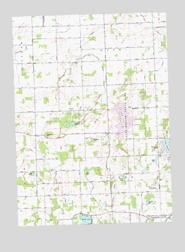
Price, MI USGS Topographic Map
Click on map above to begin viewing in our Map Viewer.

This topographic map contains these locations and features:
Feature Name Type Latitude Longitude GNIS ID View Map
Aldrich LakeLakeN42.8869°W84.3950°619928View Map
Archer Memorial FieldAirportN42.9062°W84.4724°1624141View Map
Blood CemeteryCemeteryN42.9145°W84.3814°621604View Map
Blood LakeLakeN42.9120°W84.3867°621607View Map
Cedar LakeLakeN42.9053°W84.4441°622924View Map
Clinton Area Fire and Rescue Station 3BuildingN42.8935°W84.4271°2636118View Map
Curtis LakeLakeN42.9350°W84.4537°624239View Map
Cutler and Walker DrainCanalN42.9434°W84.4525°624252View Map
Dennis Farms AirportAirportN42.8944°W84.3871°1623994View Map
Geary Post Office (historical)Post OfficeN42.9000°W84.4450°2573850View Map
Giffels LakeLakeN42.9010°W84.4136°626796View Map
Grove Bible ChurchChurchN42.9286°W84.4250°627472View Map
Hickok DrainCanalN42.9770°W84.3794°628187View Map
Holstein FarmLocaleN42.9817°W84.4236°2725322View Map
Jessie Post Office (historical)Post OfficeN42.9722°W84.4250°2573846View Map
Jury DrainCanalN42.9764°W84.4769°629426View Map
Kelley FarmsLocaleN42.9603°W84.3833°2725327View Map
Kniffin DrainStreamN42.9781°W84.4983°629816View Map
Lake OvidReservoirN42.9368°W84.4130°1617044View Map
Martin FarmsLocaleN42.9283°W84.4608°2725208View Map
Miller Brothers FarmLocaleN42.9992°W84.4244°2725324View Map
Montague LakeLakeN42.9249°W84.4375°632590View Map
Mud LakeLakeN42.9056°W84.4866°632951View Map
Pline FarmsLocaleN42.9586°W84.4900°2725212View Map
PricePopulated PlaceN42.9289°W84.4836°1617804View Map
Price Post Office (historical)Post OfficeN42.9289°W84.4836°2573842View Map
Price United Methodist ChurchChurchN42.9289°W84.4842°2573723View Map
Reed CemeteryCemeteryN42.8920°W84.4280°635753View Map
Richmond LakeLakeN42.9289°W84.4750°635887View Map
Round LakeLakeN42.8777°W84.4452°636323View Map
Shepard DrainCanalN42.9917°W84.4255°637737View Map
Sleepy Hollow State ParkParkN42.9386°W84.4128°638102View Map
South Ovid CemeteryCemeteryN42.9713°W84.4479°638397View Map
Stilson CemeteryCemeteryN42.9261°W84.4437°638849View Map
Township of OvidCivilN42.9868°W84.4252°1626874View Map
Township of VictorCivilN42.8998°W84.4243°1627199View Map
Victor Post Office (historical)Post OfficeN42.9292°W84.4247°2573849View Map
Walter FarmLocaleN42.9997°W84.4275°2725325View Map
Werner FarmLocaleN42.9664°W84.4267°2725323View Map
Westchester HeightsPopulated PlaceN42.9192°W84.3811°1617933View Map
Wyrick FarmLocaleN42.9644°W84.4461°2725130View Map

Note: Coordinates in the location and feature list above are referenced to NAD83 datum.


Copyright (C) 2008-2025 Ryan Niemi / Sunset Dynamics ... All Rights Reserved