TopoQuest Logo
Do you find TopoQuest useful?
Help keep TopoQuest running and adding new maps/features by donating!
Bitcoin:  19c7KJd3qBynnjoSw5npx9KScwjBe4ifkT
Litecoin:  LXs6TkuXGGXo1vDsWCkWVdjQX94eUKd6ui
Home View Maps Find Maps Find Places Resources & Links


Ovid West, Michigan Topographic Map

USGS Map Title: Ovid West, MI
USGS Map MRC: 43084A4
DRG (GeoTIFF) Download: o43084a4.tif


Neighboring USGS Topographic Map Quads:


  Pompeii, MI  
43084B5
 

  Ashley, MI  
43084B4
 

  Chapin, MI  
43084B3
 

  Saint Johns North, MI  
43084A5
 

  Ovid West, MI  
43084A4
 

  Ovid East, MI  
43084A3
 

  Saint Johns South, MI  
42084H5
 

  Price, MI  
42084H4
 

  Laingsburg, MI  
42084H3


Map MRC Location:

N44°
W85°
N44°
W84°
H8 H7 H6 H5 H4 H3 H2 H1
G8 G7 G6 G5 G4 G3 G2 G1
F8 F7 F6 F5 F4 F3 F2 F1
E8 E7 E6 E5 E4 E3 E2 E1
D8 D7 D6 D5 D4 D3 D2 D1
C8 C7 C6 C5 C4 C3 C2 C1
B8 B7 B6 B5 B4 B3 B2 B1
A8 A7 A6 A5 A4 A3 A2 A1
N43°
W85°
N43°
W84°

Ovid West, MI USGS 1:24K Topographic Map Preview:
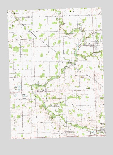
Ovid West, MI USGS Topographic Map
Click on map above to begin viewing in our Map Viewer.

This topographic map contains these locations and features:
Feature Name Type Latitude Longitude GNIS ID View Map
A and M FarmsLocaleN43.0431°W84.3856°2725329View Map
A and S FarmsLocaleN43.0239°W84.4575°2725131View Map
Al Jo FarmsLocaleN43.0797°W84.4156°2725253View Map
Alder Creek DrainStreamN43.0081°W84.3978°619924View Map
Baker CreekStreamN43.0792°W84.4105°620476View Map
Barrio DitchCanalN43.0839°W84.4839°620644View Map
Bear Foote FarmLocaleN43.0872°W84.4033°2725256View Map
Bernath FarmLocaleN43.0164°W84.4028°2725330View Map
Bradshaw HillSummitN43.0578°W84.4036°621857View Map
Calvary ChurchChurchN43.0020°W84.3878°622490View Map
DuplainPopulated PlaceN43.0467°W84.4525°625013View Map
Duplain and Ovid DrainCanalN43.0361°W84.4266°625014View Map
Duplain CemeteryCemeteryN43.0461°W84.4647°625015View Map
Duplain Church of ChristChurchN43.0458°W84.4547°2573665View Map
Duplain Post Office (historical)Post OfficeN43.0467°W84.4525°2573857View Map
Duplain Township Elsie Village CemeteryCemeteryN43.0893°W84.3923°2573877View Map
E B Ridge DairyLocaleN43.0936°W84.4819°2725260View Map
EE Knight Elementary SchoolSchoolN43.0906°W84.3928°2573793View Map
ElsiePopulated PlaceN43.0886°W84.3869°625542View Map
Elsie Area Ambulance ServiceBuildingN43.0878°W84.3884°2662030View Map
Elsie Area Fire DepartmentBuildingN43.0878°W84.3884°2636121View Map
Elsie Family Health Care CenterHospitalN43.0864°W84.3875°2573792View Map
Elsie Post OfficePost OfficeN43.0889°W84.3861°2573790View Map
Elsie Public LibraryBuildingN43.0883°W84.3881°2573789View Map
Elsie StationLocaleN43.0967°W84.3867°2573786View Map
Elsie Village HallBuildingN43.0889°W84.3864°2573791View Map
Fabus FarmsLocaleN43.0558°W84.4247°2725262View Map
Fenmore Baptist ChurchChurchN43.1028°W84.3875°2573787View Map
Ford CemeteryCemeteryN43.1180°W84.3847°2562150View Map
Kiesling FarmsLocaleN43.0325°W84.3850°2725326View Map
Kurncz FarmsLocaleN43.0464°W84.4956°2725125View Map
Lakeside Golf CourseLocaleN43.1131°W84.4300°2515885View Map
Little Maple RiverStreamN43.0178°W84.4289°630689View Map
Mae Shady NurseryBuildingN43.0928°W84.4058°2725264View Map
Maple Valley FarmsLocaleN43.1069°W84.4278°2725266View Map
Nash FarmsLocaleN43.0544°W84.4281°2725258View Map
Ovid-Elsie High SchoolSchoolN43.0459°W84.3883°634236View Map
Peck FarmsLocaleN43.1086°W84.4653°2725268View Map
Reha FarmsLocaleN43.0244°W84.3847°2725328View Map
Riverside CemeteryCemeteryN43.0906°W84.4091°635987View Map
Rochester Colony Historical MarkerParkN43.0468°W84.4557°2568557View Map
Schiffer Acres AirportAirportN43.0370°W84.4316°1624140View Map
ShepardsvillePopulated PlaceN43.0045°W84.4258°637739View Map
Shepardsville Post Office (historical)Post OfficeN43.0044°W84.4258°2573835View Map
Shepardsville United Methodist ChurchChurchN43.0042°W84.4256°2573828View Map
Shephardsville Station (historical)LocaleN43.0053°W84.4256°2573829View Map
Stevens DrainCanalN43.0545°W84.4928°638810View Map
Sturgis DrainCanalN43.0159°W84.4744°638994View Map
Taylor FarmLocaleN43.0797°W84.4653°2725270View Map
Township of DuplainCivilN43.0742°W84.4257°1626197View Map
Tripp Creek AirportAirportN43.0645°W84.4891°1624144View Map
United Methodist ChurchChurchN43.0889°W84.3894°2573788View Map
Village of ElsieCivilN43.0895°W84.3892°2398819View Map
Village of Elsie Police DepartmentBuildingN43.0885°W84.3880°2737534View Map
Wadell FarmsLocaleN43.1019°W84.4647°2725271View Map
Wise CreekStreamN43.0773°W84.3986°1616657View Map
WOES-FM (Ovid-Elsie)TowerN43.0456°W84.3872°1625465View Map

Note: Coordinates in the location and feature list above are referenced to NAD83 datum.


Copyright (C) 2008-2025 Ryan Niemi / Sunset Dynamics ... All Rights Reserved