TopoQuest Logo
Do you find TopoQuest useful?
Help keep TopoQuest running and adding new maps/features by donating!
Bitcoin:  19c7KJd3qBynnjoSw5npx9KScwjBe4ifkT
Litecoin:  LXs6TkuXGGXo1vDsWCkWVdjQX94eUKd6ui
Home View Maps Find Maps Find Places Resources & Links


Saint Paul, Arkansas Topographic Map

USGS Map Title: Saint Paul, AR
USGS Map MRC: 35093G7
DRG (GeoTIFF) Download: o35093g7.tif


Neighboring USGS Topographic Map Quads:


  Durham, AR  
35093H8
 

  Japton, AR  
35093H7
 

  Witter, AR  
35093H6
 

  Delaney, AR  
35093G8
 

  Saint Paul, AR  
35093G7
 

  Pettigrew, AR  
35093G6
 

  Bidville, AR  
35093F8
 

  Cass, AR  
35093F7
 

  Yale, AR  
35093F6


Map MRC Location:

N36°
W94°
N36°
W93°
H8 H7 H6 H5 H4 H3 H2 H1
G8 G7 G6 G5 G4 G3 G2 G1
F8 F7 F6 F5 F4 F3 F2 F1
E8 E7 E6 E5 E4 E3 E2 E1
D8 D7 D6 D5 D4 D3 D2 D1
C8 C7 C6 C5 C4 C3 C2 C1
B8 B7 B6 B5 B4 B3 B2 B1
A8 A7 A6 A5 A4 A3 A2 A1
N35°
W94°
N35°
W93°

Saint Paul, AR USGS 1:24K Topographic Map Preview:
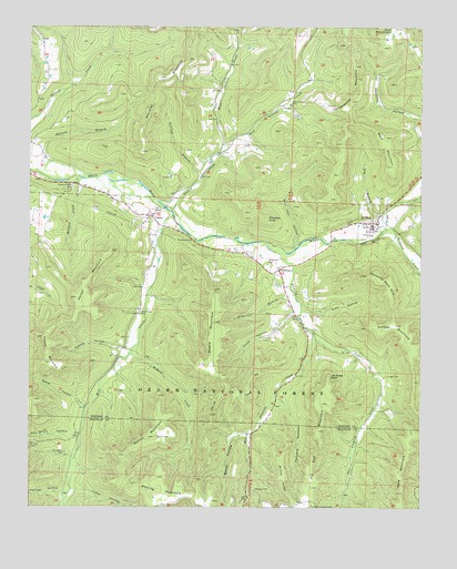
Saint Paul, AR USGS Topographic Map
Click on map above to begin viewing in our Map Viewer.

This topographic map contains these locations and features:
Feature Name Type Latitude Longitude GNIS ID View Map
Allard MountainSummitN35.7981°W93.8160°70427View Map
Anderson BranchStreamN35.8056°W93.7905°70443View Map
Baldwin CreekStreamN35.8215°W93.7632°70498View Map
Black HollowValleyN35.7762°W93.8585°70696View Map
Bonds HollowValleyN35.7692°W93.8055°70761View Map
BrashearsPopulated PlaceN35.8117°W93.7957°66390View Map
Brashears CemeteryCemeteryN35.8134°W93.7985°66391View Map
Burrell CemeteryCemeteryN35.7681°W93.8344°70934View Map
Burrell MountainSummitN35.7681°W93.8352°70935View Map
Chimney Rock MountainSummitN35.8084°W93.7613°71139View Map
CombsPopulated PlaceN35.8256°W93.8366°71205View Map
Combs CemeteryCemeteryN35.8365°W93.8307°81346View Map
Combs ChurchChurchN35.8362°W93.8305°71206View Map
Combs Post OfficePost OfficeN35.8263°W93.8389°84382View Map
Cooper MountainSummitN35.7976°W93.7544°71225View Map
Cragar CemeteryCemeteryN35.7845°W93.7610°71274View Map
Davis HollowValleyN35.8045°W93.7899°71344View Map
Dog BranchStreamN35.8254°W93.7630°71397View Map
East Fleming CreekStreamN35.7959°W93.7849°71499View Map
East Greasy CreekStreamN35.8423°W93.8157°71514View Map
Elam HollowValleyN35.8006°W93.7849°71546View Map
Fairview School (historical)SchoolN35.7959°W93.7844°81351View Map
Fisher HollowValleyN35.7545°W93.8596°71615View Map
Fleming CreekStreamN35.8184°W93.7991°71635View Map
Fly Gap (historical)Populated PlaceN35.7523°W93.8052°74622View Map
Fly Gap Lookout TowerTowerN35.7501°W93.7849°82430View Map
Fly Gap MountainSummitN35.7554°W93.7846°71647View Map
Fortner HollowValleyN35.7534°W93.8649°71664View Map
Gap School (historical)SchoolN35.7529°W93.8046°81333View Map
Greasy CreekStreamN35.8270°W93.8299°71826View Map
Greasy Creek CemeteryCemeteryN35.8551°W93.7924°71830View Map
Greenwood School (historical)SchoolN35.8451°W93.8107°81355View Map
Hall MountainSummitN35.8745°W93.7588°71881View Map
Hare MountainSummitN35.7592°W93.7571°71904View Map
Hickory CreekStreamN35.8356°W93.8588°71984View Map
Hickory Creek CemeteryCemeteryN35.8331°W93.8613°71986View Map
Joe Salee BluffCliffN35.7842°W93.7794°72194View Map
Mack MountainSummitN35.8459°W93.7613°72531View Map
Mahaffey KnobSummitN35.8254°W93.7996°72541View Map
McHone CreekStreamN35.7898°W93.8433°72598View Map
McKay RidgeRidgeN35.7576°W93.7938°72601View Map
Mill CreekStreamN35.8270°W93.8307°72667View Map
Mill Creek CemeteryCemeteryN35.8006°W93.8396°77660View Map
Morgan CemeteryCemeteryN35.7548°W93.8024°72728View Map
Parker MountainSummitN35.8042°W93.8602°73003View Map
Parsley HollowValleyN35.7912°W93.8466°73009View Map
Patrick BranchStreamN35.8359°W93.8541°73014View Map
Phelps MountainSummitN35.7940°W93.8710°73060View Map
Prater CemeteryCemeteryN35.8237°W93.7735°73197View Map
Ritchey BranchStreamN35.8362°W93.8205°73304View Map
Riverside CemeteryCemeteryN35.8298°W93.7524°73310View Map
Saint PaulPopulated PlaceN35.8242°W93.7641°73457View Map
Saint Paul Elementary SchoolSchoolN35.8229°W93.7649°66411View Map
Saint Paul Fire DepartmentBuildingN35.8227°W93.7673°2117083View Map
Saint Paul High SchoolSchoolN35.8234°W93.7659°66412View Map
Saint Paul Post OfficePost OfficeN35.8243°W93.7649°2781883View Map
Soda Cave CreekStreamN35.8012°W93.7882°81360View Map
Standley MountainSummitN35.8665°W93.8252°73689View Map
Tanyard HollowValleyN35.7770°W93.7935°73821View Map
Town of Saint PaulCivilN35.8251°W93.7652°2407273View Map
Township of Mill CreekCivilN35.8450°W93.8292°68851View Map
Van Brunt CemeteryCemeteryN35.7640°W93.8635°73957View Map
Van Brunt HollowValleyN35.7687°W93.8621°73958View Map
Vandeventer MountainSummitN35.8651°W93.7716°73959View Map
West Fleming CreekStreamN35.7959°W93.7849°74060View Map
West Greasy CreekStreamN35.8423°W93.8157°74071View Map
Whiting MountainSummitN35.7540°W93.8335°74137View Map
Wolf Pen HollowValleyN35.8176°W93.7899°74194View Map

Note: Coordinates in the location and feature list above are referenced to NAD83 datum.


Copyright (C) 2008-2024 Ryan Niemi / Sunset Dynamics ... All Rights Reserved