TopoQuest Logo
Do you find TopoQuest useful?
Help keep TopoQuest running and adding new maps/features by donating!
Bitcoin:  19c7KJd3qBynnjoSw5npx9KScwjBe4ifkT
Litecoin:  LXs6TkuXGGXo1vDsWCkWVdjQX94eUKd6ui
Home View Maps Find Maps Find Places Resources & Links


Salt Canyon, California Topographic Map

USGS Map Title: Salt Canyon, CA
USGS Map MRC: 39122A3
DRG (GeoTIFF) Download: o39122a3.tif


Neighboring USGS Topographic Map Quads:


  Leesville, CA  
39122B4
 

  Manor Slough, CA  
39122B3
 

  Williams, CA  
39122B2
 

  Wilbur Springs, CA  
39122A4
 

  Salt Canyon, CA  
39122A3
 

  Cortina Creek, CA  
39122A2
 

  Wilson Valley, CA  
38122H4
 

  Glascock Mountain, CA  
38122H3
 

  Rumsey, CA  
38122H2


Map MRC Location:

N40°
W123°
N40°
W122°
H8 H7 H6 H5 H4 H3 H2 H1
G8 G7 G6 G5 G4 G3 G2 G1
F8 F7 F6 F5 F4 F3 F2 F1
E8 E7 E6 E5 E4 E3 E2 E1
D8 D7 D6 D5 D4 D3 D2 D1
C8 C7 C6 C5 C4 C3 C2 C1
B8 B7 B6 B5 B4 B3 B2 B1
A8 A7 A6 A5 A4 A3 A2 A1
N39°
W123°
N39°
W122°

Salt Canyon, CA USGS 1:24K Topographic Map Preview:
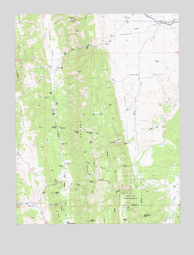
Salt Canyon, CA USGS Topographic Map
Click on map above to begin viewing in our Map Viewer.

This topographic map contains these locations and features:
Feature Name Type Latitude Longitude GNIS ID View Map
Becker FlatFlatN39.0285°W122.3364°218952View Map
Boulder CanyonValleyN39.0199°W122.2997°219679View Map
Britton SpringSpringN39.0252°W122.3167°219857View Map
Bunker HillSummitN39.0957°W122.2658°220160View Map
California Department of Forestry and Fire Protection Colusa CountyBuildingN39.0119°W122.3574°2622108View Map
Cortina Indian RancheriaCivilN39.0183°W122.2904°221603View Map
Cortina RidgeRidgeN39.0435°W122.3244°221604View Map
Cottonwood SpringSpringN39.0538°W122.3164°221659View Map
Doe FlatFlatN39.0504°W122.3522°222457View Map
Fox CanyonValleyN39.0766°W122.3475°223777View Map
Helmer HillSummitN39.0182°W122.3461°225150View Map
Jackson CanyonValleyN39.0102°W122.3511°226077View Map
Jackson MountainSummitN39.0016°W122.3197°226086View Map
La Coma TallacSummitN39.0546°W122.3269°226700View Map
Manzanita CreekStreamN39.0035°W122.2580°228035View Map
Parry SpringSpringN39.0490°W122.3200°230379View Map
Plum OrchardAreaN39.0024°W122.2953°1666640View Map
Salt CanyonValleyN39.1077°W122.3055°232291View Map
Schoolhouse DivideRidgeN39.0043°W122.2791°232678View Map
Strode CanyonValleyN39.0199°W122.2833°235603View Map
Telegraph RidgeRidgeN39.0074°W122.3447°236084View Map
Three SistersSummitN39.1216°W122.3325°236318View Map
Whiskey HillSummitN39.0577°W122.3444°237615View Map
Wilbur Springs Station California Division (historical)LocaleN39.0121°W122.3575°237735View Map
Wilson CanyonValleyN39.0482°W122.2916°237959View Map

Note: Coordinates in the location and feature list above are referenced to NAD83 datum.


Copyright (C) 2008-2024 Ryan Niemi / Sunset Dynamics ... All Rights Reserved