TopoQuest Logo
Do you find TopoQuest useful?
Help keep TopoQuest running and adding new maps/features by donating!
Bitcoin:  19c7KJd3qBynnjoSw5npx9KScwjBe4ifkT
Litecoin:  LXs6TkuXGGXo1vDsWCkWVdjQX94eUKd6ui
Home View Maps Find Maps Find Places Resources & Links


Leesville, California Topographic Map

USGS Map Title: Leesville, CA
USGS Map MRC: 39122B4
DRG (GeoTIFF) Download: o39122b4.tif


Neighboring USGS Topographic Map Quads:


  Gilmore Peak, CA  
39122C5
 

  Lodoga, CA  
39122C4
 

  Sites, CA  
39122C3
 

  Hough Springs, CA  
39122B5
 

  Leesville, CA  
39122B4
 

  Manor Slough, CA  
39122B3
 

  Benmore Canyon, CA  
39122A5
 

  Wilbur Springs, CA  
39122A4
 

  Salt Canyon, CA  
39122A3


Map MRC Location:

N40°
W123°
N40°
W122°
H8 H7 H6 H5 H4 H3 H2 H1
G8 G7 G6 G5 G4 G3 G2 G1
F8 F7 F6 F5 F4 F3 F2 F1
E8 E7 E6 E5 E4 E3 E2 E1
D8 D7 D6 D5 D4 D3 D2 D1
C8 C7 C6 C5 C4 C3 C2 C1
B8 B7 B6 B5 B4 B3 B2 B1
A8 A7 A6 A5 A4 A3 A2 A1
N39°
W123°
N39°
W122°

Leesville, CA USGS 1:24K Topographic Map Preview:
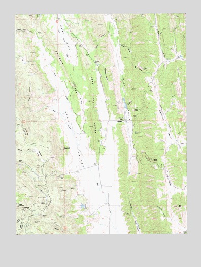
Leesville, CA USGS Topographic Map
Click on map above to begin viewing in our Map Viewer.

This topographic map contains these locations and features:
Feature Name Type Latitude Longitude GNIS ID View Map
Adobe SpringSpringN39.1952°W122.4111°217999View Map
Bald HillSummitN39.1404°W122.3825°218571View Map
Baldy MountainSummitN39.1421°W122.4991°218620View Map
Barrel SpringSpringN39.1428°W122.4800°218694View Map
Batiste CanyonValleyN39.2279°W122.4439°218732View Map
Bear Valley ButtesSummitN39.1860°W122.4441°218893View Map
Big CanyonValleyN39.2157°W122.3997°219146View Map
Buck FlatFlatN39.1307°W122.4903°219985View Map
California Department of Forestry and Fire Protection LeesvilleBuildingN39.1849°W122.4353°2622109View Map
California Division of Forestry StationLocaleN39.1846°W122.4350°220399View Map
Cooks MountainSummitN39.2404°W122.4967°221491View Map
Cultivator CanyonValleyN39.2329°W122.4233°233748View Map
Davis CanyonValleyN39.2157°W122.4994°259079View Map
Doyle CanyonValleyN39.1368°W122.4536°222578View Map
Grapevine FlatFlatN39.1393°W122.4903°224451View Map
Grassey CanyonValleyN39.1977°W122.4908°224469View Map
Gravelly ButtesSummitN39.2224°W122.4678°224488View Map
Gravelly FlatFlatN39.1968°W122.4519°224489View Map
High ValleyValleyN39.1918°W122.4203°234011View Map
Huffmaster Ranch (historical)LocaleN39.2104°W122.4011°1666639View Map
John Cooper CanyonValleyN39.1979°W122.4197°226262View Map
Lambert HillSummitN39.2257°W122.4391°226835View Map
LeesvillePopulated PlaceN39.1893°W122.4236°252723View Map
Leesville GapGapN39.1902°W122.4228°227002View Map
Mill CreekStreamN39.1563°W122.4430°263602View Map
Oat ValleyBasinN39.1507°W122.3866°229913View Map
Rees Jones 361 DamDamN39.1966°W122.4194°1663842View Map
Robbers FlatFlatN39.1574°W122.4655°231667View Map
Rocky PointLocaleN39.1674°W122.4989°231785View Map
Sawtelle ValleyBasinN39.1696°W122.4836°232626View Map
Shoemaker ValleyValleyN39.2207°W122.4411°234696View Map
Shuckman CanyonValleyN39.1338°W122.3894°233071View Map
Skinnerville SpringSpringN39.1826°W122.4140°233198View Map
Stinchfield CanyonValleyN39.1507°W122.4566°235487View Map
SugarloafSummitN39.1732°W122.4653°235652View Map
Sulphur SpringSpringN39.2063°W122.4128°1666641View Map
West Colusa DivisionCivilN39.2025°W122.4235°1935367View Map
Windy PointCliffN39.1671°W122.4000°238029View Map
York Hill 360 DamDamN39.1399°W122.4511°1663841View Map

Note: Coordinates in the location and feature list above are referenced to NAD83 datum.


Copyright (C) 2008-2024 Ryan Niemi / Sunset Dynamics ... All Rights Reserved