TopoQuest Logo
Do you find TopoQuest useful?
Help keep TopoQuest running and adding new maps/features by donating!
Bitcoin:  19c7KJd3qBynnjoSw5npx9KScwjBe4ifkT
Litecoin:  LXs6TkuXGGXo1vDsWCkWVdjQX94eUKd6ui
Home View Maps Find Maps Find Places Resources & Links


Wilbur Springs, California Topographic Map

USGS Map Title: Wilbur Springs, CA
USGS Map MRC: 39122A4
DRG (GeoTIFF) Download: o39122a4.tif


Neighboring USGS Topographic Map Quads:


  Hough Springs, CA  
39122B5
 

  Leesville, CA  
39122B4
 

  Manor Slough, CA  
39122B3
 

  Benmore Canyon, CA  
39122A5
 

  Wilbur Springs, CA  
39122A4
 

  Salt Canyon, CA  
39122A3
 

  Lower Lake, CA  
38122H5
 

  Wilson Valley, CA  
38122H4
 

  Glascock Mountain, CA  
38122H3


Map MRC Location:

N40°
W123°
N40°
W122°
H8 H7 H6 H5 H4 H3 H2 H1
G8 G7 G6 G5 G4 G3 G2 G1
F8 F7 F6 F5 F4 F3 F2 F1
E8 E7 E6 E5 E4 E3 E2 E1
D8 D7 D6 D5 D4 D3 D2 D1
C8 C7 C6 C5 C4 C3 C2 C1
B8 B7 B6 B5 B4 B3 B2 B1
A8 A7 A6 A5 A4 A3 A2 A1
N39°
W123°
N39°
W122°

Wilbur Springs, CA USGS 1:24K Topographic Map Preview:
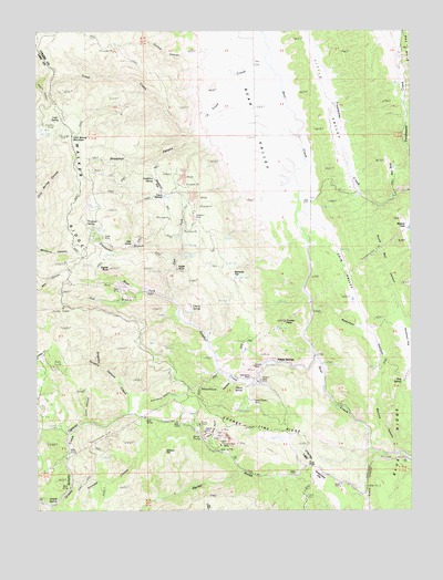
Wilbur Springs, CA USGS Topographic Map
Click on map above to begin viewing in our Map Viewer.

This topographic map contains these locations and features:
Feature Name Type Latitude Longitude GNIS ID View Map
Abbott MineMineN39.0224°W122.4453°217938View Map
Bear ValleyValleyN39.0763°W122.4164°233471View Map
Blank SpringSpringN39.0315°W122.4323°219442View Map
Blue RidgeRidgeN39.0271°W122.3794°1662340View Map
Cain ValleyValleyN39.0757°W122.4072°220371View Map
Central MineMineN39.0379°W122.4289°253010View Map
Cherry SpringSpringN39.0532°W122.4494°274687View Map
Clyde MineMineN39.0716°W122.4805°221268View Map
Cold SpringSpringN39.1015°W122.4946°221328View Map
Cold Spring MountainSummitN39.0979°W122.4886°221339View Map
County Line RidgeRidgeN39.0205°W122.4211°221681View Map
Coyote PeakSummitN39.0491°W122.4169°221760View Map
Deadshot CanyonValleyN39.0954°W122.4444°222135View Map
Deadshot FlatFlatN39.0841°W122.4597°222136View Map
Deadshot SpringSpringN39.0863°W122.4618°222137View Map
Destanella FlatFlatN39.0052°W122.4055°222274View Map
Eagle RockPillarN39.0624°W122.4533°222829View Map
East Fork Sulphur CreekStreamN39.0549°W122.4578°222900View Map
Eaton SpringsSpringN39.0821°W122.4569°222955View Map
Elgin MineMineN39.0557°W122.4725°222815View Map
Empire MineMineN39.0341°W122.4261°223200View Map
Freshwater BranchStreamN39.0660°W122.4539°223925View Map
Gaither CanyonValleyN39.1193°W122.4503°224007View Map
Gibson HillSummitN39.0155°W122.4580°224155View Map
Glory Hole GulchValleyN39.0182°W122.4450°224238View Map
Grigsby CanyonValleyN39.0393°W122.4816°224617View Map
Grizzly SpringSpringN39.0018°W122.4983°224647View Map
Hamilton CanyonValleyN39.0516°W122.4080°224834View Map
Hamilton FlatFlatN39.0435°W122.3775°233977View Map
Hog SpringSpringN39.0335°W122.3791°225415View Map
Little ValleyValleyN39.0824°W122.3930°227400View Map
Lucky CanyonValleyN39.0230°W122.4844°227819View Map
Lynch CanyonValleyN39.0143°W122.3889°227858View Map
Malaney FlatFlatN39.0624°W122.4364°227979View Map
Manzanita MineMineN39.0379°W122.4322°228041View Map
Oak CoveValleyN39.0702°W122.4691°229840View Map
Oat HillsRangeN39.1207°W122.3772°229910View Map
Rathburn MineMineN39.0768°W122.4489°231247View Map
Remington CanyonValleyN39.0282°W122.4650°231492View Map
Salt BranchStreamN39.0563°W122.4666°232290View Map
Schoolhouse CanyonValleyN39.0332°W122.4369°265919View Map
Signal RockPillarN39.0629°W122.4772°233115View Map
South Rail CanyonValleyN39.0788°W122.3855°235102View Map
Stag FlatFlatN39.0874°W122.3814°235345View Map
Sulphur CreekStreamN39.0396°W122.4083°235704View Map
Til Jones SpringSpringN39.0759°W122.4842°236350View Map
Trout CreekStreamN39.1127°W122.4194°236565View Map
Turkey Run MineMineN39.0171°W122.4391°236643View Map
Walker RidgeRidgeN39.0857°W122.4855°237183View Map
Warnick CanyonValleyN39.0155°W122.3808°237256View Map
West Fork Sulphur CreekStreamN39.0554°W122.4575°237485View Map
Wide Awake MineMineN39.0285°W122.4278°237726View Map
Widow FlatsFlatN39.0757°W122.3794°237729View Map
Wilbur SpringsPopulated PlaceN39.0393°W122.4197°252833View Map

Note: Coordinates in the location and feature list above are referenced to NAD83 datum.


Copyright (C) 2008-2024 Ryan Niemi / Sunset Dynamics ... All Rights Reserved