TopoQuest Logo
Do you find TopoQuest useful?
Help keep TopoQuest running and adding new maps/features by donating!
Bitcoin:  19c7KJd3qBynnjoSw5npx9KScwjBe4ifkT
Litecoin:  LXs6TkuXGGXo1vDsWCkWVdjQX94eUKd6ui
Home View Maps Find Maps Find Places Resources & Links


Wilson Valley, California Topographic Map

USGS Map Title: Wilson Valley, CA
USGS Map MRC: 38122H4
DRG (GeoTIFF) Download: o38122h4.tif


Neighboring USGS Topographic Map Quads:


  Benmore Canyon, CA  
39122A5
 

  Wilbur Springs, CA  
39122A4
 

  Salt Canyon, CA  
39122A3
 

  Lower Lake, CA  
38122H5
 

  Wilson Valley, CA  
38122H4
 

  Glascock Mountain, CA  
38122H3
 

  Middletown, CA  
38122G5
 

  Jericho Valley, CA  
38122G4
 

  Knoxville, CA  
38122G3


Map MRC Location:

N39°
W123°
N39°
W122°
H8 H7 H6 H5 H4 H3 H2 H1
G8 G7 G6 G5 G4 G3 G2 G1
F8 F7 F6 F5 F4 F3 F2 F1
E8 E7 E6 E5 E4 E3 E2 E1
D8 D7 D6 D5 D4 D3 D2 D1
C8 C7 C6 C5 C4 C3 C2 C1
B8 B7 B6 B5 B4 B3 B2 B1
A8 A7 A6 A5 A4 A3 A2 A1
N38°
W123°
N38°
W122°

Wilson Valley, CA USGS 1:24K Topographic Map Preview:
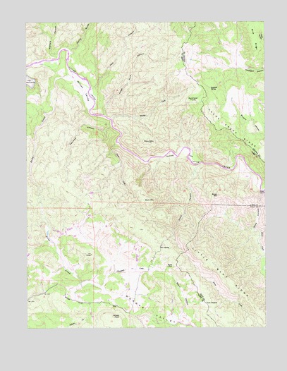
Wilson Valley, CA USGS Topographic Map
Click on map above to begin viewing in our Map Viewer.

This topographic map contains these locations and features:
Feature Name Type Latitude Longitude GNIS ID View Map
Baldy MountainSummitN38.9291°W122.4011°218619View Map
Bear SpringSpringN38.9079°W122.4316°218878View Map
Bosch CanyonValleyN38.8796°W122.4214°219666View Map
Brushy CreekStreamN38.9605°W122.4572°219944View Map
Buck MountainSummitN38.9271°W122.4403°1658153View Map
Butte RockPillarN38.8999°W122.4278°220297View Map
Cache Creek RidgeRidgeN38.9521°W122.3900°220356View Map
Cache Creek WildernessReserveN38.9571°W122.4747°2760090View Map
Chandans CreekStreamN38.8916°W122.4644°220903View Map
Crack CanyonValleyN38.9421°W122.4105°221780View Map
Davis CanyonValleyN38.9307°W122.3783°222040View Map
Davis CreekStreamN38.9052°W122.3761°222045View Map
Dunfield FlatsFlatN38.9682°W122.4122°222724View Map
Dunfield SpringSpringN38.9727°W122.4044°222725View Map
Grizzly PeakSummitN38.8793°W122.4561°1658678View Map
Harley GulchValleyN38.9871°W122.4789°224942View Map
Jack CanyonValleyN38.9732°W122.4678°226032View Map
Judge Davis CanyonValleyN38.9616°W122.4600°226367View Map
Kennedy FlatsFlatN38.9457°W122.4228°226496View Map
Little Blue RidgeRidgeN38.8852°W122.3847°227196View Map
Morgan Valley School (historical)SchoolN38.8827°W122.4508°1670260View Map
Petrified CanyonValleyN38.9574°W122.4566°230581View Map
Reiff Post Office (historical)Post OfficeN38.8827°W122.4511°1766177View Map
Rocky CreekStreamN38.9793°W122.4764°231763View Map
Round MountainSummitN38.9505°W122.4380°231962View Map
Stemple CanyonValleyN38.9868°W122.4841°235442View Map
Trout CreekStreamN38.9507°W122.4544°236564View Map
Twin SistersSummitN38.8855°W122.4083°1660061View Map
Wilson ValleyValleyN38.9625°W122.4667°237996View Map

Note: Coordinates in the location and feature list above are referenced to NAD83 datum.


Copyright (C) 2008-2025 Ryan Niemi / Sunset Dynamics ... All Rights Reserved