TopoQuest Logo
Do you find TopoQuest useful?
Help keep TopoQuest running and adding new maps/features by donating!
Bitcoin:  19c7KJd3qBynnjoSw5npx9KScwjBe4ifkT
Litecoin:  LXs6TkuXGGXo1vDsWCkWVdjQX94eUKd6ui
Home View Maps Find Maps Find Places Resources & Links


Calaveritas, California Topographic Map

USGS Map Title: Calaveritas, CA
USGS Map MRC: 38120B5
DRG (GeoTIFF) Download: o38120b5.tif


Neighboring USGS Topographic Map Quads:


  Mokelumne Hill, CA  
38120C6
 

  Rail Road Flat, CA  
38120C5
 

  Fort Mountain, CA  
38120C4
 

  San Andreas, CA  
38120B6
 

  Calaveritas, CA  
38120B5
 

  Murphys, CA  
38120B4
 

  Salt Spring Valley, CA  
38120A6
 

  Angels Camp, CA  
38120A5
 

  Columbia, CA  
38120A4


Map MRC Location:

N39°
W121°
N39°
W120°
H8 H7 H6 H5 H4 H3 H2 H1
G8 G7 G6 G5 G4 G3 G2 G1
F8 F7 F6 F5 F4 F3 F2 F1
E8 E7 E6 E5 E4 E3 E2 E1
D8 D7 D6 D5 D4 D3 D2 D1
C8 C7 C6 C5 C4 C3 C2 C1
B8 B7 B6 B5 B4 B3 B2 B1
A8 A7 A6 A5 A4 A3 A2 A1
N38°
W121°
N38°
W120°

Calaveritas, CA USGS 1:24K Topographic Map Preview:
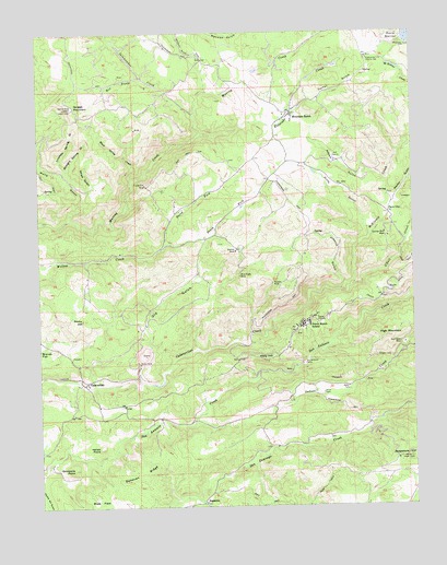
Calaveritas, CA USGS Topographic Map
Click on map above to begin viewing in our Map Viewer.

This topographic map contains these locations and features:
Feature Name Type Latitude Longitude GNIS ID View Map
Adobe GulchValleyN38.2105°W120.5094°217993View Map
Barnhardt MineMineN38.1649°W120.5952°1670871View Map
Bence MineMineN38.1569°W120.5213°1670872View Map
Black Spring CreekStreamN38.2108°W120.5938°219408View Map
Blue Eagle MineMineN38.1855°W120.5588°219488View Map
Bone Hard MineMineN38.1599°W120.5424°1670873View Map
Bosco MineMineN38.1610°W120.5466°1670874View Map
Buck FieldFlatN38.1258°W120.6038°233561View Map
Bund MineMineN38.1266°W120.6063°1670875View Map
Calaveras CountyCivilN38.2046°W120.5541°1675885View Map
CalaveritasPopulated PlaceN38.1580°W120.6099°1658190View Map
Calaveritas Hill Consolidated MineMineN38.1516°W120.6122°1670876View Map
Cave CityPopulated PlaceN38.2024°W120.5085°252646View Map
Central Calaveras Fire and Rescue Protection District Station 3BuildingN38.2277°W120.5424°2623791View Map
Chaparral MineMineN38.1646°W120.5410°1670877View Map
Corral GulchValleyN38.2258°W120.5446°221588View Map
Cotton Flat MineMineN38.2252°W120.5352°1670878View Map
Crooked Spring GulchValleyN38.2127°W120.6169°221848View Map
Department of Forestry and Fire Protection EsperanzaBuildingN38.2429°W120.5158°2623945View Map
Dirty GulchValleyN38.1971°W120.5155°222411View Map
DogtownLocaleN38.1258°W120.5716°233789View Map
Donovan RidgeRidgeN38.1335°W120.5921°222511View Map
Economic MineMineN38.1610°W120.5371°1670879View Map
Eldorado CreekStreamN38.2224°W120.5719°223078View Map
Emery 491 DamDamN38.2483°W120.5027°1663912View Map
Emery ReservoirReservoirN38.2488°W120.5014°259902View Map
Esmeralda MineMineN38.1583°W120.5294°1670880View Map
Esmeralda School (historical)SchoolN38.1560°W120.5352°1670881View Map
Esperanza Fire Control StationLocaleN38.2430°W120.5158°223248View Map
Foley MineMineN38.2452°W120.5699°1670882View Map
French GulchValleyN38.1263°W120.5730°271227View Map
Fricot Ranch SchoolSchoolN38.1735°W120.5358°223950View Map
Friendship MineMineN38.1838°W120.5238°1670883View Map
Gaston Hill MineMineN38.2144°W120.5333°1670884View Map
Gum Boot MineMineN38.1680°W120.5052°224736View Map
Hidden Cave MineMineN38.2116°W120.5174°1670885View Map
High MountainSummitN38.1694°W120.5102°225270View Map
Humboldt MineMineN38.2152°W120.5449°1670886View Map
Indian CreekStreamN38.1480°W120.5744°261728View Map
Italian PointSummitN38.1405°W120.6063°226021View Map
Janes GulchValleyN38.2071°W120.6105°226144View Map
Joaquin GulchValleyN38.1819°W120.5249°226246View Map
Lucky Jim MineMineN38.2094°W120.5894°227820View Map
Martin GulchValleyN38.2041°W120.5077°263237View Map
McKinney CreekStreamN38.2230°W120.5010°263394View Map
Mountain RanchPopulated PlaceN38.2283°W120.5408°229196View Map
Mountain Ranch Lutheran ChurchChurchN38.2283°W120.5419°1804884View Map
Mountain Ranch MineMineN38.2310°W120.5574°1670887View Map
Mountain Ranch Post OfficePost OfficeN38.2276°W120.5417°2780956View Map
New Orleans MineMineN38.1763°W120.5405°1670888View Map
North Fork Willow CreekStreamN38.1941°W120.5838°234380View Map
O'Neil CreekStreamN38.1827°W120.5219°267089View Map
Old GulchValleyN38.1577°W120.5919°229970View Map
Oro Fino MineMineN38.1727°W120.5869°1670889View Map
Quarry FourMineN38.1652°W120.5908°1670890View Map
Quiggs MountainSummitN38.2296°W120.6138°1659449View Map
Railroad Hill MineMineN38.1416°W120.6213°1670891View Map
Richie Hill MineMineN38.1638°W120.6119°1670892View Map
Rocky HillSummitN38.1741°W120.6116°231773View Map
Rose Hill MineMineN38.2166°W120.5649°1670893View Map
San Antonio CampLocaleN38.1624°W120.5377°232366View Map
Sierra Vista LookoutLocaleN38.2299°W120.6138°233099View Map
Simmons PointSummitN38.1349°W120.6152°233159View Map
Soapstone HillSummitN38.1377°W120.5024°234809View Map
South Fork Willow CreekStreamN38.1941°W120.5838°235066View Map
Starlite MineMineN38.1924°W120.5602°235396View Map
Straight Spring GulchValleyN38.2127°W120.6169°235573View Map
Sunset MineMineN38.1835°W120.5474°235809View Map
Thomas Brothers MineMineN38.1958°W120.5091°236249View Map
Walla GulchValleyN38.2008°W120.6155°237191View Map
Wally HillSummitN38.1635°W120.5510°237196View Map
Wet Prong Salamander CreekStreamN38.2383°W120.5913°237580View Map
Zwinge Ranch (historical)LocaleN38.2083°W120.6108°1670894View Map

Note: Coordinates in the location and feature list above are referenced to NAD83 datum.


Copyright (C) 2008-2025 Ryan Niemi / Sunset Dynamics ... All Rights Reserved