TopoQuest Logo
Do you find TopoQuest useful?
Help keep TopoQuest running and adding new maps/features by donating!
Bitcoin:  19c7KJd3qBynnjoSw5npx9KScwjBe4ifkT
Litecoin:  LXs6TkuXGGXo1vDsWCkWVdjQX94eUKd6ui
Home View Maps Find Maps Find Places Resources & Links


San Diego NE, Texas Topographic Map

USGS Map Title: San Diego NE, TX
USGS Map MRC: 27098H1
DRG (GeoTIFF) Download: o27098h1.tif


Neighboring USGS Topographic Map Quads:


  Anna Rose, TX  
28098A2
 

  Midway, TX  
28098A1
 

  Sandia, TX  
28097A8
 

  Shaeffer Ranch, TX  
27098H2
 

  San Diego NE, TX  
27098H1
 

  Orange Grove, TX  
27097H8
 

  San Diego, TX  
27098G2
 

  Alice North, TX  
27098G1
 

  Agua Dulce, TX  
27097G8


Map MRC Location:

N28°
W99°
N28°
W98°
H8 H7 H6 H5 H4 H3 H2 H1
G8 G7 G6 G5 G4 G3 G2 G1
F8 F7 F6 F5 F4 F3 F2 F1
E8 E7 E6 E5 E4 E3 E2 E1
D8 D7 D6 D5 D4 D3 D2 D1
C8 C7 C6 C5 C4 C3 C2 C1
B8 B7 B6 B5 B4 B3 B2 B1
A8 A7 A6 A5 A4 A3 A2 A1
N27°
W99°
N27°
W98°

San Diego NE, TX USGS 1:24K Topographic Map Preview:
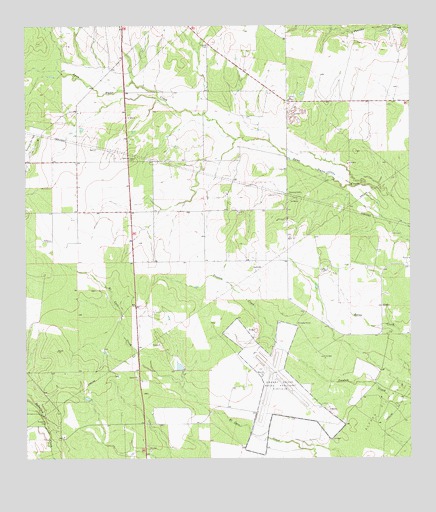
San Diego NE, TX USGS Topographic Map
Click on map above to begin viewing in our Map Viewer.

This topographic map contains these locations and features:
Feature Name Type Latitude Longitude GNIS ID View Map
Agua Dulce Ranch Number 1 ColoniaPopulated PlaceN27.9703°W98.0272°2011498View Map
Agua Dulce Ranch Number 2 ColoniaPopulated PlaceN27.9472°W98.0314°2011499View Map
Agua Dulce Ranch Number 3 ColoniaPopulated PlaceN27.9603°W98.0303°2011500View Map
Aimee Acres ColoniaPopulated PlaceN27.9334°W98.0342°2011501View Map
Aimee Acres Number 2 ColoniaPopulated PlaceN27.9372°W98.0364°2011502View Map
Alfred Oil FieldOilfieldN27.8778°W98.0064°1329356View Map
Amargosa CemeteryCemeteryN27.8861°W98.1186°1329479View Map
Amargosa Census Designated PlaceCensusN27.8916°W98.1086°2586907View Map
Amargosa ColoniaPopulated PlaceN27.8864°W98.1072°2011506View Map
Amargosa Number 2 ColoniaPopulated PlaceN27.8842°W98.1042°2011507View Map
Dilworth CemeteryCemeteryN27.9942°W98.0642°1334362View Map
El Ranchito ColoniaPopulated PlaceN27.9764°W98.0314°2011515View Map
La Carmelita Ranch Number 1 ColoniaPopulated PlaceN27.9303°W98.0264°2011439View Map
Little Lake Acres ColoniaPopulated PlaceN27.9692°W98.0792°2011442View Map
Loma Alta Ranch ColoniaPopulated PlaceN27.9714°W98.0883°2011443View Map
Orange Grove Naval Auxiliary FieldAirportN27.9006°W98.0492°1387268View Map
Orange Grove-Sandia DivisionCivilN27.9603°W98.0475°1939063View Map
Owl RanchPopulated PlaceN27.8920°W98.0959°2413654View Map
Owl Ranch Census Designated PlaceCensusN27.8927°W98.0934°2629101View Map
Owl Ranch Number 1 ColoniaPopulated PlaceN27.8934°W98.0933°2011458View Map
Owl Ranch Number 2 ColoniaPopulated PlaceN27.8872°W98.0972°2011459View Map
Owl Ranch Number 3 ColoniaPopulated PlaceN27.8953°W98.0972°2011460View Map
Owl Ranch-Amargosa Census Designated Place (historical)CensusN27.8920°W98.1036°2632930View Map
Salinas ColoniaPopulated PlaceN27.8872°W98.0914°2011467View Map
San Petronilla Number 3 ColoniaPopulated PlaceN27.8892°W98.1072°2011468View Map
Vally-Hi Acres Number 1 ColoniaPopulated PlaceN27.9964°W98.0914°2011421View Map
Wasicek ColoniaPopulated PlaceN27.9614°W98.0883°2011424View Map
West Alfred Estates ColoniaPopulated PlaceN27.9092°W98.0142°2011426View Map

Note: Coordinates in the location and feature list above are referenced to NAD83 datum.


Copyright (C) 2008-2025 Ryan Niemi / Sunset Dynamics ... All Rights Reserved