TopoQuest Logo
Do you find TopoQuest useful?
Help keep TopoQuest running and adding new maps/features by donating!
Bitcoin:  19c7KJd3qBynnjoSw5npx9KScwjBe4ifkT
Litecoin:  LXs6TkuXGGXo1vDsWCkWVdjQX94eUKd6ui
Home View Maps Find Maps Find Places Resources & Links


San Lorenzo, New Mexico Topographic Map

USGS Map Title: San Lorenzo, NM
USGS Map MRC: 32107G8
DRG (GeoTIFF) Download: o32107g8.tif


Neighboring USGS Topographic Map Quads:


  Allie Canyon, NM  
32108H1
 

  Hendricks Peak, NM  
32107H8
 

  Hillsboro Peak, NM  
32107H7
 

  Santa Rita Mine, NM  
32108G1
 

  San Lorenzo, NM  
32107G8
 

  Maverick Mountain, NM  
32107G7
 

  Hurley East, NM  
32108F1
 

  Whitehorse Mountain, NM  
32107F8
 

  Dwyer, NM  
32107F7


Map MRC Location:

N33°
W108°
N33°
W107°
H8 H7 H6 H5 H4 H3 H2 H1
G8 G7 G6 G5 G4 G3 G2 G1
F8 F7 F6 F5 F4 F3 F2 F1
E8 E7 E6 E5 E4 E3 E2 E1
D8 D7 D6 D5 D4 D3 D2 D1
C8 C7 C6 C5 C4 C3 C2 C1
B8 B7 B6 B5 B4 B3 B2 B1
A8 A7 A6 A5 A4 A3 A2 A1
N32°
W108°
N32°
W107°

San Lorenzo, NM USGS 1:24K Topographic Map Preview:
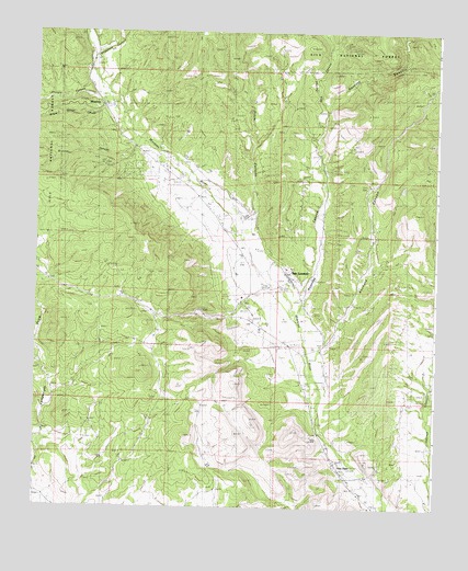
San Lorenzo, NM USGS Topographic Map
Click on map above to begin viewing in our Map Viewer.

This topographic map contains these locations and features:
Feature Name Type Latitude Longitude GNIS ID View Map
00017 Water WellWellN32.8645°W107.9859°919550View Map
00028 Water WellWellN32.8276°W107.9123°919822View Map
00031 Water WellWellN32.8170°W107.9125°919825View Map
00042 Water WellWellN32.7956°W107.9061°919837View Map
00045 Water WellWellN32.8067°W107.9164°919831View Map
00048 Water WellWellN32.7929°W107.9237°919521View Map
00053 Water WellWellN32.7865°W107.9173°919838View Map
00056 Water WellWellN32.7884°W107.9089°919841View Map
00060 Water WellWellN32.7814°W107.8772°919513View Map
00064 Water WellWellN32.8554°W107.9767°919569View Map
00071 Water WellWellN32.8442°W107.9667°919546View Map
00073 Water WellWellN32.8356°W107.9545°919816View Map
00078 Water WellWellN32.8332°W107.9581°919539View Map
00080 Water WellWellN32.8334°W107.9473°919541View Map
00093 Water WellWellN32.8104°W107.9962°919529View Map
00096 Water WellWellN32.8181°W107.9298°919532View Map
00101 Water WellWellN32.8056°W107.9256°919829View Map
00276 Water WellWellN32.7773°W107.9131°919843View Map
00285 Water WellWellN32.7515°W107.8973°919860View Map
00286 Water WellWellN32.7501°W107.8984°919858View Map
00320 Water WellWellN32.7717°W107.9739°919508View Map
00321 Water WellWellN32.7690°W107.9970°919851View Map
01036 Water WellWellN32.7948°W107.9145°919834View Map
01069 Water WellWellN32.8030°W107.9167°919525View Map
10020 Water WellWellN32.7501°W107.8984°919859View Map
10167 Water WellWellN32.8377°W107.9104°919542View Map
10168 Water WellWellN32.8095°W107.9100°919832View Map
10169 Water WellWellN32.7801°W107.9059°919847View Map
10171 Water WellWellN32.8356°W107.9687°919814View Map
10172 Water WellWellN32.8148°W107.9253°919823View Map
10173 Water WellWellN32.7829°W107.9959°919514View Map
Acklin Store Historic SiteBuildingN32.8267°W107.9200°933523View Map
Ancheta CanyonValleyN32.7920°W107.9084°903145View Map
Antonio Torres HouseBuildingN32.8101°W107.9200°935777View Map
Beth TankReservoirN32.8712°W107.9049°2038365View Map
Brunner CanyonValleyN32.8423°W107.9695°902870View Map
Brunner TankReservoirN32.8409°W107.9959°936710View Map
Casas Adobes AirparkAirportN32.8111°W107.9349°2444047View Map
Doctor Granville Wood House Historic SiteBuildingN32.8562°W107.9798°934308View Map
Father Roger Aull House and ChapelBuildingN32.8101°W107.9200°933339View Map
G 77 Water WellWellN32.8223°W107.9370°918823View Map
Georgetown CanyonValleyN32.8542°W107.9803°912419View Map
Janss Historic SiteLocaleN32.8562°W107.9798°933758View Map
Jesus Valencia HouseBuildingN32.7609°W107.9053°935476View Map
Luciana B Grijalva House Historic SiteBuildingN32.8101°W107.9200°933472View Map
Mattocks SiteLocaleN32.8562°W107.9798°936059View Map
Menard-Galaz HouseBuildingN32.8101°W107.9200°935475View Map
MimbresPopulated PlaceN32.8562°W107.9798°908770View Map
Mimbres Census Designated PlaceCensusN32.8332°W107.9559°2584155View Map
Mimbres Post OfficePost OfficeN32.8513°W107.9764°2781535View Map
Mimbres SchoolSchoolN32.8562°W107.9798°936058View Map
Mimbres Valley Community ChurchChurchN32.8562°W107.9798°901847View Map
Mimbres Valley Emergency Medical ServicesBuildingN32.8197°W107.9379°2657671View Map
Mimbres Weather StationLocaleN32.8562°W107.9798°931884View Map
Mud Springs CanyonValleyN32.8542°W107.9089°908956View Map
Noonday CanyonValleyN32.8048°W107.9153°909117View Map
Otto Huechling House Historic SiteBuildingN32.8562°W107.9798°933396View Map
Reeds Peak Lookout TowerTowerN32.8562°W107.9798°935891View Map
Rio Mimbres Baptist ChurchChurchN32.8562°W107.9798°902097View Map
Rose MineMineN32.7823°W107.9628°910428View Map
San JuanPopulated PlaceN32.7609°W107.9053°910644View Map
San Juan Historic DistrictLocaleN32.7609°W107.9053°934426View Map
San LorenzoPopulated PlaceN32.8101°W107.9200°920693View Map
San Lorenzo Catholic ChurchChurchN32.8562°W107.9798°902496View Map
San Lorenzo Census Designated PlaceCensusN32.8086°W107.9221°2584207View Map
Sheppard CanyonValleyN32.8698°W107.9809°911004View Map
Shingle CanyonValleyN32.8576°W107.9820°911016View Map
Stitzel CanyonValleyN32.8265°W107.9325°911422View Map
Upper Mimbres Volunteer Fire Department Station 1BuildingN32.8496°W107.9754°2657624View Map
Wheaton-Smith SiteLocaleN32.7609°W107.9053°935941View Map
William Redding HouseBuildingN32.8562°W107.9798°935439View Map

Note: Coordinates in the location and feature list above are referenced to NAD83 datum.


Copyright (C) 2008-2025 Ryan Niemi / Sunset Dynamics ... All Rights Reserved