TopoQuest Logo
Do you find TopoQuest useful?
Help keep TopoQuest running and adding new maps/features by donating!
Bitcoin:  19c7KJd3qBynnjoSw5npx9KScwjBe4ifkT
Litecoin:  LXs6TkuXGGXo1vDsWCkWVdjQX94eUKd6ui
Home View Maps Find Maps Find Places Resources & Links


Maverick Mountain, New Mexico Topographic Map

USGS Map Title: Maverick Mountain, NM
USGS Map MRC: 32107G7
DRG (GeoTIFF) Download: o32107g7.tif


Neighboring USGS Topographic Map Quads:


  Hendricks Peak, NM  
32107H8
 

  Hillsboro Peak, NM  
32107H7
 

  Kingston, NM  
32107H6
 

  San Lorenzo, NM  
32107G8
 

  Maverick Mountain, NM  
32107G7
 

  P A Mountain, NM  
32107G6
 

  Whitehorse Mountain, NM  
32107F8
 

  Dwyer, NM  
32107F7
 

  Whiterock Mountain, NM  
32107F6


Map MRC Location:

N33°
W108°
N33°
W107°
H8 H7 H6 H5 H4 H3 H2 H1
G8 G7 G6 G5 G4 G3 G2 G1
F8 F7 F6 F5 F4 F3 F2 F1
E8 E7 E6 E5 E4 E3 E2 E1
D8 D7 D6 D5 D4 D3 D2 D1
C8 C7 C6 C5 C4 C3 C2 C1
B8 B7 B6 B5 B4 B3 B2 B1
A8 A7 A6 A5 A4 A3 A2 A1
N32°
W108°
N32°
W107°

Maverick Mountain, NM USGS 1:24K Topographic Map Preview:
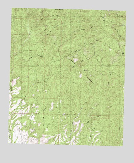
Maverick Mountain, NM USGS Topographic Map
Click on map above to begin viewing in our Map Viewer.

This topographic map contains these locations and features:
Feature Name Type Latitude Longitude GNIS ID View Map
Ackin TankReservoirN32.8420°W107.7959°2038341View Map
Bull Trap CanyonValleyN32.8515°W107.8528°904193View Map
Casey CanyonValleyN32.8567°W107.7611°2038794View Map
Columbia MineMineN32.8690°W107.7975°905267View Map
Corral CanyonTankReservoirN32.7962°W107.7911°899206View Map
Dry TankReservoirN32.8380°W107.8001°899195View Map
Fogarty CanyonValleyN32.8159°W107.8228°906323View Map
Getaway TankReservoirN32.8095°W107.7986°2038480View Map
Gold Pan CanyonValleyN32.8479°W107.8548°906617View Map
Grandview MineMineN32.8637°W107.8011°899196View Map
Haystack MountainSummitN32.8742°W107.8223°906892View Map
Hot Springs WellReservoirN32.7898°W107.7931°899205View Map
Juniper Water WellReservoirN32.7642°W107.7834°899201View Map
LC DamDamN32.7956°W107.8053°899204View Map
Little Gallinas CanyonValleyN32.8223°W107.8706°908019View Map
Maverick MountainSummitN32.8198°W107.7934°908476View Map
Noonday PeakSummitN32.7845°W107.7836°909118View Map
Patsy MineMineN32.8662°W107.7900°909506View Map
Quien Sabe CanyonValleyN32.7770°W107.8731°909938View Map
Rock TankReservoirN32.8679°W107.8092°2038654View Map
Royal John MineMineN32.8437°W107.7842°910463View Map
Seven Brothers MountainSummitN32.8626°W107.7570°910954View Map
Silver CreekStreamN32.8498°W107.8556°2038806View Map
Silver Creek CanyonValleyN32.8637°W107.8450°911066View Map
Squirrel SpringSpringN32.8531°W107.8106°2038696View Map
Top Water TankReservoirN32.7631°W107.7750°899202View Map
Trail CanyonValleyN32.8476°W107.8514°911774View Map
Twin Calf TankReservoirN32.8418°W107.8487°899198View Map
Upton Cabin WellReservoirN32.8329°W107.8206°899199View Map
Upton TankReservoirN32.8378°W107.8108°899200View Map
Watson WellReservoirN32.7570°W107.7573°899203View Map
Wilson CanyonValleyN32.8415°W107.7936°912423View Map

Note: Coordinates in the location and feature list above are referenced to NAD83 datum.


Copyright (C) 2008-2025 Ryan Niemi / Sunset Dynamics ... All Rights Reserved