TopoQuest Logo
Do you find TopoQuest useful?
Help keep TopoQuest running and adding new maps/features by donating!
Bitcoin:  19c7KJd3qBynnjoSw5npx9KScwjBe4ifkT
Litecoin:  LXs6TkuXGGXo1vDsWCkWVdjQX94eUKd6ui
Home View Maps Find Maps Find Places Resources & Links


San Miguel Mountain, New Mexico Topographic Map

USGS Map Title: San Miguel Mountain, NM
USGS Map MRC: 35106G7
DRG (GeoTIFF) Download: o35106g7.tif


Neighboring USGS Topographic Map Quads:


  San Pablo, NM  
35106H8
 

  Rancho del Chaparral, NM  
35106H7
 

  Seven Springs, NM  
35106H6
 

  La Ventana, NM  
35106G8
 

  San Miguel Mountain, NM  
35106G7
 

  Jemez Springs, NM  
35106G6
 

  Holy Ghost Spring, NM  
35106F8
 

  Gilman, NM  
35106F7
 

  Ponderosa, NM  
35106F6


Map MRC Location:

N36°
W107°
N36°
W106°
H8 H7 H6 H5 H4 H3 H2 H1
G8 G7 G6 G5 G4 G3 G2 G1
F8 F7 F6 F5 F4 F3 F2 F1
E8 E7 E6 E5 E4 E3 E2 E1
D8 D7 D6 D5 D4 D3 D2 D1
C8 C7 C6 C5 C4 C3 C2 C1
B8 B7 B6 B5 B4 B3 B2 B1
A8 A7 A6 A5 A4 A3 A2 A1
N35°
W107°
N35°
W106°

San Miguel Mountain, NM USGS 1:24K Topographic Map Preview:
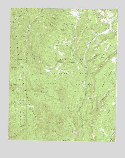
San Miguel Mountain, NM USGS Topographic Map
Click on map above to begin viewing in our Map Viewer.

This topographic map contains these locations and features:
Feature Name Type Latitude Longitude GNIS ID View Map
Bales CanyonValleyN35.8245°W106.7945°903522View Map
Bales SeepSpringN35.8207°W106.8311°903523View Map
Bear SpringsSpringN35.7872°W106.8573°928690View Map
Butterfly SpringSpringN35.7904°W106.7819°899311View Map
Caņon CehollitaValleyN35.7681°W106.7886°904632View Map
Church CanyonValleyN35.8553°W106.7995°905142View Map
Giant Footprint RuinsLocaleN35.7609°W106.7548°906532View Map
Jemez National Recreation AreaParkN35.8058°W106.7922°2571540View Map
Joaquin CanyonValleyN35.7756°W106.7917°907377View Map
Joaquin MesaSummitN35.7692°W106.8170°907378View Map
La Cueva Camp (historical)LocaleN35.8175°W106.8303°933983View Map
Lake Fork CanyonValleyN35.8536°W106.7634°907825View Map
Llano Locl SpringSpringN35.8004°W106.7871°899312View Map
McMillan CanyonValleyN35.8503°W106.8003°908538View Map
Mesa VenadoBenchN35.7614°W106.8014°908645View Map
O'Neil LandingPopulated PlaceN35.8664°W106.7956°909235View Map
PorterPopulated PlaceN35.8189°W106.7870°909796View Map
Porter Post Office (historical)Post OfficeN35.8189°W106.7870°938231View Map
Rio CebollaStreamN35.8197°W106.7881°928784View Map
Rio de las VacasStreamN35.8197°W106.7881°910223View Map
Rito la CuevaStreamN35.8245°W106.7945°910282View Map
Rito la Cueva SpringSpringN35.8175°W106.8302°910283View Map
San Miguel MountainSummitN35.8656°W106.8661°910690View Map
Schoolhouse CanyonValleyN35.8242°W106.7881°910873View Map
Sierra NacimientoRangeN35.8278°W106.8642°911039View Map
Stable CanyonValleyN35.8136°W106.7850°911378View Map
Stable Canyon ForkStreamN35.8342°W106.7523°911379View Map
Stable SpringSpringN35.8207°W106.7699°911381View Map
Trail CanyonValleyN35.8656°W106.7553°911782View Map
Tusas TankReservoirN35.8405°W106.8213°899310View Map

Note: Coordinates in the location and feature list above are referenced to NAD83 datum.


Copyright (C) 2008-2024 Ryan Niemi / Sunset Dynamics ... All Rights Reserved