TopoQuest Logo
Do you find TopoQuest useful?
Help keep TopoQuest running and adding new maps/features by donating!
Bitcoin:  19c7KJd3qBynnjoSw5npx9KScwjBe4ifkT
Litecoin:  LXs6TkuXGGXo1vDsWCkWVdjQX94eUKd6ui
Home View Maps Find Maps Find Places Resources & Links


Gilman, New Mexico Topographic Map

USGS Map Title: Gilman, NM
USGS Map MRC: 35106F7
DRG (GeoTIFF) Download: o35106f7.tif


Neighboring USGS Topographic Map Quads:


  La Ventana, NM  
35106G8
 

  San Miguel Mountain, NM  
35106G7
 

  Jemez Springs, NM  
35106G6
 

  Holy Ghost Spring, NM  
35106F8
 

  Gilman, NM  
35106F7
 

  Ponderosa, NM  
35106F6
 

  Ojito Spring, NM  
35106E8
 

  San Ysidro, NM  
35106E7
 

  Jemez Pueblo, NM  
35106E6


Map MRC Location:

N36°
W107°
N36°
W106°
H8 H7 H6 H5 H4 H3 H2 H1
G8 G7 G6 G5 G4 G3 G2 G1
F8 F7 F6 F5 F4 F3 F2 F1
E8 E7 E6 E5 E4 E3 E2 E1
D8 D7 D6 D5 D4 D3 D2 D1
C8 C7 C6 C5 C4 C3 C2 C1
B8 B7 B6 B5 B4 B3 B2 B1
A8 A7 A6 A5 A4 A3 A2 A1
N35°
W107°
N35°
W106°

Gilman, NM USGS 1:24K Topographic Map Preview:
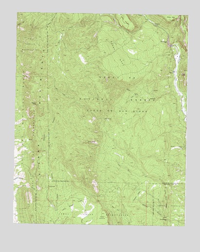
Gilman, NM USGS Topographic Map
Click on map above to begin viewing in our Map Viewer.

This topographic map contains these locations and features:
Feature Name Type Latitude Longitude GNIS ID View Map
Barrel SpringSpringN35.6517°W106.8472°899326View Map
Caņon Census Designated PlaceCensusN35.6718°W106.7527°2584064View Map
Coyote FlatsFlatN35.6431°W106.7861°905474View Map
Crow SpringsSpringN35.6877°W106.8099°905530View Map
Deer CreekStreamN35.7461°W106.7767°905688View Map
Deer Creek LandingPopulated PlaceN35.7442°W106.7748°905691View Map
Deer Creek ProspectMineN35.7481°W106.8056°916263View Map
GilmanPopulated PlaceN35.7161°W106.7600°906549View Map
Guadalupe 3 in Water WellWellN35.7378°W106.7620°922723View Map
Guadalupe BoxValleyN35.7314°W106.7634°906755View Map
Guadalupita MesaSummitN35.7467°W106.7542°918198View Map
Hard Rock RidgeRidgeN35.6395°W106.7656°906833View Map
Jack Rabbit FlatsFlatN35.6372°W106.8303°907285View Map
Log SpringsSpringN35.6472°W106.8497°908119View Map
Mesa GarciaSummitN35.7172°W106.7511°918255View Map
Navajo SpringsSpringN35.6738°W106.8222°909028View Map
Osha CanyonValleyN35.7025°W106.7536°909372View Map
Owl SpringsSpringN35.6287°W106.7640°909407View Map
Pajarito PeakSummitN35.6953°W106.8586°915875View Map
Peggy MesaSummitN35.7264°W106.8011°909536View Map
Peņasco CanyonValleyN35.6261°W106.8411°909548View Map
Porter Landing (historical)LocaleN35.7320°W106.7611°902758View Map
Sandoval CountyCivilN35.6886°W106.8660°929113View Map
Tecolote CanyonValleyN35.6261°W106.7603°911574View Map
Virgin CanyonValleyN35.7014°W106.7528°918401View Map

Note: Coordinates in the location and feature list above are referenced to NAD83 datum.


Copyright (C) 2008-2024 Ryan Niemi / Sunset Dynamics ... All Rights Reserved