TopoQuest Logo
Do you find TopoQuest useful?
Help keep TopoQuest running and adding new maps/features by donating!
Bitcoin:  19c7KJd3qBynnjoSw5npx9KScwjBe4ifkT
Litecoin:  LXs6TkuXGGXo1vDsWCkWVdjQX94eUKd6ui
Home View Maps Find Maps Find Places Resources & Links


Sanger, Texas Topographic Map

USGS Map Title: Sanger, TX
USGS Map MRC: 33097C2
DRG (GeoTIFF) Download: o33097c2.tif


Neighboring USGS Topographic Map Quads:


  Era, TX  
33097D3
 

  Valley View, TX  
33097D2
 

  Mountain Springs, TX  
33097D1
 

  Era SE, TX  
33097C3
 

  Sanger, TX  
33097C2
 

  Green Valley, TX  
33097C1
 

  Ponder, TX  
33097B3
 

  Denton West, TX  
33097B2
 

  Denton East, TX  
33097B1


Map MRC Location:

N34°
W98°
N34°
W97°
H8 H7 H6 H5 H4 H3 H2 H1
G8 G7 G6 G5 G4 G3 G2 G1
F8 F7 F6 F5 F4 F3 F2 F1
E8 E7 E6 E5 E4 E3 E2 E1
D8 D7 D6 D5 D4 D3 D2 D1
C8 C7 C6 C5 C4 C3 C2 C1
B8 B7 B6 B5 B4 B3 B2 B1
A8 A7 A6 A5 A4 A3 A2 A1
N33°
W98°
N33°
W97°

Sanger, TX USGS 1:24K Topographic Map Preview:
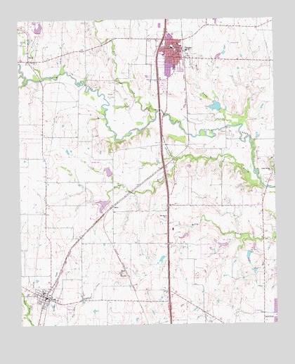
Sanger, TX USGS Topographic Map
Click on map above to begin viewing in our Map Viewer.

This topographic map contains these locations and features:
Feature Name Type Latitude Longitude GNIS ID View Map
Blanche Dodd Intermediate SchoolSchoolN33.2602°W97.2262°2004043View Map
Blue MoundSummitN33.2715°W97.2003°1352476View Map
Blue Mound ChurchChurchN33.2940°W97.1786°1352478View Map
BolivarPopulated PlaceN33.3584°W97.2453°1352625View Map
Bolivar ChurchChurchN33.3582°W97.2420°1352626View Map
Chisom Trail Elementary SchoolSchoolN33.3664°W97.1883°2004049View Map
City of Crum Wastewater Treatment FacilityLocaleN33.2580°W97.2456°2428160View Map
City of KrumCivilN33.2653°W97.2255°2411562View Map
City of SangerCivilN33.3736°W97.1697°2411812View Map
Clear Creek Intermediate SchoolSchoolN33.3151°W97.1797°2004051View Map
DaltonPopulated PlaceN33.2993°W97.2047°1379633View Map
Daughters of the American Revolution MuseumBuildingN33.2568°W97.1539°2014224View Map
Duck CreekStreamN33.3371°W97.1822°1356392View Map
Duck Creek CemeteryCemeteryN33.3487°W97.2025°1356394View Map
Dyer Elementary SchoolSchoolN33.2612°W97.2420°2004060View Map
First Baptist ChurchChurchN33.3565°W97.1742°2018321View Map
Flying V Airport (historical)AirportN33.3472°W97.2053°1387492View Map
Gateway United Baptist ChurchChurchN33.2540°W97.1267°2018265View Map
Gribble Springs ChurchChurchN33.3132°W97.1267°1358428View Map
Ironhead AirportAirportN33.3312°W97.2273°1387494View Map
Jordan CreekStreamN33.2515°W97.2278°1360426View Map
KNTU-FM (Denton)TowerN33.2901°W97.1367°1385839View Map
KrumPopulated PlaceN33.2615°W97.2381°1360773View Map
Krum Fire DepartmentBuildingN33.2629°W97.2402°2551763View Map
Krum High SchoolSchoolN33.2639°W97.2256°2003967View Map
Krum Middle SchoolSchoolN33.2603°W97.2291°2003968View Map
Krum Police DepartmentBuildingN33.2616°W97.2378°2739081View Map
Krum Post OfficePost OfficeN33.2627°W97.2396°2732013View Map
Krum United Methodist ChurchChurchN33.2623°W97.2392°2018213View Map
Lane FieldAirportN33.3654°W97.1461°1387490View Map
Lane LakeReservoirN33.3601°W97.1522°1855489View Map
Lane Lake DamDamN33.3584°W97.1520°1855488View Map
Linda Tutt High SchoolSchoolN33.3606°W97.1795°2004006View Map
Moores BranchStreamN33.3062°W97.1306°1363124View Map
Paddock LakeReservoirN33.3368°W97.1520°1855491View Map
Paddock Lake DamDamN33.3368°W97.1520°1855490View Map
Pilgrims Way Baptist ChurchChurchN33.3646°W97.1872°2018281View Map
Ranger BranchStreamN33.3312°W97.1431°1366010View Map
Richards AirportAirportN33.3014°W97.2450°1387032View Map
SangerPopulated PlaceN33.3632°W97.1739°1367736View Map
Sanger Alternative SchoolSchoolN33.3607°W97.1839°2004005View Map
Sanger CemeteryCemeteryN33.3609°W97.1606°1367738View Map
Sanger City HallBuildingN33.3627°W97.1743°2753322View Map
Sanger DivisionCivilN33.3361°W97.2399°1939167View Map
Sanger Middle SchoolSchoolN33.3616°W97.1846°2003912View Map
Sanger Oil FieldOilfieldN33.3440°W97.2050°1367739View Map
Sanger Police DepartmentBuildingN33.3625°W97.1724°2739018View Map
Sanger Post OfficePost OfficeN33.3689°W97.1748°2731920View Map
Sanger Volunteer Fire DepartmentBuildingN33.3630°W97.1717°2551441View Map
Sanger Waste Water Treatment PlantLocaleN33.3545°W97.1643°2428216View Map
Soil Conservation Service Site 51 DamDamN33.3701°W97.2403°1855494View Map
Soil Conservation Service Site 51 ReservoirReservoirN33.3701°W97.2403°1855495View Map
Soil Conservation Service Site 55b DamDamN33.3101°W97.2053°1855486View Map
Soil Conservation Service Site 55b ReservoirReservoirN33.3101°W97.2053°1855487View Map
Tedrow LakeReservoirN33.2824°W97.1514°1855493View Map
Tedrow Lake DamDamN33.2818°W97.1503°1855492View Map
Tenderfoot Learning CenterSchoolN33.3615°W97.1817°2003917View Map
Twin Lakes Number 1 DamDamN33.2718°W97.1253°1863861View Map
Williams LakeReservoirN33.2816°W97.1361°1863858View Map
Williams Lake DamDamN33.2801°W97.1370°1863857View Map

Note: Coordinates in the location and feature list above are referenced to NAD83 datum.


Copyright (C) 2008-2024 Ryan Niemi / Sunset Dynamics ... All Rights Reserved